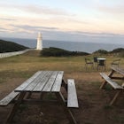
Backpack Mt Bogong
Tawonga, Victoria
Details
Distance
17.1 miles
Elevation Gain
4219.2 ft
Route Type
Loop
Description
Added by Katie Kessel
Spend the night in the Victorian Alps and summit Mt Bogong, Victoria’s highest peak, taking in stunning views of many of the other surrounding mountains. A very challenging hike that's well worth the effort for the views at the top.
Mt Bogong sits at 1,986m and takes the crown for the highest peak in Victoria and 8th highest in Australia. The views both on the way up and at the top are amazing, especially once you pass the tree line.
This hike is not only challenging because of its length and steepness nearing the top, but lack of water for much of the year. Make sure to bring water up with you or research where to find initially.
In the winter, much of the top of the mountain is covered in snow and there are warnings of avalanches. As well, the trail may be difficult to follow in the winter if there is enough snow so be prepared.
The way detailed below has been done as a circuit with two chances to summit Bogong in order to determine when you'll get the best views depending on weather, however it can be altered to be easier, longer or as a day hike (which is manageable if you don't have a large pack!).
There are two Spurs that are taken below. The first, the Staircase Spur, starts 400m below the Eskdale Spur, and is 6km to the top of the mountain. It is definitely the most grueling way to go but is more easily accessible by car if you do not have a 4x4 and has some awesome views as you get closer to Mt Bogong. The Eskdale Spur is easier (though it is still challenging!) and starts higher up the mountain, however getting there by car is challenging without a 4x4, though you can walk to/from the parking lot (as I did) along the 4x4 track.
Both tracks are difficult in their own way and both offer different fantastic views, so I recommend doing this hike as a circuit if you're up for it!
If you want to make this a longer circuit, the most manageable would be as a four day hike, staying the first night at Cleve Cole Memorial Hut then continuing to other huts in the vicinity.
Day One - Mountain Creek to Cleve Cole Memorial Hut (12.5kms)
Depending on your car’s ability, you can either park at the Mountain Creek Campground or you can continue about 2kms into the park to the second parking area, as indicated on the map below (you won't need to cross any creeks but the track is somewhat rough).
There's an intentions book here to fill out before you set off with your intended return date.
From there, follow the road about 2kms until you reach the signs for the Staircase Spur to your right indicating 6kms to the top of the mountain.
Depending on the weather and your energy level after the climb, you can ditch your bags here and head right once you reach the top of the ridge to Mt Bogong, which is only about another 100m of climbing. Please note that there is a steeper section of track you can follow that veers off to the right before you reach the top of the ridge, offering a more direct but more steep route to the top if you wish to take it. The last 1km up to the ridge offers some awesome views!
Once at the top of the ridge, head left to head towards the Cleve Cole Memorial Hut. You'll pass the track to the Eskdale Spur you'll be walking down tomorrow to your left as you're walking along the ridge.
Continue along the ridge until you reach the Cleve Cole hut, where you can sent up your tent anywhere in the valley (no booking necessary, first come first serve).
There is a stream you can find at some points during the year if you follow a path through the grass in front of the front door of the hut for about 150-200m.
Day Two - Cleve Cole Memorial Hut to Mountain Creek (15 kms)
Follow the track back the way you came, ditching your bags at Eskdale Point if you want to summit Mt Bogong (500m walk from this point).
Continue along the track down the Eskdale Spur here. Please note it's quite steep initially, so the first 1km may take some time. This section offers some of the best views of Mt Bogong.
Continue along the track until you reach a junction indicating the path to Eskdale Continues to the left (rather than Granite Flat to the right).
Continue along the track, passing Mitchell’s Hut, until you reach the Camp Creek Gap and the management track.
From here, walk along the road to the parking lot for 7kms. There are several opportunities to walk through walkers tracks rather than the road (especially in the first portion, which cuts some time off your walk) so look out for these tracks. There are also some creeks you will have to cross, so you may get a little wet (though there are lots of rocks you can try to jump across on!).
Download the Outbound mobile app
Find adventures and camping on the go, share photos, use GPX tracks, and download maps for offline use.
Get the appFeatures
Backpack Mt Bogong Reviews
Leave No Trace
Always practice Leave No Trace ethics on your adventures and follow local regulations. Please explore responsibly!
Nearby
Summit Mt. Feathertop
Hike Mount Buffalo
Hike to Kosciuszko Summit
Backpack Mitchell River
Community
© 2024 The Outbound Collective - Terms of Use - Privacy Policy


