
James HueserExplorer
Some call me the Jerry Macguire of the outdoors. The places special to me should be special to everyone. It is not my intention to hoard the best views around me. It's my responsibility to invite everyone to join, and give them every opportunity to do so.
Great hike, and a great write up. I just did this last week and arrived in Thorsmork on May 1 - the first day the campground in Basar was open, and there are some very key details to note. I'm sure you stressed this, this hike is no joke to do in one day. Serious hikers will be able to do it in around 8 hours, but I've seen people take 13 hours. Very important for everyone to know that, especially people who might not be aware of the physical commitment. I just did this hike from Skogar to Thorsmork on May 1 - the first day that camping the area opens. Everything above 600 masl was still covered in ice and snow - adding even more of a physical challenge to the already strenuous hike. Even though it can be done in Spring and Fall, it should be seriously considered before undertaking this trek. Especially if you're doing it in the shoulder seasons, a GPS track is imperative. Absolutely imperative. We had a blizzard for most of the hike up until the first hut, and then it was solid fog - we couldn't see more than 10 feet in front of us. The trail is marked with yellow posts in the snow field, but once we found one, we couldn't even see the next one. This lasted a couple of hours on the hike. At one point I had checked the GPS and we were a little east of the trail. I knew that west was to our left, so we headed directly west. When I checked the GPS next, we were even more east of the trail. The fog was so thick that it blocked out any sign of the sun, and the wind was so strong that it kept blowing us off of our heading. I'm not sure if you've done the whole trail, but the 2010 eruption didn't have much of an effect on the trail. There's obviously more rock on the trail, and I assume it got covered in the lava, but you're still just following your GPS and the yellow posts up there anyway, so having a covered trail - by lava or snow - is pretty much guaranteed. One more thing - since we had such terrible weather and were exhausted after getting to Básar, and the weather was supposed to be garbage the next day, we did our best to not have to hike the pass again. If you get to a facility (and it's open) by 9 PM, you can have them call a tour bus to pick you up the next afternoon for 4500 ISK. Since we parked at Skogar, we had to get off at Seljalandsfoss and hitchhike back. Certainly more money than hiking back, but it did so much more for our morale and the rest of our trip. Even though this review is very doom and gloom, descending into Thorsmork after the day was had was like heaven. I've never seen a landscape like it, and can't even describe it. A definite must for, as our Russian friend the next night called us, "Strong men! [and women!]"
5.0
Moraine Lake is as beautiful as it is photographed! My choice of activity here is to find a spot to sit down and just take it all in. A lot of people try to get the best shot, but it serves as an excellent backdrop for a conversation with a good friend.
3.0
It's a great intro to hiking and hopefully serves as inspiration to the views the Rockies provide. Leaves a bit to be desired for intermediates and up.
3.0
As time's passed, I've had a chance to reflect on this adventure and figured it'd be worth sharing. The view of Birdwood from Smutwood is surreal. As with other phenomenal places in the area, Smutwood draws a bit more traffic - obviously for good reason. For some of us, it's important to leave the crowd's behind and be immersed in nature, and the added traffic to Smutwood could viewed as a pain and not worth the hassle. As much as I can become frustrated with large crowds and easy objectives, this hike is far from easy. I hope everyone realizes a) how awesome it is that everybody is able to enjoy this objective, and b) people getting outside and doing a 19 km hike is worth encouraging. Now get out there and do it!
5.0
The best ridge walk you can do in K-Country - highly recommended to take your time and split it over three days. Way too much scenery to miss otherwise!
5.0
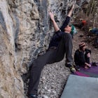
This mild winter's got me itching to get back to Buddha to boulder. Always a great day sending in the sun.
5.0
I'm all about those high peaks, but those colours look phenomenal, Pete! Thanks for posting, I've been eyeing up Siyeh for a couple summers now and think I'll have to take the plunge this summer.
5.0
I attempted to get to the Fortress by using this route - definitely couldn't even find the way to Headwall Lakes. I'll be keeping these instructions (especially that cairn) handy in the summer!
Community
Mobile Apps

© 2024 The Outbound Collective - Terms of Use - Privacy Policy