Details
Features
About this place
Experience the serene beauty of San Diego’s highlands on the Upper Santa Ysabel Creek Trail, a moderately challenging 7-mile loop near Julian that blends creek-side tranquility, open meadows, oak groves, and panoramic ridge views. Ideal for hikers, trail runners, and nature lovers, this trail is a hidden gem in Southern California’s backcountry.
Trail Overview
-
Location: Near Julian, California (Santa Ysabel East Preserve)
-
Difficulty: Moderate
-
Trail Surface: Primarily dirt fire roads and singletrack trails
-
Trailheads: Farmer Road Staging Area or Highway 79 access point
-
Restrooms: Porta-potty at the main parking area
What to Expect on the Trail
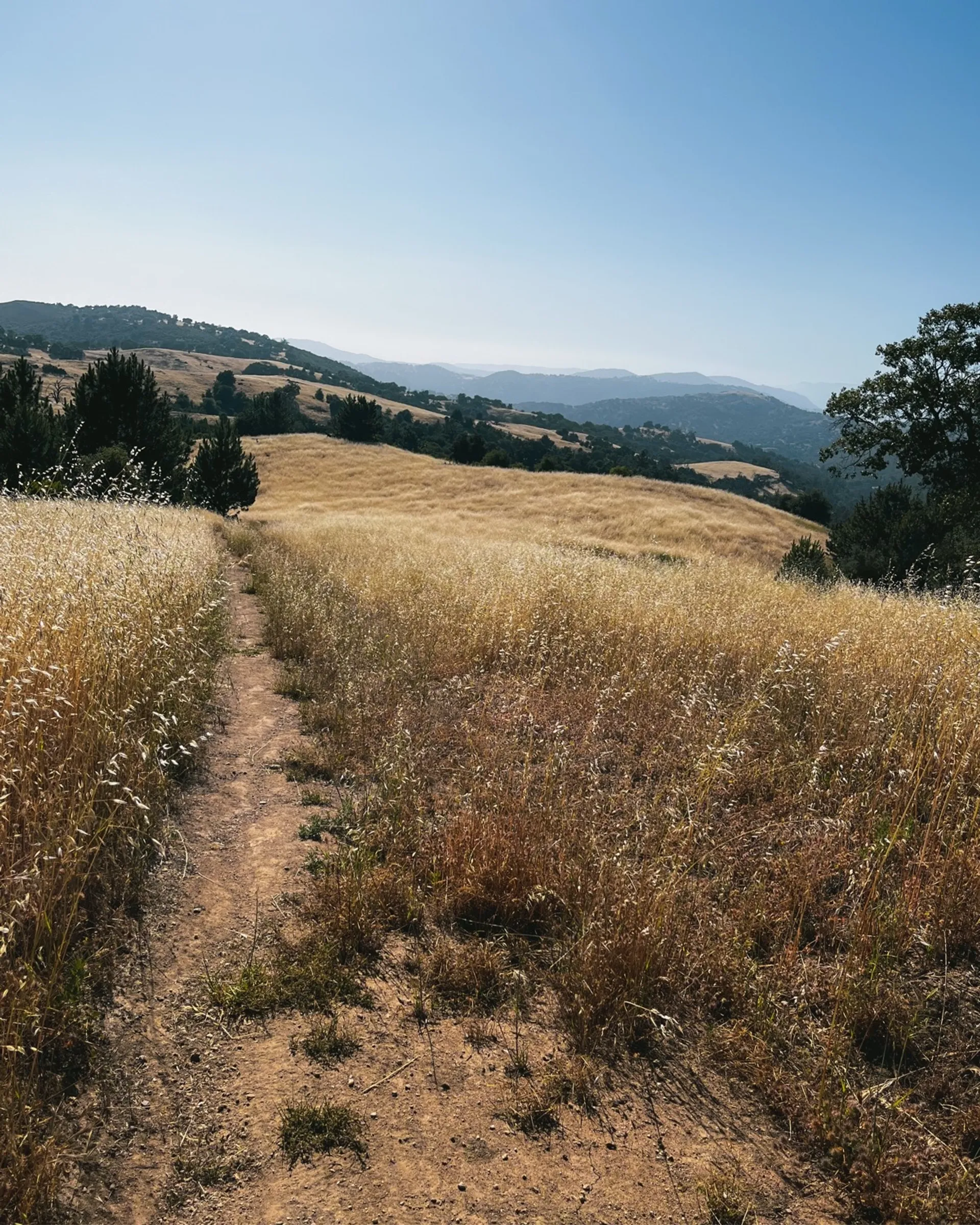
The trail begins near Santa Ysabel Creek, winding through a combination of grassy meadows, oak woodlands, and gently rolling hills. Seasonal wildflowers add bursts of color in spring, and wildlife—including hawks, eagles, and deer—are frequently seen. Cattle may be present, so hikers should stay respectful and give them space.
You’ll meander through coast live oak and Engelmann oak groves, pass beneath towering sycamores, and climb ridgelines that reward you with sweeping views of the surrounding valleys and distant peaks.
Some sections are exposed, so sun protection is important, especially in summer. There are also a few creek crossings, which may require caution or light wading depending on recent rainfall.
Best Time to Visit
-
Spring (March–June): Lush greenery, blooming wildflowers, and ideal temperatures.
-
Fall (September–November): Cooler weather and golden-hued grasses.
-
Winter: Quiet and crisp with fewer crowds—ideal for solitude seekers.
-
Summer: Can be hot and dry; plan to start early and bring extra water.
Tips for Visiting
-
Parking: Use the Farmer Road staging area for the best access. Limited parking is also available off Highway 79.
-
Facilities: A porta-potty is available at the main trailhead.
-
Water: No potable water on the trail. Bring plenty, especially in warmer months.
-
Dogs: Allowed on leash. Watch for wildlife and cattle.
-
Footwear: Wear comfortable hiking shoes. Trekking poles are helpful for creek crossings and elevation changes.
-
Leave No Trace: Pack out everything you bring in, and respect the natural surroundings.
Why Hike Upper Santa Ysabel Creek Trail?
-
A moderate, scenic loop that blends multiple landscapes—creeks, meadows, ridges, and oak forests.
-
Rich in biodiversity, with frequent opportunities to observe birds of prey, native plants, and grazing cattle.
-
Fewer crowds than nearby trails in Julian or Lake Cuyamaca, offering a peaceful and immersive experience.
-
Year-round accessibility, with particularly beautiful conditions in spring and fall.
Sample Day Itinerary
Start your hike early to enjoy cooler morning temperatures. Stop for a mid-trail snack at one of the ridge viewpoints. After your hike, visit the nearby town of Julian to enjoy a meal or a slice of the town’s famous apple pie.
Leave No Trace

