Maple Ridge, British Columbia
Looking for the best camping in Maple Ridge? We've got you covered with the top trails, trips, hiking, backpacking, camping and more around Maple Ridge. The detailed guides, photos, and reviews are all submitted by the Outbound community.
Top Camping Spots in and near Maple Ridge
-
Whistler, British Columbia
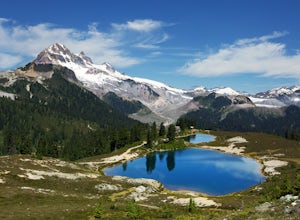
Hike to Elfin Lakes, BC
4.713.7 mi / 1968.5 ft gainTo access the trail head you will have to drive a few kilometres up a pretty beat up service road, so SUV's and 4x4 are a must but it can be done in a regular car if you take it easy. Lots of pot holes and loose rocks.The hike to Elfin Lakes might be 11km each way, but it is not very steep and is...Read more -
Whistler, British Columbia
Hike to Little Diamond Head
22 mi / 5900 ft gainGiven the total distance and cumulative elevation gain of this hike, I would suggest a good level of fitness to reach the summit. The trail does not have any technical challenges and the elevation gain is gradual. The final kick up to the summit involves some loose scree and minor exposure depend...Read more -
Bow, Washington
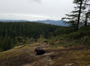
North Butte via Chuckanut Trail
1.07.71 mi / 2047 ft gainThe HikeThe hike there isn't short, has several steep sections, and ends at the top of the mountain. There are cliff warnings at the top, so be careful as you explore the view! The steepest portions are at the beginning and right at the end. The trail is very well maintained (because it is so pop...Read more -
Olga, Washington
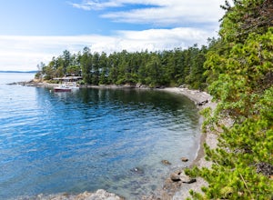
Camp at Obstruction Pass State Park
5.0The nine primitive campsites and one Cascadia Marine Trail campsite of Obstruction Pass State Park are the only first come, first serve campsites available on Orcas Island. The campsites themselves overlook a fantastic (and accessible beach) and Obstruction Pass itself. There are four composting ...Read more -
Squamish, British Columbia
Backpack to Lake Lovely Water
3.76.24 mi / 3714 ft gainThis adventure is one of the best kept secrets in the Whistler area, let alone, British Columbia. The trailhead for Lake Lovely Water is located on the west side of the Squamish River. There is no road access to the trailhead so you need to cross the river via boat. Make reservations with the jet...Read more -
Blakely Island, Washington
Boat Camp at Blakely Island
From Washington Park in Anacortes, Washington we launched our 19' Beachcraft with a deep hull into Puget Sound on a beautiful blue sky morning. The weather and water was favorable for an overnight adventure to Blakely Island! We made our way across Rosario Straight and toward James Island (20 mi...Read more -
Fraser Valley D, British Columbia
Camp at Jones Lake
3.0Southwest of Hope and just east of Chilliwack, Jones Lake is a recreation site at a reservoir lake in the coastal mountain range, managed by BC Hydro. Set below granite mountain peaks and surrounded by a dense forest (that is unfortunately being logged), this lake isn't pristine, but it sure is p...Read more -
Fraser Valley D, British Columbia
Paddle on Jones Lake, BC
5.0Jones Lake Reservoir is approximately 25 km southwest of the town of Hope, British Columbia. Directly off of BC Highway #1 at the community of Laidlaw. To reach the lake, you will have to drive 9 km (5.6 mi.) on a steep and pretty beat up gravel road. The Jones Lake Forest Service Road is car ac...Read more -
Squamish, British Columbia
Camp at Alice Lake Provincial Park
5.0Alice Lake Provincial Park is located just North of Squamish. To get here, exit right off Highway 99 when coming from the South onto Alice Lake Rd. The campground is located under 5 minutes up the road and is first come first serve during low season. From late Spring to Early fall, make sure y...Read more -
Friday Harbor, Washington
Kayak Camp on Stuart Island
5.0The northwestern-most point of the San Juan Islands, Stuart Island, is arguably the most gorgeous island to circumnavigate. Unfortunately, as Stuart Island is 16 miles away from the closest ferry port, there is no simple way to get there in one day. A couple of options to get there include:1) Onc...Read more -
Whatcom County, Washington
Yellow Aster Butte and Tomyhoi Peak
4.713.4 mi / 4902 ft gainThe best way to describe the location is due east of Bellingham. After driving through gorgeous roads to reach Twin Lakes Road (fire service road 3065), you are treated to about a 4-mile drive up to the trailhead for Yellow Aster Butte (8.3 miles RT with 2850' of gain) and Tomyhoi Peak. The drive...Read more -
Whatcom County, Washington
Yellow Aster Butte
9.08 mi / 3258 ft gainYellow Aster Butte has to be one of the most visually rewarding hikes in the Mt. Baker-Snoqualmie National Forest for the effort required to get there. Abundant with lush, rolling mountain meadows, hikers can be treated to an abundance of wildflowers, heather fields, and berry patches with dreamy...Read more -
Whatcom County, Washington
Winter Hike to Winchester Mountain
3.5 mi / 1320 ft gainDespite this trip report being titled "to Winchester Mountain", the fun doesn’t stop there. Even though Winchester Mountain is the most popular summer hike departing from Twin Lakes, this whole area turns into a fun-zone during the winter.Upon reaching higher ground above the lakes, this zone off...Read more -
Whatcom County, Washington
Winchester Mountain Fire Lookout
4.83.28 mi / 1335 ft gainWinchester Mountain is said to have the greatest reward for least amount of effort in all the North Cascades. One of the last fire-lookouts in the region stands on the summit. Views from the summit of Winchester Mountain are beautiful and dramatic to say the least. Being one of the easiest hikes...Read more -
Squamish-Lillooet, British Columbia
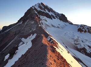
Climb Mt. Garibaldi
12.5 mi / 4350 ft gainDuration: 2 DaysClosed Gate (described below): 49.831834, -123.088424Camp Ground: 49.855926, -123.016797 Driving north from Vancouver along the Sea to Sky Highway (HWY 99) pass through Squamish. Turn right on to Cat Lake Road (Cheekye FSR).49°48’52.6”N 123°07’25.5”W From here the route becomes ...Read more -
Deming, Washington
Backcountry Skiing Near Mt. Baker
5.0Park at Heather Meadows parking lot at Mount Baker Ski Resort and follow the Blueberry cat-track, which is actually a paved road in the summer, leading south up for 2 miles passing Austin Pass and continuing southwest on to Artist Point, gaining 1200 ft in elevation. From there, dig out your snow...Read more

