2 Days of Adventure through the Landscapes of Oregon’s Remote Southeastern Corner

Oregon’s most remote areas are in its southeastern corner. Here, deep in the rainshadow of the Cascades, the dry lands are folded and faulted in tilting mountains and vast expanses of sagebrush. Fault-block mountains delineate this geography, flourished with shallow lakes and the very occasional river fed by snowmelt from on high. Lava underlies much of the terrain, ancient flows now bent and rent into horst and graben. Pronghorn roam freely, birds flock in great numbers along the flyway, and jackrabbits dart among the underbrush with lizards and snakes. At the center of this landscape lies its highest point, a grand crown of earth reaching nearly 10,000 feet above the distant sea, a summit around which we orbit as we make this journey, exploring the world around Steens Mountain.
Friday
With a good friend in town, it’s time to head east and explore springtime in an arid land. We know a two day trip isn’t enough, but it will have to do for now. It has been over a year since I was in southeast Oregon, and I’m as anxious to return as I am to share this magical geography with another. We load up our cameras and our mobile library of maps, field guides, and geologic texts, grab some breakfast, and head east into the High Desert.
Glass Buttes
We pull off Highway 20 for a quick exploration and some obsidian rockhounding. The Glass Buttes are a group of volcanic vents that were most active between 6 and 7 million years ago. Today, they are a prime destination for obsidian collecting — hence the name “Glass Buttes.” We ramble along a rough road for a bit, approaching the base of the main complex, and eventually hop out at a promising location. The open ground between the sagebrush is all black and red, a mixture of dark, shimmering obsidian and other igneous rocks. There is no one else here. This will be a theme for most of our journey: solitude.
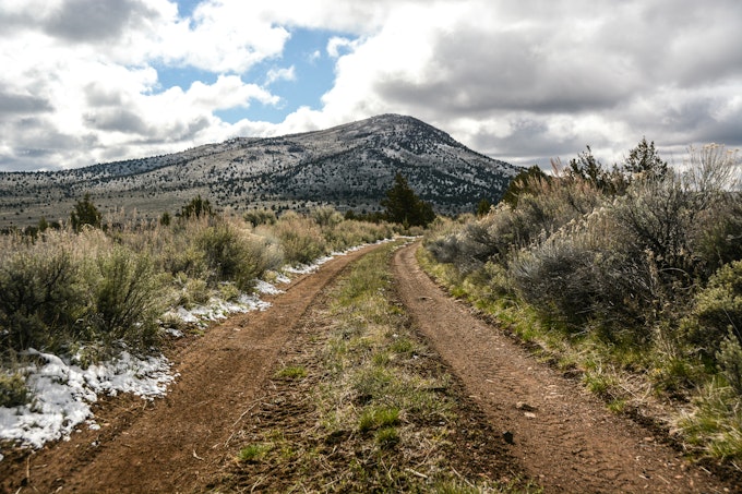
Fresh snow still lies in some shady spots among the junipers. Puddles fill depressions in the road, splattering our obsidian-black car with the tans and browns of the dusty landscape. There’s plenty to explore here, with dirt roads forking off frequently to different corners of the buttes, but the rest will have to wait for another day. More peaks call in the southeast.
Malheur National Wildlife Refuge
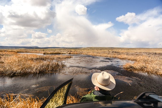
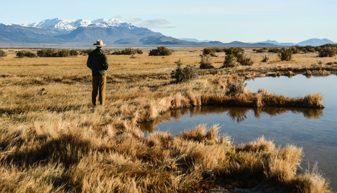
We gas up in Burns, then turn south for the birds. Malheur NWR is our destination (though we have no plans to occupy it long term), but the flooded fields along the way are just as rich with avian travelers as the Blizten River will soon prove to be. We admire the sandhill cranes and the long-billed curlews then press on to the refuge proper. At headquarters we borrow a free CD to guide us along the Center Patrol Road and start upstream along the Blitzen. Birds are bountiful all the way down to Frenchglen, along with mule deer and cottontails.
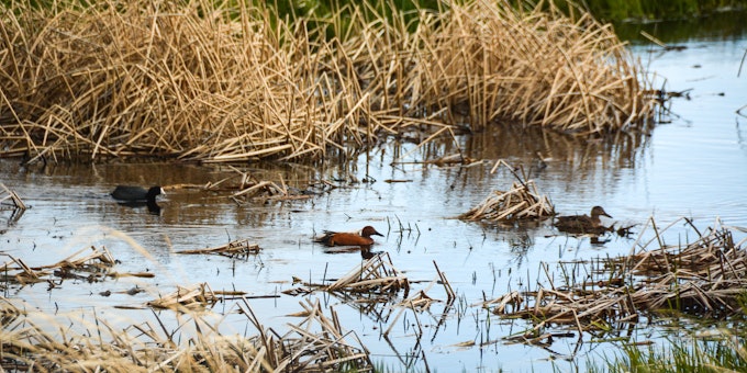
We stop often, identifying ducks and swallows, roaming through the sagebrush, and wishing the clouds over snowy Steens would part. The sun shines warm on the valley, and it seems we can claim to be the only humans occupying it currently. Of course there are others, but the vast expanse allows for solitude on some scale. Fresh green tule pokes up through the surface of the shimmering water, but the brown stalks of last season color the landscape. Spring isn’t entirely sprung here: the snows of Steens will soon fill these wetlands and sloughs far higher than they sit today. Yet even though the ponds aren’t full, the beauty is undeniable. By the time the day is done, we identify 25 species of birds, and there are likely another 10 that we see only fleetingly and thus fail to note.
Diamond Craters, the Round Barn, and Frenchglen
About halfway down the Center Patrol Road, we take a brief jaunt northeast to Diamond Craters, a conglomeration of volcanic maars and cinder cones that erupted around 7500 years ago. We amble among the basalt and stand alone on the flanks of this little shield volcano. A kestrel zips by overhead, beating its wings under intermittently clear and cloudy skies. Sagebrush gives way to red cinder and basaltic outcrops, yielding glimpses of the moonscape that has been overtaken by the flora of the high desert. It can be challenging to escape the influence of volcanism in Oregon.
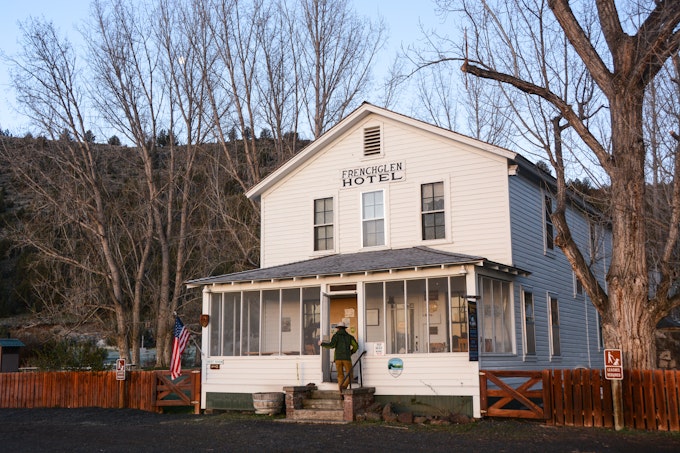
Past Diamond Craters, we stop at the Pete French Round Barn, remnant of a time when French and his cattle ranch operations ruled this corner of the state. The Round Barn was used to break horses in the winter, its uncommon shape conducive to training and exercising the animals. From here, we drive to Frenchglen, a small town named for French and his father-in-law, Hugh Glenn. We spend the night in the historic Frenchglen Hotel, watching the last light fade out on the snowy heights of Steens to the east. Though I long to gain elevation, the gates on the loop road are still closed for the season. Just another reason to return.
Saturday
Day breaks and we drive south into the Catlow Valley. The views west to Hart Mountain are grand, but soon we turn east through Long Hollow and cross over towards the town of Fields between Steens and the Pueblo Mountains. Early light glows on the peaks that spread out before us, and the scenery reminds me very much of Iceland, only with different plants.
Borax Lake
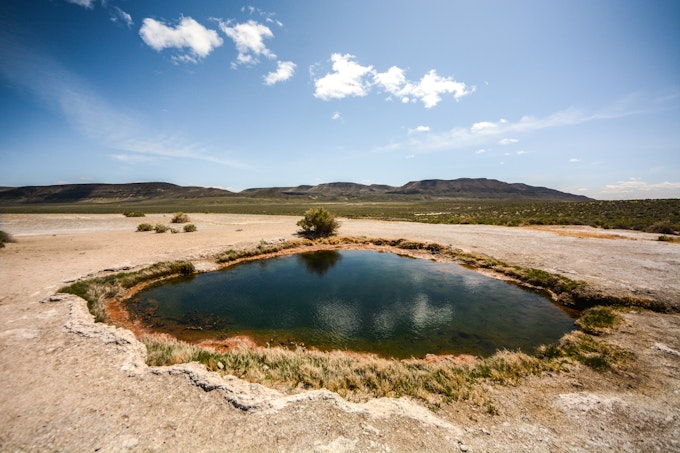
The morning’s first stop is Borax Lake, a bubbling body of water on the southern edge of the Alvord Desert. Fed by hot springs, the lake steams in the morning sun, elevated on a pedestal of its own making. Its name comes from its natural production of borax salts that were mined from the area back in the late 1800s.
Today, this land is owned by the Nature Conservancy with the goal of protecting the lake’s endemic fish species: the Borax Lake chub. The water has 25 times the critical limit of arsenic for human consumption, but the chub is well adapted to this ecosystem and thus thrives. Willets and Canada geese share the lakeshore with us, and together we enjoy a sublime view of Steens Mountain.
Alvord Desert
After 9:30am breakfast milkshakes in Fields, we head north for the Alvord. This is Oregon’s driest spot, with an annual rainfall of 5 to 7 inches. The desert lies in the rainshadow of Steens, which in turn lies deep in the rainshadow of the Cascades, so water is scarce here. But not today.
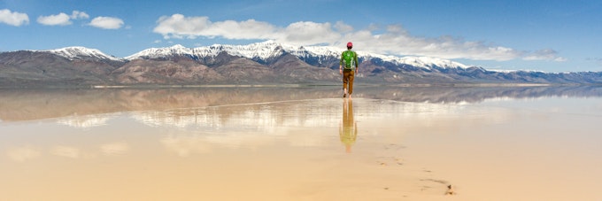
We crest a ridge and receive our first view of the playa, the dessicated bed of a long gone glacial lake. Usually it is a sweeping plain of cracked white earth, but today its center is shimmering with a shallow, ephemeral body of water. We drive out onto the playa and soon reach the shore of the “lake.” The spring weather has delivered this oasis via scant rain and snowmelt, and on this calm April morning the water is reflecting the surrounding ranges in full glory. We cruise further out to the east and find a place to take it all in. There are a few other souls out on the Alvord this morning, but we can’t see them from here. All is still, quiet, reflective, and wonderful.
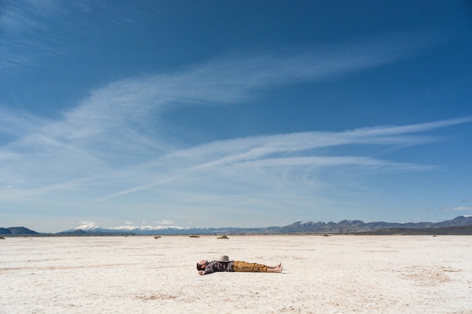
The Alvord Desert is one of my favorite places in Oregon. Its size is hard to comprehend, its flatness is freeing, and its views are never underwhelming. In every direction there is beauty, in every direction there is wilderness. Big sky arches endlessly above while cracked earth below beckons one to wander any and every which way. There is freedom in this place, freedom granted by open air, open ground, and open eyes. Endless beauty, endless desert, endless exploration.
Mickey Hot Springs
As ever, time marches on and pulls us out of our desert reverie. We’re bound for Bend this evening, so we must move on with one last wonder awaiting us to the north. Gravel tracks in the sagebrush lead us out to Mickey Hot Springs, a small enclave of Yellowstone-esque mud pots and geothermal springs. We take care to follow the footprints of others here, for the ground is thin in spots and we aren’t keen on getting cooked. Before us lies a deep emerald pool ringed with the oranges and reds of the thermophiles that call it home. Beyond that, a mudpot boils beside a bubbling spring whose outflow trickles down into the sagebrush.
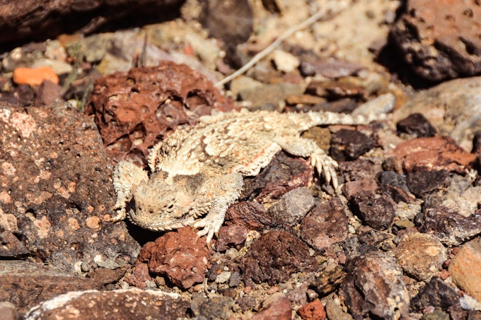
I startle a jackrabbit as I head up a slope for a better view. As I photograph him, my attention is called upslope: we’ve spotted a lizard. Not just any lizard, either, but my favorite lizard — the desert horned lizard. This one is perfectly camouflaged, its coloration impeccably mimicking the lichens and rock over which it scrambles. Though their appearance suggests menace, these lizards aren’t much to be afraid of (unless you are an ant or similar invertebrate, in which case you should be very wary of getting eaten).
For me, this is the perfect cap to desert ramblings: an encounter with a favorite species on the flanks of a geothermal wonder in the shadow of Steens. The road soon pulls us back to the west, away from Steens, past hawks and falcons on fenceposts, through wetlands with white-faced ibises, and over the sagebrush plains dotted by pronghorns. Southeast Oregon fades into Central Oregon and the beauty of the Alvord falls further and further behind.
In my heart, though, I’m still there, walking barefoot through the shallow water and mud of the playa, staring at Steens, rapt in the wonder of the desert.