
Kyle C

Rappel Big Horn Canyon
Moab, Utah
3.5 mi
/ 500 ft gain
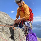
This canyon requires an Arches Canyoneering Permit, two 60m ropes, 100 ft of webbing, and your normal canyoneering kit.
To reach the parking for the canyon, drive five miles or so into Arches until you reach a bridge. Shortly after the bridge, there will be a pull-off to the left where you can leave your vehicle. From the parking lot, follow the wash directly west towards the cliffband. Ski...

Paddle Rampart Reservoir
Colorado Springs, ColoradoRampart Reservoir is located off of Rampart Range Road and is boat accessible from Spring until Fall. It has a boat ramp for motorized as well as human powered boats. There are vault toilets nearby. It is a nice place to spend the day paddling at close to 9,000 ft elevation. Just be prepared for the weather! You can fish as well as hike around the lake as well. The lake is stocked by the state....

Climb at Lumpy Ridge
Estes Park, ColoradoLumpy Ridge is mostly a traditional climbing area with most climbs being two or more pitches after a mile to 3+ miles of mostly flat walking. From climbers left to right the larger areas consist of Sundance Buttress, The Bookend, The Bookmark, The Book, and Twin Owls. There are smaller formations between these that are worth exploring as well.
Sundance Buttress is the highest of the cliffs a...

Hike Cheyenne Mountain
Colorado Springs, Colorado
16 mi
/ 3400 ft gain
This trail starts out of Limekiln Trailhead in Cheyenne Mountain State Park. This is a large, obvious trailhead with bathrooms and water. From the trailhead follow the Talon trails on flatter terrain for the first 3 or so miles until it starts to steepen and turns to Dixon trail. These first few miles can be great areas for wildlife. Dixon takes you through switchbacks in forested terrain with ...

Descend Lost and Found Canyon
Moab, Utah
4 mi
/ 600 ft gain
For this descent you will need two 60 meter ropes, an Arches National Park canyoneering permit, be comfortable with 4th class slick rock, and have your usual canyoneering kit. This canyon does require some basic chimneying and canyoneering climbing techniques as well. The trailhead can be reached with a high clearance car in most conditions as long as it has not rained recently.
From the park...

Breckenridge Troll
Breckenridge, Colorado
5.0
0.2 mi
/ 26 ft gain
Isak Heartstone, otherwise known as the Breckenridge troll, can be accessed from the Illinois Gulch Trailhead. This trailhead can be full for much of the day, so it is advisable to find parking in town and then take a bus, walk, or bike to the starting point of this short walk. Once at the trailhead, follow the Trollstigen signs for 500 or so feet on an easy path in the summer or an icy, comp...

Shelf Road
Cañon City, Colorado
5.0
Shelf Road, which was once a toll road from Cripple Creek to Canon City, is now a maintained dirt road that most high clearance two wheel drive cars can make. It will take over an hour to travel the 25 miles or so, and it can be completed going from north to south or the opposite. I will explain the route from south to north.
From the town of Canon City, follow Highway 9 north. You will go ...

Descend MMI Canyon
Moab, Utah
3 mi
/ 700 ft gain
For this descent you will need to be comfortable with 4th class slick rock, have two 60m ropes, and an Arches National Park canyoneering permit along with your usual canyon kit.
MMI Canyon can be accessed with 4WD/AWD as long as it has not rained. The pin on the map will take you to this location. There is a 2WD trailhead that almost doubles the length of the route that is a few miles northw...

Camp at Skaftafell Campground
64.016137,-16.968895, IcelandSkaftafell is a large campground in the largest national park in Iceland. Grass for tents is located on the east side of the campground and gravel is on the west side for vans. You are situated very close to plenty of hiking trails that you can reach from the campsites themselves. Some of the more popular hikes include Svartifoss and Sjónarnípa. There are obviously many others.
The camping is...

Explore Asticou Azalea Garden and Preserve
Mount Desert, MaineAsticou Azalea Garden is a portion of 1400 acres managed by Land & Garden Preserve. Here, you park at a small parking lot on the east side of 198 close to the intersection of Peabody Dr. and 198. Parking is limited so if it is full come back in a bit!
From the parking lot you can follow a trail south winding through trees and ponds on a gradual walkway. You can explore the moss garden, ...

Siamese Twins Loop
Colorado Springs, Colorado
4.0
0.55 mi
/ 105 ft gain
Siamese twins is about a half mile hike with little elevation gain that is a quick hike while driving the park. The hardest thing about this is getting a parking spot to tell you the truth. On a weekend or pretty much any summer day the five or so spots available at the trailhead are constantly full. For this reason, it might be easier to park at the store down the road or if you are spendin...

Manitou Springs' Mineral Springs
Manitou Springs, Colorado
5.0
Manitou Springs is home to eight mineral springs all fairly close to the main shopping strip of Manitou. The springs were originally utilized by the Native Americans. In the 19th century, they were utilized by visitors from all over the world due to their supposed health benefits. They all taste different based off of their mineral content, and most of them have some degree of carbonation. The ...

Walk to Rainbow Falls
Manitou Springs, Colorado
0.5 mi
This waterfall was designated a historic site in 2016 due to its rich history dating back to the Native Americans and more recently the locals of Manitou Springs. The bridge itself that crosses over the falls was created in the early 20th century and was an architectural marvel during the time.
Parking can be tight especially during the summer. There are a few sites at the hairpin turn on Se...

Paddle Lily Lake
Estes Park, ColoradoLily Lake allows boating in non-motorized watercraft and is only a short carry from your parking area by 7. Parking can be limited so get there in the morning early so that you can enjoy the morning wildlife and decreased crowds. You can spend an hour or so here kayaking slowly around enjoying the water. Ducks and other birds often frequent the western edge of the lake.
This lake is in the nati...
")
Mount Lindsey (CLOSED)
Gardner, Colorado
1.0
8.5 mi
/ 3300 ft gain
NOTE: As of September 2021, Mount Lindsey has been closed to public access indefinitely. (Source)
At 14,042 Mt. Lindsey is not one of the tallest 14ers, but it is a fun objective regardless. The Lily Lake trailhead can be somewhat difficult to access without a high clearance car, but most cars can probably make it. There is quite a bit of private property along the road so just be careful if ...

Hike, Climb, or Bike Red Rock Open Space
Colorado Springs, Colorado
2.0
3 mi
/ 300 ft gain
Red Rock Canyon Open Space was made public in the early 00's after years of use as a quarry and landfill. Some of the stone quarried from the area have even been used in some of the downtown buildings.
Getting there is straightforward, heading West on 24 there is an obvious turn off left between 31st street and Manitou Springs. From the entrance of the park, you can turn right to a small parkin...
Community
Mobile Apps

© 2024 The Outbound Collective - Terms of Use - Privacy Policy