Bailey Cove
Book this listing through our partner Recreation Gov
About Bailey Cove
Overview
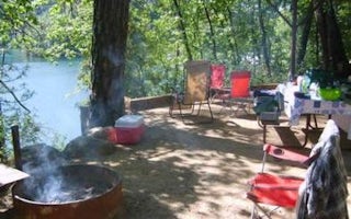
Bailey Cove Campground is nestled in a forested area on the McCloud Arm of Shasta Lake. The site is a popular destination due to its convenient access from I-5 and the adjacent public boat ramp.The area surrounding the campground offers an abundance of recreational and sightseeing opportunities.
Recreation
The campground provides access to the 3-mile Bailey Cove Trail. This trail hugs the shoreline and is open to both hikers and mountain bikers.Lake Shasta attracts anglers due to its wide variety of fish. Boaters can access the lake via the adjacent boat ramp, and boat rentals are available nearby.
Facilities
Each of the 7 sites has a tent pad, picnic table, raised fire ring, bear boxes, and paved parking spur. Brick pavers have been used to provide added accessibility. Flush toilets and drinking water are provided.There is a day use area adjoined to the campground and boat ramp, which provides parking and restrooms and pic-nic tables with bbq's and hiking trails.
Natural Features
Shasta-Trinity is the largest national forest in California with a diverse landscape encompassing five wilderness areas, hundreds of mountain lakes and 6,278 miles of streams and rivers.Lake Shasta sits at an elevation of 1,067 feet, with 365 miles of shoreline punctuated by steep mountains blanketed in manzanita and evergreens. A snow-capped Mount Shasta, the second-tallest mountain in the Cascade Range, looms in the distance.
This area boasts abundant wildlife. Osprey nests are often seen in the area around Bailey Cove Campground.
Nearby Attractions
Lake Shasta Caverns are also located on the McCloud Arm of Shasta Lake in an area know as the Grey Rocks. Tours are given daily at this privately owned facility.At an elevation of 3,500 feet, the nearby Hirz Mountain Lookout offers panoramic views of Mt. Shasta, Mt. Lassen and the surrounding area.
Bailey Cove Reviews
Have you stayed here? Be the first to leave a review!
Top Spots in or near Shasta County
Houseboat Lake Shasta
Redding, California
1 mi
/ 1 ft gain
Lake Shasta sits at the foot of infamous Mt Shasta, past the major Northern California city of Redding. From the Bay Area you can count on at least a 3.5 hour drive to get to waters edge, but the drive goes by quickly just cruising on HWY 5. There are multiple Marinas on Shasta but the largest is at Bridge Bay, ironically located right where HWY 5 crosses over Lake Shasta. There are multiple di...
Camp at Shasta Campground
Redding, CaliforniaShasta Campground offers 27 tent/trailer campsites, picnic tables, paved loop road, vault toilets, OHV staging area, potable water, and fire rings. To get to the campground head along Keswick Reservoir, below Shasta Dam. Take I-5 north from Redding about 10 miles to Shasta Dam Blvd. Follow Shasta Dam Blvd. to Shasta Dam (dam hours are 6AM to 10PM), cross the dam, turn left and follow the road...
Flanagan and Chamise Peak Trail
Redding, California
5.0
4.64 mi
/ 906 ft gain
The Flanagan Trail to Chamise Peak is a family-friendly hike with moderate slopes and excellent views. The trail winds through shaded woodland, offering glimpses of Shasta Dam, Lassen, and the Sacramento River. Though long, it’s manageable for all ages, with a bench halfway up and a picnic table at the peak. However, there are no restrooms or water stations available.
The trailhead begins ...
Potem Falls
Round Mountain, California
5.0
0.58 mi
/ 151 ft gain
Park in the pull-out on Fenders Ferry Road. There you will find the Potem Falls trailhead. The hike is only 0.6 miles long--you'll likely spend more time enjoying the falls than getting there! Bring your swim gear if you want to jump in the pool. The trail is dog-friendly and open March-October.
Hilltop Trail Head to Sundial Bridge
Redding, California
4.0
2.27 mi
/ 167 ft gain
Hilltop Trail Head to Sundial Bridge is an out-and-back trail where you may see wildflowers located near Redding, California.
Arboretum Loop Trail
Redding, California
3.5
2.07 mi
/ 43 ft gain
Arboretum Loop Trail is a loop trail that takes you by a river located near Redding, California.
Camping and Lodging in Shasta County
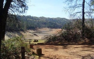
Shasta County, California
Nelson Point
Overview
Nelson Point Campground is situated along the Sacramento Arm of Shasta Lake, easily accessible from 1-5 and located nearby many ...
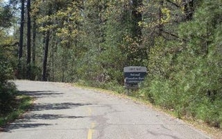
Hirz Bay Road
Hirz Bay
Overview
Hirz Bay Campground is nestled among Manzanita and oak trees on a hilltop overlooking the McCloud Arm of Shasta Lake. The scenic...
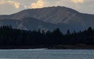
Redding, California
Mariners Point Group Campground
Overview
Mariners Point Campground is located where the Pit and Squaw arm of Shasta Lake come together and offers sites to both tent and ...
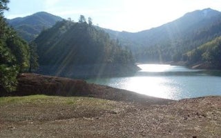
Shasta County, California
Dekkas Rock
Overview
Dekkas Rock Campground provides scenic views of the mountainous shoreline from the McCloud Arm of Lake Shasta. This group campgr...
Lakehead-Lakeshore, California
Antlers
Overview
Antlers Campground is situated on a bluff above the Sacramento arm of Shasta Lake. The grounds are heavily forested with pine tr...
Whiskeytown-Shasta-Trinity Nra
Peltier Bridge Primitive Campground
Overview
This tent-only campground is located in the southeast corner of Whiskeytown National Recreation Area, 13.5 miles west of Redding...
Unfortunately, we don't have up-to date pricing data for this listing, but you can check pricing through Recreation Gov.
Book NowAdd your business today to reach The Outbound's audience of adventurous travelers.
Community
© 2024 The Outbound Collective - Terms of Use - Privacy Policy


