Cowpuncher Guard Station
Book this listing through our partner Recreation Gov
About Cowpuncher Guard Station
Overview
Cowpuncher Guard Station is located in the Dixie National Forest, 20 miles northeast of the town of Escalante in southern Utah. The cabin is situated just off the Hells Backbone Road and is accessed by road during summer and fall. Roads are usually closed by snow 5.5 miles from the cabin from late November to mid-April. Check the ranger station for winter conditions.Recreation
The cabin is surrounded by trails, including the Great Western Trail which offer abundant opportunities for hiking, mountain biking and horseback riding. Horses may be kept in a corral just down the road. Pine Creek flows through the site offering excellent trout fishing. The scenic Hells Backbone Road is minutes away and is a popular scenic drive for both cars and OHVs.Facilities
The cabin is comfortably furnished with bunk beds and one full size bed, table and chairs, wood cook stove, propane stovetop, kitchen sink with cold running water (summer and early fall), battery operated lanterns, pots and pans, dishes and utensils. A covered porch extends the space outside with a picnic table and fire ring below. A vault toilet is located 150 ft. from the cabin and firewood is provided.Natural Features
Cowpuncher sits in a secluded meadow surrounded by pine and aspen groves next to a small trout stream. The elevation at the cabin is 8,000 feet and the adjacent pine and aspen covered slopes quickly rise up to 8,900 feet. Summer days are warm and nights are cool.Nearby Attractions
Cowpuncher offers a cool escape from the surrounding desert landscape and is often used as a base to explore the surrounding area. The Escalante area of southern Utah offers breathtaking scenery nearly everywhere you look. Sightseeing along Road 153, Hells Backbone Road, and Utah Highway 12, a National All American Highway, is very popular. The Grand Staircase-Escalante National Monument, Anasazi State Park, and the Escalante Petrified Forest State Park are all located in the area.Cowpuncher Guard Station Reviews
Have you stayed here? Be the first to leave a review!
Top Spots in or near Escalante
Backpack Death Hollow in Grand Staircase-Escalante
Boulder, Utah
22 mi
/ 1600 ft gain
The most popular route into Death Hollow is from the Boulder airstrip near the town of Boulder, Utah. The trailhead for the Boulder Mail Trail begins, or ends here depending on which way you are hiking. Leave a car at the Highway 12 bridge over the Escalante River for the thru hike, or get lucky and try to hitchike back to your car at the trailhead which I've done before as its a very short a...
Drive the Burr Trail Scenic Backway
Boulder, Utah
5.0
66.2 mi
/ 4124 ft gain
The Burr Trail is a 66 miles mostly-paved road connecting Boulder, Utah / Highway 12 with the Notom-Bullfrog road that passes through some of the most scenic (and largely untouched) painted-rock backcountry in three of our national parks/monuments including Grand Staircase-Escalante, Capitol Reef, and Glen Canyon with endless epic hikes and backpacking trips like Hiking the Upper Muley Twist, t...
Upper Calf Creek Falls
Boulder, Utah
5.0
1.76 mi
/ 571 ft gain
Finding the trailhead for the Upper Calf Creek Falls can be a little difficult. Head east out of Escalante and follow highway 12 for about 20.6 miles. There will be a dirt turnout on the left hand side that leads to a dirt parking lot and a trail sign with registration for the Upper Calf Creek Falls hike. The sign can be hidden behind some trees so be on the lookout. We missed the turnout the f...
Camp and Fish Deer Creek Lake
Boulder, Utah
2.7 mi
/ 702 ft gain
There is something magical about Deer Creek Lake. The views are amazing, the hike is revitalizing, and the mountain air speaks to your soul. Stars seem to shine brighter here than any other trip you will go on. Out here, it is you and the wild. You will be able to see fish colored with bright cutthroat red from the shore line while occasionally seeing them break the surface during feeding. On a...
Backpack the Escalante River
Escalante, Utah
14 mi
/ 400 ft gain
The Escalante River trail is an easily accessible, moderately strenuous hike within Grand Staircase-Escalante National Monument. The national monument encompasses over 2 million acres of wilderness, choc-full of large canyons, narrow slot canyons, rivers, hoodoos, arches, natural bridges and more. This trail follows the Escalante River through a large canyon, and allows access to many side cany...
Escalante River Trail: Escalante to UT-12
Escalante, Utah
12.97 mi
/ 3373 ft gain
Escalante River Trail: Escalante to UT-12 is a point-to-point trail that takes you by a river located near Eggnog, Utah.
Camping and Lodging in Escalante
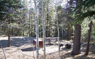
Escalante, Utah
Posey Lake Campground
Overview
Posey Lake Campground is located next to its beautiful namesake lake high on the Colorado Plateau at an elevation of 8,800 feet....
Garfield County, Utah
Lower Bowns
Overview
Lower Bowns Campground is located on the east side of Boulder Mountain on the shore of Lower Bowns Reservoir at an elevation of ...
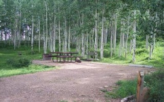
Garfield County, Utah
Barker Recreation Area
Overview
Barker Recreation Area is located high on the Colorado Plateau at an elevation of 9,300 feet. Visitors enjoy canoeing, fishing a...
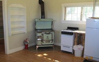
Bicknell, Utah
Aquarius Ranger Station
Overview
Aquarius Ranger Station is located about 15 miles south of Loa, in eastern Utah. It sits on the west side of beautiful Boulder M...
, Utah
Rosebud Atv
Overview
Rosebud ATV Campground is located high on the Colorado Plateau at an elevation of 8300 feet. Torrey, Utah is just 17 miles north...
Teasdale, Utah
Singletree
Overview
Singletree Campground is located on the east side of Boulder Mountain in central Utah. Visitors enjoy hiking and sightseeing in ...
Unfortunately, we don't have up-to date pricing data for this listing, but you can check pricing through Recreation Gov.
Book NowAdd your business today to reach The Outbound's audience of adventurous travelers.
Community
© 2024 The Outbound Collective - Terms of Use - Privacy Policy


