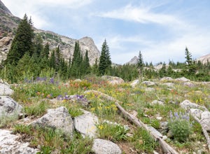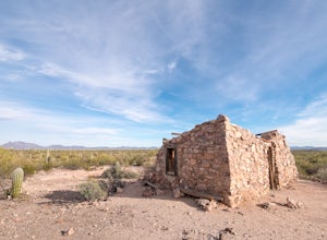
Hike to the Ruins of Fort Bowie
Bowie, Arizona
5.0
3 mi
/ 500 ft gain
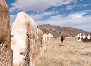
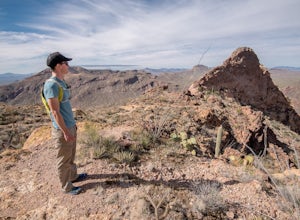
Fort Bowie is an abandoned military outpost and the site of many bloody battles between the government and Native Americans. The fort and visitor center can only be reached on foot, which guarantees a quiet, uncrowded experience through this lovely canyon.Begin at the trailhead on Apache Pass Road. The approach from the town of Bowie is paved until the last couple miles, and is suitable for a p...
Explore the Town Walls of Piran
Piran, Slovenia
5.0
0.5 mi
/ 200 ft gain
From Tartini Square walk east on Ulica IX Korpusa. The short 1/4 mile trek is mostly uphill. Enter the town walls at the turnstile entrance on your left. The entrance fee, paid directly into the turnstile, is 2 Euros.The town is constantly battling to keep the walls standing and the stairs safe, so not all areas are open for exploring. Expect steep staircases, short ceilings, and narrow balconi...
Hike to the Oak Hill Fire Tower
Concord, New Hampshire
4.0
3 mi
/ 500 ft gain
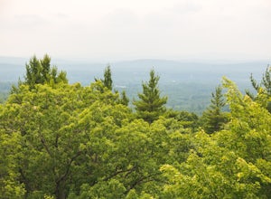
Climbing to the Fire Tower on Oak Hill is a great urban adventure, short enough for a lunch break trail run or a morning hike with the family. The trail is primarily wooded, with a panoramic view from the Fire Tower for those brave enough to ascend it's wooden steps.Park at the well signed dirt lot on Shaker Road, north of the intersection with Snow Pond Road. A small kiosk outlines the hiking ...
Devil's Den Trail
Winslow, Arkansas
5.0
1.26 mi
/ 315 ft gain
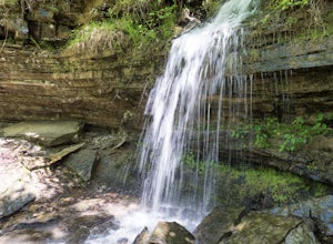
The Devil's Den Trail, in Devil's Den State Park, is a haven of vivid green along Lee Creek. This is the perfect hike for families, photographers, and those new to the Ozarks.
The trail is a modest 1 1/2 miles with little elevation gain. In that compact span it weaves past gravity fed seeps, dripping (sometimes rushing) waterfalls, caves that waft cold air from their depths, and the beautiful ...
Ski to Redfish Lake
Stanley, Idaho
5.0
4 mi
/ 200 ft gain
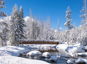
Park in the turnout west of Redfish Lake Road on Highway 75. The turnout is plowed to fit 10 to 15 cars.Walk over the bridge and turn right onto Redfish Lake Road. You will likely see tracks as it's a good access spot for backcountry skiers. The trail follows the road and is easy to navigate.Pass by the beautiful timber bridge over Redfish Creek before seeing Little Redfish Lake on your right. ...
Hike the Little City of Rocks
Gooding County, Idaho
4.0
4.2 mi
/ 800 ft gain
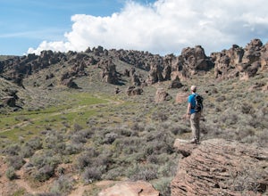
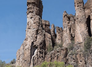
Located near Gooding, Idaho, the Little City of Rocks provides endless wandering through volcanic ash hoodoos and sagebrush desert.The parking area is less than two miles down a decently graded dirt road. In spring there is a water crossing. If your car cannot cross park and walk the short distance to the trailhead.Little City of Rocks's main trail lollipops for a total distance of 4.2 miles. T...
Shoshone Falls
Kimberly, Idaho
4.3
0.61 mi
/ 174 ft gain
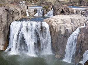
From Highway 93 in Twin Falls turn east onto Falls Avenue. After two miles turn left onto Champlin Road and continue to the entrance of Shoshone Falls Park.
Enjoy a view of the waterfalls from one of the many lookout decks. For a longer adventure, hop on the paved Centennial Trail and walk, run, or bike 1.4 miles to the site of Evel Knievel's unsuccessful 1974 jump across the canyon on a rocke...
Mesa Nature Trail
Ashton, Idaho
5.0
2.44 mi
/ 236 ft gain
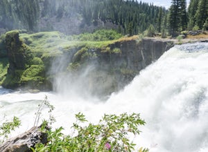
The Mesa Nature Trail begins on the dirt road to the Upper Mesa Falls overflow parking lot. The first mile of the trail is wide and smooth. Pause a half mile in to admire the Henry's Fork from the top of a lava field.
The trail terminates at a flat bluff overlooking the top of Upper Mesa Falls. To get closer, follow the narrow trail that heads north from the bluff.
The trail, steep and cover...
Corral Creek
Hailey, Idaho
5.0
6.55 mi
/ 696 ft gain
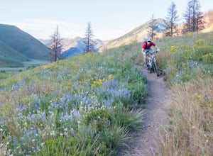
Park at the Trail Creek trailhead 2.5 miles north of Sun Valley. Pedal north and cross a wooden bridge over Trail Creek. Climb onto the bench and bike straight across toward the burned trees. Turn left onto signed Corral Creek Trail #325.
Nearly all of the 600 feet of climbing is done on the way out. Stop to catch your breath while admiring the views of the Pioneer Mountains. The trail termina...
Hike Little Bear Canyon to the Middle Fork of the Gila River
Catron County, New Mexico
8.5 mi
/ 1400 ft gain
After driving the winding mountain road from Silver City to Gila Hot Springs, I knew I had to do more than just see the Gila Cliff Dwellings (which are stunning, don't miss them). The Gila Wilderness is the first designated wilderness in the world, championed by Aldo Leopold. A hike into this remote Wilderness is a must.
The trail to Little Bear Canyon starts at TJ Corral, a short drive from th...
Hike around Nick's Lake
Old Forge, New York
6.2 mi
/ 475 ft gain
The hike around Nick's Lake is a gentle, beautiful hike near the resort town of Old Forge, New York. Park for free at the Bisby Road Trailhead, or cut two miles off the route and pay to park at Nick's Lake Campground ($10 per car).
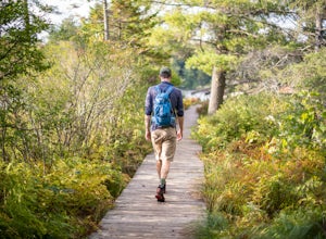
If you start from Bisby Road, sign in at the trail register then hike on the rocky trail toward the lake. At one mile in, you'll see a trail junction with big signs ...
Hike the Pioneer Cabin Loop
Hailey, Idaho
5.0
8.5 mi
/ 2500 ft gain
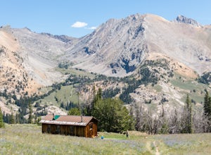
The hike to Pioneer Cabin is a Sun Valley classic, combining incredible mountain views with fields of wildflowers and a steady climb.Begin the hike at the Pioneer Cabin Trailhead. Climb 2500 feet over 3.6 miles on the Pioneer Cabin Trail. The terrain switches from forested to high alpine meadow and finally up a switchbacked scree field before cresting above the cabin. Wildflowers are best in la...
Hike to Big Fall Creek Falls
Mackay, Idaho
0.5 mi
/ 200 ft gain
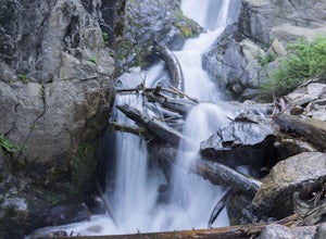
Access the trailhead for Big Fall Creek Falls via Trail Creek Road. From Sun Valley the road is typically passable for sedans but is prone to producing flat tires. The parking area doubles as dispersed, free camping.Start the hike by crossing the creek on the log bridge. With the creek on your right, follow the well-worn path up to the falls.Seeing the falls requires a water crossing without a ...
Draper Preserve
Hailey, Idaho
3.0
0.65 mi
/ 36 ft gain
Draper Preserve is a family friendly, dog friendly, photograph friendly hike accessible from the center of Hailey.
Lion Park, the starting point of this hike, has ample parking, a covered picnic area, and bathroom facilities. In the winter there is also a warming hut for the nearby cross country ski trails (trail pass required for the ski trails).
Take off from the covered picnic area and hi...
Hike Tumamoc Hill
Tucson, Arizona
5.0
3 mi
/ 800 ft gain
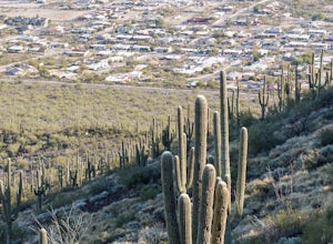
Tumamoc Hill is urban adventuring at it's finest. Park on Anklam Road, directly across from St Mary's Hospital, and follow the other hikers and runners to the trailhead.Tumamoc Hill is a one-lane paved road, trafficked infrequently by University of Arizona employees who work on the Hill's ecology research center. A sign at the base asks that the public stay off the road from 9:00am to 5:00pm du...
Hike the Rockefeller Forest Loop
Humboldt County, California
0.7 mi
/ 20 ft gain
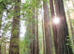
From the Avenue of the Giants turn west onto Mattole Road. Continue 1.5 miles to the Rockefeller Forest trailhead.Rockefeller Forest is a less well known grove in Humboldt Redwoods State Park. It's distance from the main road shelters the forest from traffic noise. The trail is wide and smooth, suitable for families and the less adventurous.The redwoods in Rockefeller Forest are densely spaced...
Hike the Estes Canyon/Bull Pasture Loop
Ajo, Arizona
3.6 mi
/ 900 ft gain
The trailhead for Estes Canyon/Bull Pasture is on the Ajo Mountain Road scenic loop. Ajo Mountain Road is a dirt, windy, sometimes steep, one way road. It is maintained so that a passenger car can drive it using caution.The trailhead has parking for two dozen cars, bathrooms, and a small shaded picnic area. Start this hike in the morning to beat the afternoon heat, and bring twice the water you...
Hike the Dismal Swamp Loop
Pocahontas, Tennessee
3.8 mi
/ 400 ft gain
Civil War history buffs may find themselves near the tiny town of Shiloh, Tennessee. While in the area be sure to explore Big Hill Pond State Park, in nearby Pocahontas, and hike Dismal Swamp.
After a night at the park's campground I drove a couple of miles on well-graded gravel road to the trailhead. Be sure to stop at the Visitor Center to get a map as trail junctions in the park aren't well ...
Camp at Twin Peaks Campground
Ajo, ArizonaTwin Peaks is the primary campground at Organ Pipe Cactus National Monument, minutes from the Mexican border in southern Arizona.This campground has it all: it's affordable, it's in the middle of a beautiful and remote desert, and it's surrounded by hiking.Twin Peaks is first come first served. If the campground is full you are not out of luck, there is ample boondocking available just outside ...
Bike around the Coba Mayan Ruins
Tulum, Mexico
5.0
3.1 mi
/ 20 ft gain
A short 45 minutes from Tulum, Mexico lies the partially excavated Mayan ruins of Coba. Encompassing 80 square kilometers, ancient Coba was connected via a network of elevated roads called sacbes.After paying a small entry fee to the Mexico National Institute of Anthropology and History ($64 pesos, $3.50 US) stop by the bike rental station inside the entry gate. For $40 pesos ($2.25 US) you can...
Hike Along Silver Creek
Bellevue, Idaho
3 mi
From the intersection of Highways 75 and 20 drive east on Highway 20 for 7.3 miles. Turn right onto Kilpatrick Bridge Road and drive another 1.5 miles to the Silver Creek Preserve Visitor Center.Stop at the Visitor's Center to take in the desert landscape and snap a few pictures. Exit on the far side of the porch onto the trail. The trail crosses over a series of boardwalks then hugs the edge o...
Hike to Johnstone Pass
Hailey, Idaho
5.0
5.4 mi
/ 2200 ft gain
Johnstone Pass is a diamond in a valley flush with hidden gems.Turn east onto East Fork Big Wood River Road from Highway 75. Continue through the defunct mining town of Triumph where the road turns to dirt and becomes Forest Service Road 118. At the fork stay right. Pass the Sawmill and Federal Gulch Forest Service campgrounds. Drive to the end of the road, approximately 17 miles from Highway 7...
Hike the Victoria Mine Trail
Ajo, Arizona
4.2 mi
/ 100 ft gain
The Victoria Mine Trail is a gentle traverse of the Sonoran Desert landscape. Any time of year, but especially in summer, be sure to bring plentiful water and sun protection, as there is no shade or respite on this route.Start at the southern end of Twin Peaks Campground, where there is trailhead parking for a handful of cars. Sign the trail register and start to make your way across the desert...
Hike the Desert View Trail
Ajo, Arizona
1.2 mi
/ 250 ft gain
The Desert View loop trail begins in the Twin Peaks Campground's group camping area. Hike it in either direction, but be sure to get to the top before the sun goes down.The trail is a gentle climb through a diverse cactus forest. Birds abound, and keep an eye out for the occasional lizard, snake and coyote. Once at the top the trail follows the ridge, providing plenty of spots to catch the sun ...
Community
© 2024 The Outbound Collective - Terms of Use - Privacy Policy

