Clarkdale, Arizona
Looking for the best hiking in Clarkdale? We've got you covered with the top trails, trips, hiking, backpacking, camping and more around Clarkdale. The detailed guides, photos, and reviews are all submitted by the Outbound community.
Top Hiking Spots in and near Clarkdale
-
Sedona, Arizona
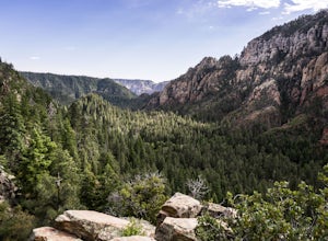
Hike up Cookstove Trail
1.6 mi / 800 ft gainEither a compliment to a night spent at the Pine Flat Campground or a quick day hike to top of your Sedona/Oak Creek adventure, this short hike will give you an alternative, but comparatively gorgeous view of the Sedona Area.This trail starts just north of Pine Flat Campground near milepost 387 a...Read more -
Prescott, Arizona
Hike Lynx Lake
4.83.52 mi / 182 ft gainStarting at the parking lot, you will have to pay your dues prior to beginning your hike. You will immediately be met with fresh air and refreshing summer temperatures. A short decent down will lead you to the first trail marker, which the 55-acre lake becomes the centerpiece of your view. At thi...Read more -
Camp Verde, Arizona
The Bull Pen
5.01.87 mi / 92 ft gainThis trail starts at the end of Bullpen Rd and your adventure begins in beautiful thickets of trees and plants. The going is easy and the tempting sound of rushing water is on your right as you continue parallel to West Clear Creek. The trail will veer left up a rocky old service road but pay att...Read more -
Flagstaff, Arizona
Hike the Two-Spot Loop Trail
2.5 mi / 100 ft gainThis loop trail has two different starting points. You can start at the south end of Rogers Lake (which is what I did) or the north end. I hike in a clockwise direction. This is recommended if you are hiking in the late afternoon as I did. The sun will be at your back during the section that has ...Read more -
Flagstaff, Arizona
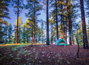
Camp at Red Rock
4.8Starting from Downtown Flagstaff we headed west. After making a left turn on Woody Mountain Road, we continued for 22 miles. Woody Mountain Road then becomes Forest Road 231. Continue on FS 231 until you find a killer spot to pitch it! Make sure to be wary of elk herds crossing the roads.We made ...Read more -
Flagstaff, Arizona
Hike the Soldier's Trail
5.05.6 mi / 300 ft gainThis trail was named in honor of the military troops that trained here during World War II. Keep in mind, this loop trail is at 7000 feet, so if you are driving up from Phoenix or even Sedona, you may feel a little winded. However, there is no serious climbs on this hike so you may feel no diffe...Read more -
Mayer, Arizona
Verde Rim Loop Trail
14.32 mi / 2631 ft gainVerde Rim Loop Trail is a loop trail where you may see beautiful wildflowers located near Camp Verde, Arizona.Read more -
Prescott, Arizona
Giant Alligator Juniper Trail
4.69 mi / 495 ft gainGiant Alligator Juniper Trail is an out-and-back trail that takes you past scenic surroundings located near Prescott, Arizona.Read more -
Yavapai County, Arizona
Verde Hot Springs
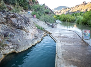
3.32.46 mi / 118 ft gainThe pools at the Verde Hot springs are the remnants from an old resort built in the 1920's. The resort was a once thriving tourist attraction and also rumored to be one of Al Capone's hideouts. In the 1960's a fire destroyed the resort only leaving behind the foundation and the thermal pools al...Read more -
Pine, Arizona
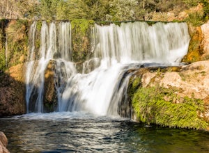
Fossil Creek Falls
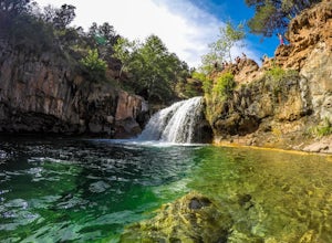
4.82.42 mi / 328 ft gainThe journey is definitely worth it! Don't let the description discourage you from visiting here. This is simply to help you be prepared so that you can enjoy this wonderful place as safely as possible! Fossil Creek Rd can only be accessed from Camp Verde via FH 9 (Hwy 260) and FR 708 due to road...Read more -
Black Canyon City, Arizona
Hike the Badger Spring Wash Trail
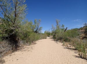
3.54 miBadger Spring Wash is a dry stream bed most of the year. This trail starts from the Badger Spring Trailhead just off Route 17 north from Phoenix. The trail follows the stream bed, sometimes in or along side for 1.5 miles. At about one mile, you reach the spring and a good amount of water which is...Read more -
Black Canyon City, Arizona
Badger Springs Wash Trail
5.01.48 mi / 98 ft gainBadger Springs Wash Trail is an out-and-back trail that takes you by a waterfall located near Cordes Junction, Arizona.Read more -
Pine, Arizona
Bob Bear Trail
5.08.58 mi / 1650 ft gainThe Bob Bear Trail (formerly Fossil Springs Trail) is a 8.3 mile out-and-back hike that takes you through a challenging, exposed trail to a waterfall in Tonto NF near Pine, AZ. Make sure you bring plenty of water for this hike 2-3L per person and give yourself ample time to get out and back. This...Read more -
Flagstaff, Arizona
Camp at Pine Grove Campground
Pine Grove Campground in Flagstaff Arizona is a hidden gem. Upper and Lower Lake Mary, Ashurst, Marshall and Kinnikinick lakes are nearby and can provide ample recreational activities.The campsites are clean and have all the luxurious amenities (Coin-operated showers, tables, fire rings and cooki...Read more -
Flagstaff, Arizona
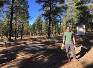
Frisbee Golf at McPherson's
1 miMcPherson's is a public disk golf course five minutes north of downtown Flagstaff. The course is seasonally open from May - November. There are no tee times, and it is free to play. A somewhat tightly wooded 18-hole course with multiple pin placements makes this fun for beginners and a challenge...Read more -
Black Canyon City, Arizona
Richinbar Mine and Pueblo Trail
5.02.36 mi / 92 ft gainRichinbar Mine and Pueblo Trail is a loop trail where you may see beautiful wildflowers located near Crown King, Arizona.Read more

