Crown King, Arizona
Looking for the best hiking in Crown King? We've got you covered with the top trails, trips, hiking, backpacking, camping and more around Crown King. The detailed guides, photos, and reviews are all submitted by the Outbound community.
Top Hiking Spots in and near Crown King
-
Phoenix, Arizona
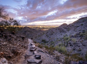
Quartz Ridge Trail
4.52.29 mi / 509 ft gainQuartz Ridge in the Phoenix Mountain Preserve (also known as Trail 8A) is a great escape getaway trail that can be done as a single track or combined with many intersecting trails. It is a very popular trail for hikers, trail runners, pet walkers, sky gawkers and more! The trailhead sits in a sm...Read more -
Fountain Hills, Arizona
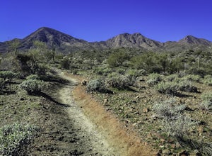
Hike the Dixie Mine Trail
2.05.5 mi / 591 ft gainThe MineDixie mine was established in 1877, when mining scouts noticed the large amount of quartz in the area. The Dixie Mine was sold many times throughout the 20th Century and was ruled no longer efficient in 1977 when it was sold to the McDowell Mountain Regional Park. The PetroglyphsThe area ...Read more -
Phoenix, Arizona
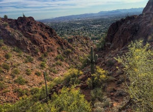
Echo Canyon Trail on Camelback Mountain
4.52.46 mi / 1214 ft gainIf you live near or around Phoenix, you know that Camelback Mountain is pretty hard to miss. Due to the mountain's height, this hike isn't exactly what you would call easy. There are two sides of the mountain you can hike, Echo Canyon and Cholla Trail. Echo Canyon is shorter, but still an extreme...Read more -
Phoenix, Arizona
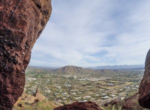
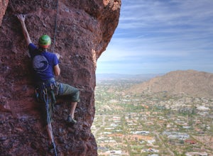
Climb the Praying Monk
4.30.5 miPark at the Echo Canyon Parking Area.From the trailhead, hike up Echo trail until your reach the saddle. At the saddle, you will turn south and start taking the climbers trail to the headwall, which is just past the sign that says "caution, active bee area." Once you reach the headwall, there a...Read more -
Phoenix, Arizona
Climb the East Face of the Praying Monk
0.5 mi / 200 ft gain5.6 Sport climb, up an 80 foot face, 9 bolts to the top. This was the first outdoor climb for myself. It opened the doors to getting out of the gym and becoming a part of the local climbing community. I highly recommend it, as it is not too difficult, and can be done with a group of people. The...Read more -
Yavapai County, Arizona
Bell Trail
7.12 mi / 591 ft gainBell Trail is an out-and-back trail that takes you by a river located near Rimrock, Arizona.Read more -
Pine, Arizona
Hike the Pine Creek Loop in Tonto Natural Bridge SP
4.71.8 mi / 300 ft gainThere is a fee to enter this area. It was $7 when we went. There are 4 trails with many viewpoints from the parking lot, all of which are out and back. We followed the recommendation of the ranger working at the visitor's center and took the Gowan Trail down to the observation deck located in the...Read more -
Paradise Valley, Arizona
Camelback Mountain via Cholla Trail
4.52.68 mi / 1158 ft gainThis challenging hike up the east side of Camelback Mountain has beautiful views of Phoenix and Scottsdale, and is not often crowded. You will begin on switchbacks heading up the mountain, with trail markers to guide you at first. The hike increases in difficulty about 1 mile in, when you reach ...Read more -
Scottsdale, Arizona
Sunrise Trail to Sunrise Peak
4.83.73 mi / 1037 ft gainSunrise Peak, also known as Sunrise Trail, is located at the residential foothills of the McDowell Mountains in Scottsdale, Arizona. The trail will start next to a residential neighborhood, but after about a quarter mile you'll be immersed in the pristine Sonoran Desert. The trail will lead you t...Read more -
Buckeye, Arizona
Hike Valley Vista from Turnbuckle Trail
5.02 miThe Valley Vista trail is a short hike in Skyline Regional Park, located in the southern region of the White Tank Mountains west of Phoenix. From the top you'll have a great view of the Estrella Mountain Range and the southwest valley. For the most direct route, take the Turnbuckle trail. This...Read more -
Payson, Arizona
Hike Barnhardt Trail
4.88 mi / 1912 ft gainTo get to the trailhead, use the turnoff of highway 87 labeled Barnhardt trail (has a marked sign coming from both Payson and Phoenix). Barnhardt road is just over 4 miles and is unpaved. The road can be driven on by lower clearance cars because the terrain is not too rocky. Once at the trailhead...Read more

