Flagstaff, Arizona
Looking for the best photography in Flagstaff? We've got you covered with the top trails, trips, hiking, backpacking, camping and more around Flagstaff. The detailed guides, photos, and reviews are all submitted by the Outbound community.
Top Photography Spots in and near Flagstaff
-
Sedona, Arizona
Mescal Mountain Loop
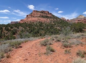
4.59 mi / 453 ft gainThe Mescal Mountain Loop Hike circles Mescal Mesa uses three different trails. Park at the Mescal Trail parking area on Long Canyon Road. The Mescal Trail is 2.4 miles long and winds up to the base of the mesa where it travels along beautiful open slick rock. It is an easy hike but the trail is ...Read more -
Sedona, Arizona
Hike the Boynton Canyon Trail
5.06 miThis is my favorite trail in all of Sedona. The trail head is at the end of Boynton Canyon rd near the entrance of Enchanted Spa and Resort. The trail goes along the property of Enchanted Spa for about 1 mile. This is the rockiest part of the trail as you pass by a large cliff.Soon after leaving ...Read more -
Sedona, Arizona
Devils Kitchen
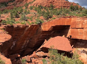
5.00.35 mi / 23 ft gainGreat spot for photos, and is at the beginning of one of the best trails in Sedona. The parking lot can get full easily, since this is a very popular trail. The sinkhole is close to the trailhead, but I encourage you to continue on down the Soldier’s Pass trail. As with all outdoor advent...Read more -
Sedona, Arizona
Soldier's Pass Trail to Brins Mesa Trail
4.84.4 mi / 617 ft gainStarting at the trailhead is a parking lot for around 14 vehicles, arrive early in the morning if you want to be guaranteed a parking spot. Otherwise the hike starts off relatively easy with a quick stop at Devil's Kitchen; a big hole in the ground where a rock has now fallen in (see pictures). ...Read more -
Sedona, Arizona
Devil's Bridge Trail
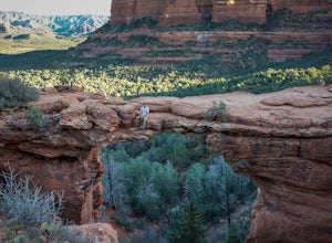
4.63.94 mi / 400 ft gainThe Devil's Bridge is the largest natural sandstone arch in Coconino National Forest and an iconic landmark. If you're visiting the Sedona area, hiking this trail is a must do. The hike: From the trailhead, the hike gradually slopes upward as it winds its way through the trees. The trail is eas...Read more -
Sedona, Arizona
Fay Canyon Trail
3.82.56 mi / 666 ft gainLocated on the outskirts of Sedona's main attractions, Fay Canyon is a hidden gem. The Fay Canyon Trail is an easy, scenic hike that takes you through this lesser-known Sedona canyon. You won't see majestic open views like those of Bell Rock, but you will find gorgeous views, without the crowds. ...Read more -
Sedona, Arizona
Fay Canyon Arch
4.51.5 mi / 361 ft gain...The hike through Fay Canyon goes 1.25 miles to Box Canyon and is rated easy to moderate. To see Fay Canyon Arch though is a much shorter hike. From Boynton Pass Rd, park at Fay Canyon parking lot. The parking lot offers restrooms and a few picnic tables to relax at. The start of the trail is d...Read more -
Sedona, Arizona
Hike the Chimney Rock Loop, Sedona
2 mi / 400 ft gainThis loop hike starts at the Andante Trailhead at the end of Andante Road on the edge of Sedona. From the parking area, turn left (west) onto the Andante Trail and follow it for a short distance until the trail ends on the Thunder Mountain Trail. Turn left and follow the Thunder Mountain Trail un...Read more -
Sedona, Arizona
4X4 to Honanki Heritage Site
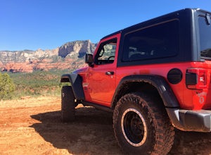
5.0One of Sedona’s best and most scenic drives, that happens to also lead to Native American ruins, has to be Loy Butte Road (FR-525). This route also forms the eastern half of the famous Outlaw 4×4 Jeep Trail. The road is very rough in places, especially during the latter part of the drive. The roa...Read more -
Sedona, Arizona
Hike to Bear Mountain
5.06 mi / 2000 ft gainBear Mountain is one of the more difficult hikes in Sedona but has very easy access. There is a parking area between Doe Mountain and Bear Mountain. The trailhead is across the street and the initial approach is very flat. The red rock bluff you first see on the approach is only part of B...Read more -
Sedona, Arizona
Hike the Cockscomb Trail
1.5 mi / 330 ft gainThis is a wonderful less traveled trail that is fairly easy hiking, at least until you reach the base of the Cockscomb. It does not have much shade. I recommend hiking this trail late afternoon into sunset as the trail weaves between Doe Mountain and the Cockscomb on the west side. The setting su...Read more -
Sedona, Arizona
Broken Arrow Trail to Chicken Point
4.62.79 mi / 420 ft gainStart your hike at the Broken Arrow Trailhead, just .2 miles past the end of Morgan Rd. You will be immediately greeted by Sedona slickrock trails and red rock views for days! Take a minute to sneak a peek at Devil's Dining Room Sinkhole around 0.6 miles in. It has a sign and is just of to the ri...Read more -
Sedona, Arizona
Broken Arrow Trail to Chapel of the Holy Cross
4.54.91 mi / 640 ft gainThe Broken Arrow Trail is stunning. To reach the Broken Arrow Trail from the town of Sedona, head south on 179-S for approximately 1.5 miles and turn left on Morgan Road. Drive down Morgan Road until you reach the end of the asphalt and it turns into a dirt road. Drive down the dirt road approx...Read more -
Sedona, Arizona
Sedona Wind Caves
0.52 mi / 89 ft gainThese beautiful caves are located mid-way through a short 0.5 mile hike, rated moderate. And if you weren’t looking, you would never know they were there… note that they are before the end of the trail, on the right as you hike. The caves are well trafficked, so if you go, make sure to go earl...Read more -
Sedona, Arizona
Robbers Roost
5.00.95 mi / 148 ft gainThe hike begins on the eastern side of the parking area. It is only a half mile hike but the views are amazing. Hike through the beautiful Sedona landscape of red rock and juniper before finding your way to this breathtaking cliff side view! Feel free to explore more of the mountain and find othe...Read more -
Flagstaff, Arizona
SP Crater
1.96 mi / 341 ft gainOff of the 89, just north of Flagstaff AZ, there is an unmarked dirt road just before a gas station. It leads out to privately owned land that's open to the public. Some friends and I went out there to get away from our day jobs. As we headed down the road, the land opened up in vast expanses of ...Read more

