Happy Jack, Arizona
Looking for the best hiking in Happy Jack? We've got you covered with the top trails, trips, hiking, backpacking, camping and more around Happy Jack. The detailed guides, photos, and reviews are all submitted by the Outbound community.
Top Hiking Spots in and near Happy Jack
-
Flagstaff, Arizona
Camp at Red Rock
4.8Starting from Downtown Flagstaff we headed west. After making a left turn on Woody Mountain Road, we continued for 22 miles. Woody Mountain Road then becomes Forest Road 231. Continue on FS 231 until you find a killer spot to pitch it! Make sure to be wary of elk herds crossing the roads.We made ...Read more -
Flagstaff, Arizona
Hike Fatman's Loop
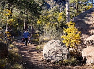
5.02.5 mi / 690 ft gainSitting on the eastern slope of Mt Elden is a super fun multi-use trail called Fatman's Loop. It's a perfect spot for hiking, trail running, day strolling, or walking the pup. All the while, treating you to glimpses of the eastern suburbs of Flagstaff, beautiful wild flowers, and cool rock format...Read more -
Flagstaff, Arizona
Frisbee Golf at McPherson's
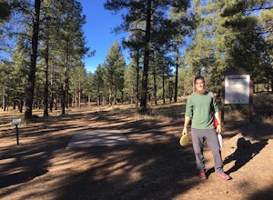
1 miMcPherson's is a public disk golf course five minutes north of downtown Flagstaff. The course is seasonally open from May - November. There are no tee times, and it is free to play. A somewhat tightly wooded 18-hole course with multiple pin placements makes this fun for beginners and a challenge...Read more -
Clarkdale, Arizona
Hike the Tuzigoot Trail
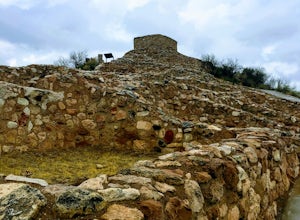
4.50.5 mi / 55 ft gainSpend a couple of hours to discover the incredible legacy of an ancient people at Tuzigoot National Monument. Start at the Visitor Center, then take a self-guided, half mile loop trail that will lead around and through an incredible 110 room pueblo. The large building was home to the Sinagua peo...Read more -
Mayer, Arizona
Verde Rim Loop Trail
14.32 mi / 2631 ft gainVerde Rim Loop Trail is a loop trail where you may see beautiful wildflowers located near Camp Verde, Arizona.Read more -
Payson, Arizona
Hike See Canyon Trail
5.07.6 mi / 2043 ft gainSee Canyon Trail #184 is a 7.6 mile trail in the Tonto National Forest that features a creek and spring. This trail is most popular during the fall when the leaves begin to change color and fall along the creek. The trail runs from the parking lot up to FS 300 above the rim. The trail starts of...Read more -
Payson, Arizona
Canyoneering at Christopher Creek/Box Canyon
5.02 mi / 200 ft gainJust a little bit east of Payson Arizona is a canyoneering playground called Christopher Creek Canyon (aka Box Canyon). The water is nice and cold, and is only muddy after rainstorms. Make your way from pool to pool as you descend through the canyon, cliff jumping, rappelling, and down climbing. ...Read more -
Payson, Arizona
Dispersed Camping on Mogollon Rim (FR 9350)
4.7Dispersed camping with a view! With no site fees and no reservations, this camping spot is incredibly popular. Note that several campsites are bordered by a 200' vertical drop. This area is not recommended for families with young children or people who are uneasy with heights. All campsites ha...Read more -
Williams, Arizona
Hike the Kelsey Spring/Hog Hill/Dorsey Spring Loop
13.4 mi / 2200 ft gainThis hike starts at the Kelsey Spring Trailhead. Park at the end of Forest Service Road 538G. There is parking for about 6-7 cars. Just past the signage for the trail, which is also called Kelsey Winter Trail, there is a trail registration box. Be sure to sign in. The trail descends steeply for t...Read more -
Woods Canyon Lake, Arizona
Kayak Woods Canyon Lake
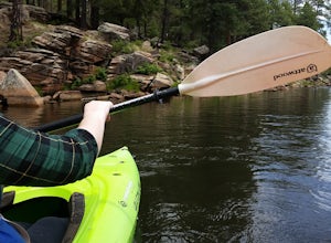
5.0Is there any better way to spend a Saturday, then paddling on a glassy, peaceful lake? You can rent kayaks at the Woods Canyon Lake Marina, or bring your own (if you’re bringing your own kayak, make sure you bring a PFD too, as it’s Arizona law). One of the best parts of this lake is that w...Read more -
Coconino County, Arizona
Hike Woods Canyon Lake Loop Trail
5.03.7 mi / 154 ft gainThis hike is a ~4 mile heavily trafficked loop trail that circles Woods Canyon Lake, on the beautiful Mogollon Rim. Peaceful and easy, this trail is suitable for all skill levels, and is great for families looking to spend a bit of time in nature. The trail follows the shoreline closely, and fo...Read more -
Flagstaff, Arizona
Bike along the San Francisco Peaks on Waterline Road
4.020 mi / 3000 ft gainWaterline Road is a closed service road that follows along the southern and eastern slopes of the San Francisco Peaks of Flagstaff, AZ. You will pass through several miles of charred ponderosa pine as well as expansive groves of aspen trees as you make your way to the Inner Basin.The road follows...Read more -
Flagstaff, Arizona
Camp in the Coconino National Forest
3.8The free camping in the Coconino (as well as the many other national forests) is generally along the old Fire Roads, and old Forest Service Roads. You can tell if a road is one of these by a brown sign with an FS 123 or any other number, FS meaning Forest Service Road. There are many of these roa...Read more -
Payson, Arizona
Hike on Rim Lakes Vista Trail #622
3.5 miThis heavily trafficked, easy trail leads along the edge of the Mogollon Rim, with spectacular views. There are lots of places for photos, but make sure to be very careful, as it’s more than a 200 ft drop! The first ½ mile of the trail is paved, making it easy for all ages to enjoy. But again, ...Read more -
Flagstaff, Arizona
Humphreys Peak Summit
5.09.57 mi / 2759 ft gainIf you think you might only get one chance to hike Humphreys Peak in your life, I recommend this hike so that you can have a unique view experience of the east and west sides of the Peaks. This is a shuttle hike of Humphreys Peak which combines the Humphreys Peak Trail and the Humphreys via Inner...Read more -
Flagstaff, Arizona
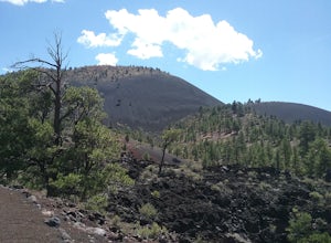
Hike the Lava Flow Trail at Sunset Crater Volcano National Monument
5.01 miGet started on the hike from the parking lot. The first quarter mile is paved and very easy to walk. The rest of the trail takes you to the base of the volcano through lava flows and tubes. This is an incredible landscape to take in along your hike.Read more

