Phoenix, Arizona
Looking for the best hiking in Phoenix? We've got you covered with the top trails, trips, hiking, backpacking, camping and more around Phoenix. The detailed guides, photos, and reviews are all submitted by the Outbound community.
Top Hiking Spots in and near Phoenix
-
Goodyear, Arizona
Hike Estrella Mountain's Baseline Trail
4.02.4 mi / 259 ft gainBaseline Trail is a 2.4 mile moderately trafficked loop trail. This trail features lovely wild flowers and is rated as intermediate. You can use this trail not just for hiking but you can also use the trail for running as well as mountain biking. On the trail you are allowed to bring your furry f...Read more -
Cave Creek, Arizona
Hike the Go John Trail
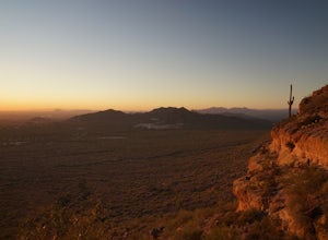
5.05.6 mi / 804 ft gainAs you park at the trailhead, you have the option to take this trail in either direction. I recommend that you travel north, which will immediately provide 0.75 miles of elevation gain. You will then reach a pass with panoramic views of the Tonto National Forest. A bench in this area provides the...Read more -
Fort McDowell, Arizona
Hike the Lower Salt River Nature Trail
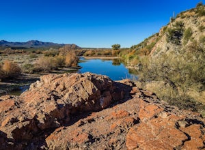
2.52.4 miThis scenic loop offers views of Four Peaks, the Salt River & Verde River, and a desert landscape with plenty of wildlife. Keep an eye out for eagles, wild horses, and other wildlife while you're on the trail. This trail starts from the Phon D Sutton Recreation site, which is located at the...Read more -
Mesa, Arizona
Photograph the Salt River Wild Horses at Coon Bluff
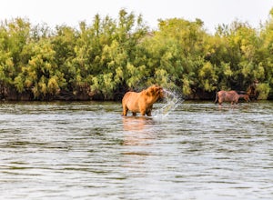
5.0Wild horses have roamed the banks of the lower Salt River since long before the Tonto National Forest was created in 1902. It is thought that these wild horses have descended from a herd brought to the area by a Spanish missionary in the 1600's. In 2015 the United States Forest Service had pu...Read more -
Cave Creek, Arizona
Elephant Mountain Fortress Hike
5.05.5 mi / 867 ft gainThis hike beings at Spur Cross Ranch in Cave Creek, which is a lush riparian area flowing with Saguaros. Starting at the trailhead, you will start this loop by hiking clockwise on Tortuga trail which will connect with the Elephant Mountain trail at 1.5 miles. As you start to ascend the Elephant M...Read more -
Waddell, Arizona
Hike Goat Camp Trail
16 miThis is one of the less traveled trails in White Tank Mountain Regional Park. If you're looking for a solid day hike in the west valley, try this one. It isn't a loop, but it ultimately connects with some of the other long trails so if you're up for a long hike, you have options. This starts f...Read more -
Waddell, Arizona
Hike to Waterfall Canyon
4.02 mi / 200 ft gainSo to fully enjoy the theme of this hike, make sure to try and go right after a rain. But also know that since this is a pretty easy hike, you will won't be the only one there. This is also a great hike/ waterfall to do with someone that is new to desert hiking, since it is relatively easy and th...Read more -
Waddell, Arizona
Hike Mesquite Canyon Trail
13 mi / 1394 ft gainThis is a great place to begin your hike in the White Tank Mountains. From the Ramada Way area, the trail begins to lead steadily into a small canyon. As you get further up, the trail will begin get more steep. After a short time it leads up to the first saddle and wraps around a ridge and bec...Read more -
Morristown, Arizona
Hike the Wild Burro Trail
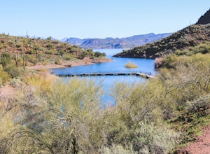
4 mi / 112 ft gainHike along the shoreline of beautiful Lake Pleasant. This 4.0 mile out-and-back trail is worth its weight in beautiful views. The path is well maintained and perfect for beginner hikers who enjoy leisurely hikes while looking for wild burros. The Wild Burro trail starts with a small descent from ...Read more -
Morristown, Arizona
Hike the Pipeline Canyon Trail
4.84 mi / -220 ft gainStarting at a little below 2,000 feet this hike takes about two hours out and back over a two-mile stretch. There is a parking lot with bathrooms at either end.For those with small members of your hiking party and two vehicles you could easily leave a car at either end of the trail. There are als...Read more -
Morristown, Arizona
Explore Lake Pleasant, AZ
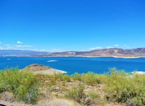
5.0Located just 30 minutes from the outskirts of Phoenix, AZ lies a 10,000 acre desert oasis known as Pleasant Lake Regional Park. This expansive body of water serves as a great opportunity to beat the heat of the central Arizona sun, while taking in the beauty of the vivid blue waters and surroundi...Read more -
Apache Junction, Arizona
Hike the Wind Cave Trail
4.32.9 mi / 790 ft gainThis is a great trail for a run or for stretching your legs exploring the caves in Usery Mountain Regional Park. Keep in mind that the trail leads you up to the cave and is the end point. To get better views of the area, you'll have to climb up past the caves, where the trail is not marked.Read more -
Maricopa County, Arizona
Hike the Goldfield Ovens Loop
7.5 mi / 575 ft gainA Tonto Day Pass is required for this hike as you will park your vehicle at the Blue Point Picnic Area. The trail starts North of the restrooms which are located at the backside of the parking lot. The trail takes you through a mesquite filled area alongside large rock faces. Be sure too look for...Read more -
Buckeye, Arizona
Hike Valley Vista from Turnbuckle Trail
5.02 miThe Valley Vista trail is a short hike in Skyline Regional Park, located in the southern region of the White Tank Mountains west of Phoenix. From the top you'll have a great view of the Estrella Mountain Range and the southwest valley. For the most direct route, take the Turnbuckle trail. This...Read more -
Morristown, Arizona
Yavapai Point Trail
5.03.08 mi / 525 ft gainYavapai Point Trail is an out-and-back trail that takes you by a lake located near New River, Arizona.Read more -
Fort McDowell, Arizona
Hike Butcher Jones Trail Around Saguaro Lake
4.64 mi / 300 ft gainButcher Jones Recreational Area truly has a little bit of everything. However, the highlight of the area is the Butcher Jones Trail, a 4 mile out and back trail that is suitable for all skill levels. With minimal elevation gain and beautiful views, it can't be beat!The trailhead is located right ...Read more

