Arizona
Find local adventures, unique places to stay, and local adventure tours in iconic destinations like The Grand Canyon, Sonoran desert, Phoenix, and more. Discover desert adventures across the state like, hiking, backpacking, rafting, and more.
Top Spots in and near Arizona
-
Paradise Valley, Arizona
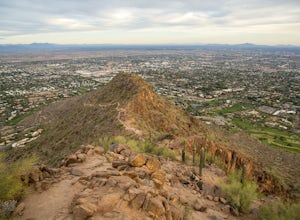
Camelback Mountain via Cholla Trail
4.52.68 mi / 1158 ft gainThis challenging hike up the east side of Camelback Mountain has beautiful views of Phoenix and Scottsdale, and is not often crowded. You will begin on switchbacks heading up the mountain, with trail markers to guide you at first. The hike increases in difficulty about 1 mile in, when you reach ...Read more -
Phoenix, Arizona
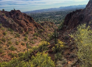
Echo Canyon Trail on Camelback Mountain
4.52.46 mi / 1214 ft gainIf you live near or around Phoenix, you know that Camelback Mountain is pretty hard to miss. Due to the mountain's height, this hike isn't exactly what you would call easy. There are two sides of the mountain you can hike, Echo Canyon and Cholla Trail. Echo Canyon is shorter, but still an extreme...Read more -
Supai, Arizona
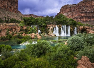
Navajo Falls
4.01.4 mi / 249 ft gainNavajo Falls Navajo Falls was created by a flash flood that tore through Havasu Canyon in August of 2008, altering the course of Havasu Creek. Visitors can reach these and other nearby falls via horseback, helicopter, or hiking from Supai Village. It is a relatively short hike from camp (just o...Read more -
Scottsdale, Arizona
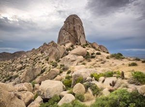
Tom's Thumb
4.33.98 mi / 1236 ft gainThe infamous “thumb” can be seen from most places in the valley – a white burst of rock jutting skyward out of the desert ridgeline. The new Tom’s Thumb Trailhead in 2012 has nice restrooms and offers tons of information about the surrounding rock climbing areas, day hikes and desert knowledg...Read more -
Sedona, Arizona
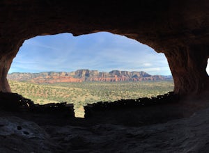
Robbers Roost
5.00.95 mi / 148 ft gainThe hike begins on the eastern side of the parking area. It is only a half mile hike but the views are amazing. Hike through the beautiful Sedona landscape of red rock and juniper before finding your way to this breathtaking cliff side view! Feel free to explore more of the mountain and find othe...Read more -
Apache Junction, Arizona
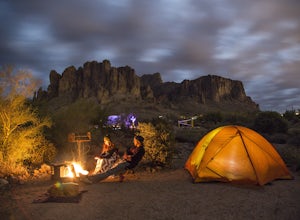
Camp at Lost Dutchman State Park
4.8Lost Dutchman State Park is located near the Superstition Mountains in central Phoenix, about 40 miles from Phoenix. There is a $7 day use fee to enter the park, which is waived if you’re camping ($15/night). The park offers 134 campsites, each with a picnic table, barbeque grill, and fire pit, a...Read more -
Payson, Arizona
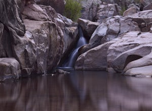
Water Wheel & Ellison Creek Cascades
4.91.76 mi / 272 ft gainA short and easy out and back hike for adventurers of all ages with scenic waterfalls along the entire trip! Starting at the Water Wheel day use area you will simply follow the well traveled path that meanders alongside the creek. You will reach the first significant waterfall within minutes whi...Read more -
Happy Jack, Arizona
Car Camp the Mogollon Rim
4.8The Mogollon Rim is part of the Colorado Plateau in eastern Arizona above Payson. The rim stretches across the Coconino National Forest and at some parts drops off nearly 2,000ft. This area is ideal for over-night car-camping. The expansive vistas above thousands of acres of national forest land ...Read more -
Sedona, Arizona
Bell Rock Trail
4.60.78 mi / 210 ft gainThe Bell Rock Trail in Sedona is a relatively easy hike with a majestic reward. It is a well maintained trail that with plenty of views to keep your eyes happy. Don't be surprised if you catch yourself turning around every 5 minutes and saying, "wow, this is gorgeous!" The trail itself is only ~...Read more -
Payson, Arizona
Horton Springs Loop
4.48.42 mi / 1896 ft gainThis is a more scenic and bit more strenuous loop hike to the spring, taking in the Derrick Trail, part of the Highline Trail, and the Horton Creek Trail.After parking the cars near Upper Tonto Creek Campground follow the Derrick Trail and hike gently uphill for 1.4 miles through the rim country ...Read more -
Sedona, Arizona
West Fork Trail
5.06.49 mi / 1102 ft gainThis is one of the most beautiful hikes in Sedona, Arizona. It is a fairly easy hike, although it is 6 miles roundtrip. A lot of families come here, and children love to play in the water. There are various stream crossings, but for most of them, you should be able to keep dry. The canyon walls ...Read more -
Sedona, Arizona
Broken Arrow Trail to Chicken Point
4.62.79 mi / 420 ft gainStart your hike at the Broken Arrow Trailhead, just .2 miles past the end of Morgan Rd. You will be immediately greeted by Sedona slickrock trails and red rock views for days! Take a minute to sneak a peek at Devil's Dining Room Sinkhole around 0.6 miles in. It has a sign and is just of to the ri...Read more -
Scottsdale, Arizona
Pinnacle Peak Trail
4.43.87 mi / 896 ft gainPinnacle Peak is a 3.8 mile out-and-back hike along a beautifully groomed trail with a moderate gain of ~1,000ft. This distinctive 600ft granite summit can be seen from most of the surrounding valley and offers spectacular views of the McDowell Mountains, iconic Four Peaks, Granite Mountain and t...Read more -
Flagstaff, Arizona
Humphreys Peak Summit
5.09.57 mi / 2759 ft gainIf you think you might only get one chance to hike Humphreys Peak in your life, I recommend this hike so that you can have a unique view experience of the east and west sides of the Peaks. This is a shuttle hike of Humphreys Peak which combines the Humphreys Peak Trail and the Humphreys via Inner...Read more -
Tuba City, Arizona
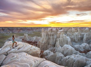
Hike Coal Mine Canyon
5.01 mi / -364 ft gainCoal Mine Canyon is a remote gem of the southwest that borders the Hopi and Navajo Indian Reservation. Coal Mine Canyon is located about 15 miles from Tuba City Arizona, The access to the canyon is off of Hwy 264 between mile marker 337 and 338 (right around 337.25). Once you make the turn off y...Read more -
Flagstaff, Arizona
Camp at Red Rock
4.8Starting from Downtown Flagstaff we headed west. After making a left turn on Woody Mountain Road, we continued for 22 miles. Woody Mountain Road then becomes Forest Road 231. Continue on FS 231 until you find a killer spot to pitch it! Make sure to be wary of elk herds crossing the roads.We made ...Read more

