Calabasas, California
Looking for the best hiking in Calabasas? We've got you covered with the top trails, trips, hiking, backpacking, camping and more around Calabasas. The detailed guides, photos, and reviews are all submitted by the Outbound community.
Top Hiking Spots in and near Calabasas
-
Arcadia, California
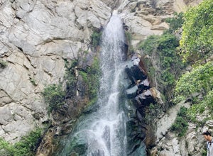
Sturtevant Falls
4.61.61 mi / 423 ft gainThis trail is currently closed. Visit the Forest Service website for updates. As you head down to Roberts Camp, a historic set of historic cabins, you’ll head out on a steep, paved road for approximately 0.6 miles. Once you reach the camp, head over the bridge and keep an eye out for the sign f...Read more -
Arcadia, California
Mt. Wilson Loop from Chantry Flat
5.012.74 mi / 4852 ft gainMt. Wilson is one of the more difficult mountains in the San Gabriel to hike, making this adventure Intermediate. While 5,700 feet doesn't seem that tall, the mountain has a prominence of almost 5,300 feet, meaning that hike is steeper and longer than some of the other popular mountains that star...Read more -
Arcadia, California
Hermit Falls Trail
4.82.49 mi / 1014 ft gainNote: Hermit Falls is Temporarily Closed From Roberts Camp, many hikers will head to Sturtevant Falls, which is an amazing 60-foot waterfall. But, if you choose to head in the opposite direction on First Water Trail, you’ll be rewarded with a fresh water swimming hole at this 35-foot tumbling wa...Read more -
Whittier, California
Hellman Park Trail
3.04 mi / 850 ft gainThis trail is great if you're looking for a quick, but intense workout. The hike itself is only 4 miles out- and-back and can be easily completed within a couple of hours. However, be prepared for a steep and steady incline for the first 1.5 miles. The trail itself is pretty wide, and if you sho...Read more -
Ventura, California
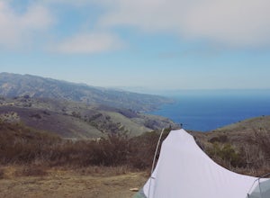
Backpack to Del Norte Campground on Santa Cruz Island
5.07 mi / 700 ft gainDel Norte Backcountry Campground is located on Santa Cruz Island, one of the islands that makes up Channel Islands National Park. It is California's largest island and is almost three times the size of Manhattan. The easiest way to get to the island is to take Island Packers, a ferry service that...Read more -
Palmdale, California
Hike to Vetter Mountain and the Fire Lookout Tower
2.8 mi / 550 ft gainIf you're looking for an easy mountain to hike, and perhaps give the kids something interesting to learn about at the top, then Vetter Mountain may fit the bill. At 5,908', and with a trailhead at about 5,350', this 1.4 mile (one way) hike only climbs about 550' vertical. The trailhead is loca...Read more -
Monrovia, California
Monrovia Falls
3.71.46 mi / 459 ft gainMonrovia Falls is closed indefinitely due to the Bobcat Fire and mudslides. Read more on the CityofMonrovia.org website. The Monrovia Falls are at the end of the main trail located in Monrovia Canyon Park. The park is easy to locate and has ample parking. Keep in mind you do have to pay a fee of...Read more -
Pearblossom, California
Camp at Horse Flats Campground
3.0The Horse Flats Campground is located 29 miles up Highway 2 from Interstate 210. You will turn left at the Santa Clara Divide Road(this intersection is also known as 3 Points). 3 miles down the road you will turn left to enter the campground. I have camped here a few times and its always been pre...Read more -
Ojai, California
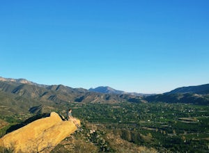
Couch Rock
3.51.3 mi / 627 ft gainDriving up Gridley Road away from Ojai you’ll come upon a small parking lot on your left and a gate barring the way to a dirt road. Park here, as close to the mountainside as possible and head onto the trail. Follow the trail until you see pass a bench, and start heading downhill. Keep your eye...Read more -
Lake Hughes, California
Hike the Pacific Crest Trail from Horse Trail to Bear Campground
11.63 mi / 2396 ft gainThis is part of the Pacific Crest Trail. If you're through-hiking or sectional hiking, you'll have to hit it eventually. Try and avoid it in the late summer or early fall because of heat, and gnats. Find a way to check the bug report, we got marauded by gnats 90% of the way (early October) and ap...Read more -
Ojai, California
Rose Valley Falls
5.00.68 mi / 256 ft gain...It's not often that you come across 100 ft waterfalls. This moderate to easy hike to Rose Valley Falls leads you to one of the tallest waterfalls in the Los Padres National Forest. The hike begins at Rose Valley Campground. If you're not staying at a campsite, park outside the entrance of the ...Read more -
Ojai, California
Rock Climb at Foothill Crag
2 miFrom downtown Ojai, head north on N Signal Street. Head up the hill and turn left onto a gravel road next to a chainlink fence once you get to the top.(There should be a sign that points to "Pratt/Foothill Trailhead.") Continue past a water tank on the right to a trailhead parking area. I've gon...Read more -
Azusa, California
Fish Canyon Falls
2.04.08 mi / 801 ft gainThis trail is currently closed! Learn more on the U.S. Forest Service website. Follow Encanto Parkway towards the hills until you come to a junction with a sign labeled "trail" that points towards a parking lot to your right. Parking is free, though on weekends it may be difficult to find a spot...Read more -
Ojai, California
Piedra Blanca Formations
5.05.41 mi / 860 ft gainThese white sandstone formations, splitting out of the forest, are a worthwhile sight as you climb up to gain a great vantage point of the valley. Spend some time exploring the rocks - the nooks & crannies are full of surprises. You can turn this into an overnighter by staying at the campgrou...Read more -
Ojai, California
Willett Hot Springs via Sespe River Trail
20.08 mi / 2598 ft gainPark at the Lions Camp parking lot. Adventure Passes aren't technically "required" but it never hurts to have one. You can stop at the Forest Service in Ojai (1190 E. Ojai Ave) or stop at the Wheeler Gorge Station on your way up to buy one for $5 for a night. The trail begins at the far side of t...Read more -
Lancaster, California
Antelope Valley Poppy Reserve
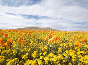
5.02 mi / 900 ft gainIf you're going during wildflower season, start your adventure at the visitors center at the end of 150th St. W. Parking in the lot outside the visitors center is $10, but there is ample street parking that is free. In the visitors center you can read more about the reserve, plan your hike, and s...Read more

