Castaic, California
The best Trails and Outdoor Activities in Castaic, California are a must-visit for anyone seeking outdoor adventures. Castaic Lake State Recreation Area is a top choice, offering a scenic hiking trail that winds around the lake. It's a moderately difficult trail, perfect for a leisurely day hike. The trail offers stunning views of the lake and surrounding mountains. If you're lucky, you might spot some local wildlife. For a more challenging hike, head to the nearby Fish Canyon Trail. This trail features a steep incline, rocky terrain, and a beautiful waterfall at the end. For a different kind of adventure, try fishing or boating on the lake. With its diverse range of activities and attractions, Castaic is a prime destination for outdoor fun.
Top Spots in and near Castaic
-
Altadena, California
Eaton Canyon to Idlehour Trail Camp
4.510.99 mi / 3291 ft gainIdlehour is nestled deep in the Angeles National Forest, so it feels like you're in the heart of some untapped wilderness instead of six miles away from a bustling metropolis. The trail camp is accessible by foot through a variety of locations, but the most popular route is through Eaton Canyon, ...Read more -
Palmdale, California
Hike to Vetter Mountain and the Fire Lookout Tower
2.8 mi / 550 ft gainIf you're looking for an easy mountain to hike, and perhaps give the kids something interesting to learn about at the top, then Vetter Mountain may fit the bill. At 5,908', and with a trailhead at about 5,350', this 1.4 mile (one way) hike only climbs about 550' vertical. The trailhead is loca...Read more -
Ojai, California
Climb at Wheeler Gorge
Grab a dozen quick draws, your 60m rope, and head up Highway 33 out of Ojai for 7 miles (One of the routes here describes the crag perfectly, a Riparian Daydream). Drive through one tunnel, and continue on for another mile or two until you reach two tunnels in quick succession. The crag is in bet...Read more -
Ventura, California
Hike Arroyo Verde Park
3.5 mi / 800 ft gainArroyo Verde Park is a small parked tucked in the hills above Ventura, California, and has a network of trails running up and down the hills surrounding the valley in the center of the park. The entrance to the park is at the intersection of Foothill Road Day Road, east of downtown Ventura. There...Read more -
Marina del Rey, California
Ballona Lagoon
5.01.8 mi / 95 ft gainSuch a relaxing and beautiful stroll in the Marina Del Rey/Venice area! Park in Marina Del Rey #13 lot (4601 Vía Marina, Marina Del Rey, CA 90292). Don't forget to pay the meter! The rate as of 2021 is $0.50/15mins, or $6 for 24hrs on weekdays, and $8 for 24hrs on weekends. Once parked, walk ...Read more -
Malibu, California
Hike Point Mugu Peak
4.52 mi / 1250 ft gainPoint Mugu State Park offers some amazing rolling mountains, sweeping meadows of tall grass, and beautiful coastal views. I suggest going in the spring. I recently went, and the wildflowers were blooming everywhere. There are campgrounds available in different parts of the park that you can make ...Read more -
Malibu, California
Hike Mugu Peak Loop via Chumash Trail
5.06.5 mi / 1255 ft gainFrom the parking lot at the trailhead, follow the steep trail going up the mountain. This part is quite challenging, so I recommend stretching out your legs before starting the hike. Once you reach the top, you will see your first junction. Go right if you want to go straight for the peak, and th...Read more -
Maricopa, California
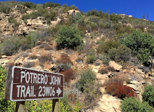
Potrero John Trail
5.03.51 mi / 627 ft gainThe Potrero John Trail is only 1.75 miles one-way, and is mostly used for hiking. It is right off Highway 33- driving north on the 33, the trailhead is on the right side of the street, right after the Potrero John Bridge (parking is fairly limited so the earlier you get there the better). There ...Read more -
Los Angeles, California
Sunset Hike in Ascot Hills
3.5Ascot Hills Park is a great hidden gem located a few miles east of Los Angeles. There is a parking lot with plenty of parking but the gates close at sunset, which is a great time to go, so if you plan on staying later, park outside the gates where there is ample street parking. Depending on the s...Read more -
Ventura, California
Bike the Sulphur Mountain Loop
28.6 mi / 2884 ft gainThe Sulphur Mountain Loop is a 28 mile cycling and mountain biking loop that begins in Ventura Canyon at the Sulphur Mountain Trailhead and loops through Ojai Valley. Beginning at the Sulphur Mountain Road trailhead off Highway 33, follow the road up and over Sulphur Mountain and down until it co...Read more -
Arcadia, California
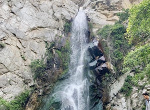
Sturtevant Falls
4.61.61 mi / 423 ft gainThis trail is currently closed. Visit the Forest Service website for updates. As you head down to Roberts Camp, a historic set of historic cabins, you’ll head out on a steep, paved road for approximately 0.6 miles. Once you reach the camp, head over the bridge and keep an eye out for the sign f...Read more -
Arcadia, California
Mt. Wilson Loop from Chantry Flat
5.012.74 mi / 4852 ft gainMt. Wilson is one of the more difficult mountains in the San Gabriel to hike, making this adventure Intermediate. While 5,700 feet doesn't seem that tall, the mountain has a prominence of almost 5,300 feet, meaning that hike is steeper and longer than some of the other popular mountains that star...Read more -
Arcadia, California
Hermit Falls Trail
4.82.49 mi / 1014 ft gainNote: Hermit Falls is Temporarily Closed From Roberts Camp, many hikers will head to Sturtevant Falls, which is an amazing 60-foot waterfall. But, if you choose to head in the opposite direction on First Water Trail, you’ll be rewarded with a fresh water swimming hole at this 35-foot tumbling wa...Read more -
Ventura, California
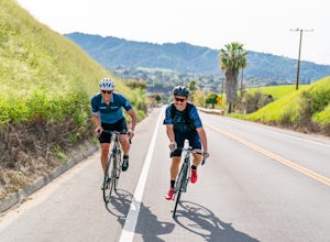
Cycle Santa Ana Road
6.5 mi / 500 ft gainThe Santa Ana to Lake Casitas via Foster Park segment of Santa Ana Road is a gorgeous, 6.5 mile road that cuts through the heart of Ventura Canyon. Santa Ana Road eventually ends at Casitas Road and the Lake Casitas Recreation Area. From there you can go west over over the pass and down to the Ri...Read more -
Ventura, California
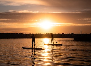
Stand Up Paddleboard the Ventura Harbor
The Ventura Harbor provides a protected entry/exit to the Pacific Ocean and is a great place to start a paddleboarding adventure. Marina Park, at the end of Pierpont Boulevard, has a ton of parking, a free public launch, and there are boards to rent along the harbor. From the launch you can head...Read more -
Ventura, California
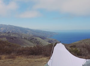
Backpack to Del Norte Campground on Santa Cruz Island
5.07 mi / 700 ft gainDel Norte Backcountry Campground is located on Santa Cruz Island, one of the islands that makes up Channel Islands National Park. It is California's largest island and is almost three times the size of Manhattan. The easiest way to get to the island is to take Island Packers, a ferry service that...Read more

