Desert Hot Springs, California
Looking for the best hiking in Desert Hot Springs? We've got you covered with the top trails, trips, hiking, backpacking, camping and more around Desert Hot Springs. The detailed guides, photos, and reviews are all submitted by the Outbound community.
Top Hiking Spots in and near Desert Hot Springs
-
Desert Hot Springs, California
Mission Creek Trail
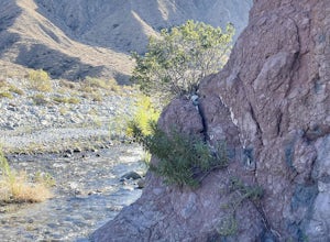
15.33 mi / 1594 ft gainMission Creek Trail is an out-and-back trail that takes you by a river located near Whitewater, California.Read more -
Morongo Valley, California
Big Morongo Canyon Trail
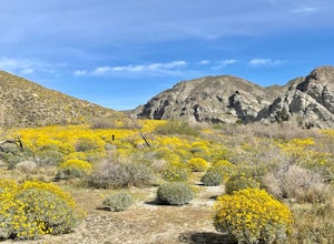
11.65 mi / 1401 ft gainBig Morongo Canyon Trail is a loop trail where you may see wildflowers located near Morongo Valley, California.Read more -
9160 Whitewater Canyon Road, California
Whitewater Ranger Station to Cottonwood TH via PCT
7.79 mi / 1421 ft gainWhitewater Ranger Station to Cottonwood TH via PCT is a point-to-point trail where you may see beautiful wildflowers located near Whitewater, California.Read more -
Whitewater, California
Red Dome via Pacific Crest Trail
4.3 mi / 387 ft gainRed Dome via Pacific Crest Trail is an out and back trail that takes you by a lake located near Whitewater, CaliforniaRead more -
Whitewater, California
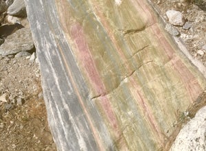
Rainbow Rock Canyon
6.3 mi / 1112 ft gainRainbow Rock Canyon is an out and back trail that takes you by a lake located near Whitewater, CaliforniaRead more -
9160 Whitewater Canyon Road, California
San Gorgonio Overlook via Pacific Crest Trail (Whitewater)
10.19 mi / 1775 ft gainSan Gorgonio Overlook via Pacific Crest Trail (Whitewater) is an out-and-back trail that takes you by a lake located near Whitewater, California.Read more -
9160 Whitewater Canyon Road, California
Pacific Crest Trail: Whitewater Preserve to Stone House
12.38 mi / 1588 ft gainPacific Crest Trail: Whitewater Preserve to Stone House is an out-and-back trail that takes you by a river located near Whitewater, California.Read more -
Palm Springs, California
North Lykken Trail from W. Crescent Drive
1.67 mi / 906 ft gainNorth Lykken Trail from W. Crescent Drive is an out-and-back trail that takes you past scenic surroundings located near Palm Springs, California.Read more -
Palm Springs, California
Museum Trail
1.52 mi / 860 ft gainThe Museum Trail is a very steep climb with a 1,000 feet elevation gain in just one mile but has some great views of downtown Palm Springs. The hike starts behind the Palm Springs Art Museum. This trail can also access the Cactus to Clouds Trail that goes all the way to the top of Mt. San Jacinto...Read more -
Palm Springs, California
Skyline Trail to Aerial Tramway Top Station
5.09.41 mi / 8238 ft gainSkyline Trail to Aerial Tramway Top Station is a point-to-point trail where you may see beautiful wildflowers located near Palm Springs, California.Read more -
Yucca Valley, California
Eureka Peak
5.00.47 mi / 82 ft gainAccessing Covington Flats in Joshua Tree National Park requires a high ground-clearance overland vehicle. Bring spare water and emergency tools incase of a breakdown. From Route 62 in Yucca Valley, CA take La Contenta Dr. South toward Joshua Tree. This is a backcountry entrance that does not hav...Read more -
Yucca Valley, California
Backpack the California Riding and Hiking Trail in Joshua Tree
36.97 mi / 2792 ft gainThe starting point for this hike is at the Black Rock campground, 5 miles from the town of Yucca Valley. You'll need to self register for a free backcountry permit before starting. The first section of the trail follows a wash then the trail narrows and, after only a mile or two, you'll begin cl...Read more -
Palm Springs, California
Winter Climb San Jacinto from the Tram
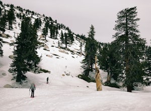
5.08 mi / 2400 ft gainIntermediate: No snow.Advanced: Lots of snow.Expert: Snow w/ high winds and low temps. GPX: https://www.gaiagps.com/datasu... San Jacinto, at 10,834 feet, is the second-highest peak in the Southern California. It's unique in that it has a rotating tram car (think slow motion disco floor) that r...Read more -
Palm Springs, California
Scramble Cornell Peak
3.5 mi / 1000 ft gainEntering Mt San Jacinto State Park via the Palm Springs Aerial Tram is one of the easiest ways to get into the wilderness area. Purchase your ticket and ride to the station where you'll be able to walk out the backdoor and onto the trail. In order to get to Cornell, your route finding skills wil...Read more -
Palm Springs, California
South Carl Lykken Trail - North Section
3.42 mi / 1076 ft gainSouth Carl Lykken Trail - North Section is an out-and-back trail that takes you by a waterfall located near Palm Springs, California.Read more -
Palm Springs, California
South Lykken Trail to Simonetta Kennett Viewpoint
3.66.45 mi / 1654 ft gainThe South Lykken Trail is the south half of the 9.5-mile Carl Lykken Trail, which weaves along a series of mountain ridges above downtown Palm Springs. Dogs are not permitted on this trail. This section of the trail runs 3.2 miles one-way. You will gain just over 1600ft of elevation at the high...Read more

