Escondido, California
Looking for the best hiking in Escondido? We've got you covered with the top trails, trips, hiking, backpacking, camping and more around Escondido. The detailed guides, photos, and reviews are all submitted by the Outbound community.
Top Hiking Spots in and near Escondido
-
San Diego, California
Surfing at Black's Beach via the Main Gate
5.01 mi / 650 ft gainWith arguably some of San Diego’s best waves, Black’s Beach can be found in the vicinity of the University of California San Diego campus, at the southern end of Torrey Pines State Beach and north of La Jolla Shores. Stately eight-figure mansions now line the bluffs where pastures and the Black f...Read more -
Santee, California
Oak Canyon in Mission Trails Regional Park
5.03.22 mi / 249 ft gainStarting on Father Junipero Serra Trail, drive 0.7 miles west to the Old Mission Dam parking lot on the left. The park closes the gates at 7pm, so make sure to park early, or plan your hike in such a way that you don't get locked in! If you think you'll need longer, you can park out on the main r...Read more -
Santee, California
Kwaay Paay Trail
2.4 mi / 846 ft gainPark your car in the small gravel parking lot at the southwest corner of Father Junipero Serra Trail and Bushy Hill Drive (this is especially important if you plan to take the sunset hike, so you'll be outside the locked park gate when you descend). There will be other hikers parked there, but I'...Read more -
Palomar Mountain, California
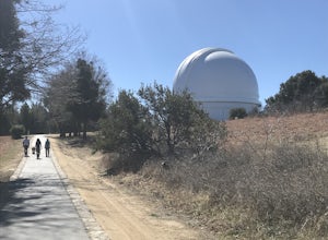
Hike to Palomar Observatory from the Palomar Observatory Campground
5.04.4 mi / 718 ft gainSituated in the Palomar Mountains of Cleveland National Forest, Palomar Observatory Campground offers many amenities for enjoyable camping and exploring the area. A portion of the campsites loop has been cleared of trees with level cement pads to allow campers to set up their own telescopes. Dr...Read more -
San Diego, California
Mission Trails 5 Peaks
15 miThe 15-ish mile route we took made it a great workout, but it didn’t crush us. We left the apartment at 6 am and were back home with plenty of time to prep cook and eat a big dinner before 5 pm. Although I completed the hike in 1 day(and I highly recommend it)many people completed each hike indi...Read more -
San Diego, California
South Fortuna Mountain
5.04.59 mi / 997 ft gainHiking at sunset/night is a great way to beat both the heat and the crowds. On a clear day, you can see from Mexico to Catalina Island! If you stay long enough, you can see all of San Diego's city lights turn on, or the marine layer fog creeps into the canyons. South Fortuna Peak is part of Miss...Read more -
Santee, California
Cowles Mountain via Big Rock Trail
4.04.86 mi / 1207 ft gainStarting somewhat near sea-level, Cowles Mountain via the Big Rock Trail climbs about 1000 ft in elevation. This trail is about 5 miles total, out and back. Arrive at Big Rock park which has good parking. At the park you will walk to the left of the tennis courts past the limits (the fence) of...Read more -
Santee, California
Cowles Mountain via Big Rock Road
4.54.32 mi / 1109 ft gainStart by plugging 8125 Arlette St, Santee, CA into your GPS. This takes you to Big Rock Park, a convenient parking spot for the Cowles Hike. From here you want to walk through the park, and around the right side of the tennis court. This will take you to the fenced entrance to the hike. Head sout...Read more -
Santee, California
Crystal Cave
4.00.46 mi / 59 ft gainStarting at 8100 Mesa road, you will see parking along the side of the road in a few places, take advantage where you find it. Pass over the trail gate that marks the start of the journey. This will be a quick trip, as the total distance is less than a mile out and back. Head a quarter mile or ...Read more -
San Diego, California
Visitor Center Loop Trail
5.01.46 mi / 148 ft gainThe Visitor Center Loop Trail is a 1.4 mile hike in San Diego that features river views and allows dogs.The Visitor Center Loop Trail is a well maintained, quick hike with shady spots scattered along the path and open year-round. This trail is great for kids and dog owners. There is a great netwo...Read more -
Ramona, California
Cedar Creek Falls
4.85.52 mi / 1024 ft gainThe trail to Cedar Falls starts out at a hill in a residential area and ends in an unexpected spot where there is a beautiful waterfall complete with a swimming hole. Surrounded by 75-foot-high cliffs, a magnificent waterfall splashes into a pool known as the Devil’s Punch Bowl. Hikers have been ...Read more -
San Diego, California
Pyles Peak
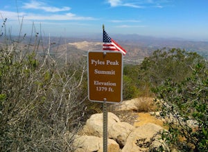
5.06.03 mi / 1706 ft gainMost people who live in San Diego have heard of, if not hiked, Cowles Mountain. At 1591 ft., Cowles is the highest peak in the city of San Diego. It's a hugely popular destination for day hikers and trail runners looking to get in a little trail time and take in the 360 degree views the summit h...Read more -
San Diego, California
La Jolla Coast Walk Trail
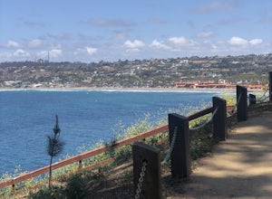
5.02.32 mi / 295 ft gainLa Jolla Coast Walk is a beautiful coastline trail, but is a bit of a heavily trafficked tourist trail. The hike can be started and ended at 3 separate locations. The trail is easily accessible with a small parking lot and tons of restaurants nearby. The trail begins near another popular touris...Read more -
Fallbrook, California
Hike the Santa Margarita River Trail
5.05 mi / 469 ft gainSanta Margarita River Trail is a 5 mile out-and-back hike that takes you near the river in Fallbrook, CA. This trail provides some shade which is helpful on hot days. If you bring your swimsuit you can hop in for a dip on hotter days. Make sure you wear good hiking shoes due to some rocky terrai...Read more -
Santa Ysabel, California
Hiking in Santa Ysabel
3.0Starting at the trailhead on Hwy 79, enter through the gate and make sure to close it behind you - the preserve is open range area for herds of cows, make sure not to disturb them when hiking. From the gate you'll see the sign with a detailed map of trails that are available for hiking. The trail...Read more -
San Diego, California
Hike to the Rope Swing in Tecolote Canyon
4.04.4 miTecolote Canyon offers a great opportunity to explore nature right in the heart of San Diego, whether it is a hike, run, or bike ride on the trails. But the best kept secret is perhaps a rope swing over the creek! The main trail starts off at Tecolote Canyon Natural Park & Nature Center, wh...Read more

