Groveland, California
Looking for the best photography in Groveland? We've got you covered with the top trails, trips, hiking, backpacking, camping and more around Groveland. The detailed guides, photos, and reviews are all submitted by the Outbound community.
Top Photography Spots in and near Groveland
-
Bridgeport, California
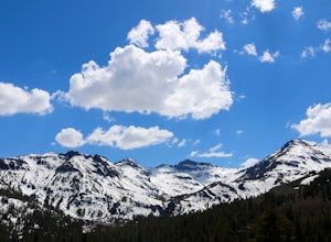
Virginia Lakes Trail
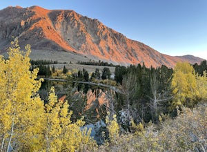
4.09.22 mi / 2464 ft gainIf you are looking for a hike with a view every half mile or so, then Virginia Lakes Trail is one to mark on your must-see list. You start at the parking lot near the first lake where bathrooms are available onsite. Try to hike right before the first snow in November so you can see the fall col...Read more -
Lee Vining, California
Backpack Virginia Lakes to Green Creek
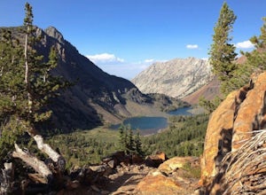
10.5 mi / 1234 ft gainKeep in mind that this is a point to point hike, so you will need to park a vehicle at Green Creek trailhead in Bridgeport as well as your start point at Virginia Lakes Resort.Starting at 9,886' at The Virginia Lakes Trailhead, you will begin by heading Northwest towards Virginia Pass. During yo...Read more -
Bridgeport, California
Backpack to Green Lake and Virginia Pass
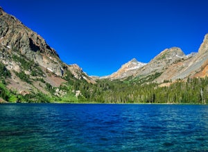
17 mi / 4452 ft gainDay 1 Green Creek Trailhead to Green Lake When we went on this hike, it was primarily to explore the area and see if it would be a feasible entrance to Northern Yosemite for extended backpacking trips. However, it also is a great two night trip to a lovely area of the Hoover Wilderness. Best...Read more -
Bridgeport, California
Hike to Peeler Lake
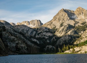
11 mi / 2400 ft gainThis trip can be done as a day trip or backpacking trip. It is around an 11 mile out-and-back trip.Park at Twin Lakes in Bridgeport, CA. There is a $10 fee and it can take a while on busy weekends. A permit is required to stay overnight in Hoover Wilderness. The trailhead can be hard to find; it ...Read more -
Madera County, California
Backpack to Lower Merced Pass Lake
4.023 mi / 880 ft gainLMPL (let's be honest, the full name is a mouthful) is situated just below the crest of Merced Pass, and can be accessed by hiking south from Yosemite Valley, or north from Chiquito Pass. This is a stunning and much less crowded spot to camp, or a great way to access some of the less climbed moun...Read more -
Arnold, California
Backpacking to Sword Lake
5.0Getting There Take 108 to Pinecrest Lake to pick up a free backcountry permit at the Summit Ranger Station. (If you reach Strawberry you've gone too far.) Continue past Beardsley Lake to Clark's Fork Road on the left. Cross two bridges and Forest Route 6N06 will take you to the trailhead (County ...Read more -
Tuolumne County, California
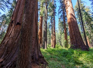
Hike the South Grove Trail in Big Trees SP
3.75 mi / 560 ft gainThe South Grove Trail of Calaveras Big Trees State Park sees far less traffic than the North Grove due to its increased mileage and distance from the park entrance. The trail starts at the South Grove Trail head which is located nine miles east of the entrance on the main park road. The trailhead...Read more -
Oakhurst, California
Hike the Shadow of the Giants Trail
4.01.1 mi / 85 ft gainThe Shadow of the Giants National Recreation trail is an amazing 1.1 mile self-guided hike through the heart of Nelder Grove. Take Hwy 41 north from Fresno; continue thru Oakhurst to Sky Ranch Road (6S10 or Forest Road 10) travel approx. 5 miles to Nelder Grove, when you reach the camp area take ...Read more -
Oakhurst, California
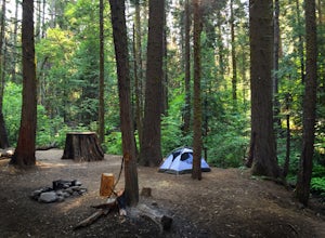
Camp at Nelder Grove Campground in Sierra National Forest
0 mi / 0 ft gainSites are located along Willow Creek with plenty of shape. Right out of the campground you can hike nearby Bull Buck Trail and discover the giant sequoia trees. This is a first-come first-serve campground so arrive early.Directions: Take Hwy 41 north from Fresno; continue thru Oakhurst to Sky Ran...Read more -
Arnold, California
Hiking Disaster Creek
While this is not a terribly scenic hike, the trees, creek, and terrain are very beautiful, and the entire area is quiet and peaceful. You're likely not to pass a single other person on the hike, which is great for letting dogs off-leash.The trail starts off with a series of switchbacks, which ga...Read more -
Arnold, California
Hike the North Grove Trail in Calaveras Big Trees SP
5.01.7 mi / 40 ft gainWhen thinking of the iconic Sequoias of the Sierra Nevada, one usually thinks of Yosemite and Sequoia National Park. However, there is a often forgotten area of Giant Sierra Redwoods that gets far less traffic than the more popular groves. The North Grove Trail takes you through a grove of over 1...Read more -
June Lake, California
Parker Lake Trail
5.03.55 mi / 584 ft gainParker Lake is tucked beneath the giant mountains of Mount Wood, Mount Lewis, and Parker Peak. I hiked the Parker Lake trail during peak foliage season and I was blown away by the amazing fall colors. The trail starts off with a steady and rocky climb. After you pass the elevation gain, the trail...Read more -
Mono County, California
Gem Lake via Rush Creek
5.06.91 mi / 2313 ft gainThis hike starts next to Silver Lake in the June Lake Loop, located just north of Mammoth Lakes, CA off HWY 395. There is a parking lot near the RV park as well as street parking across the road from the trailhead. Once you head out on the hike, you'll start gaining elevation as you hike up tow...Read more -
Lee Vining, California
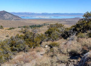
Mono Lake Vista Point
Mono Lake Vista Point is a quick pull off on the right side of Highway 395 as you’re headed south toward Mono City. The pull off is fairly big and is a great spot to pull over quickly to take in a view of Mono Lake and the greater area.Read more -
Lee Vining, California
Camp at Mono Lake
5.0Many people visit Mono Lake for a quick photo opportunity of the South Tufa. When I discovered camping was allowed on the North side of the lake, I knew I had to experience it and share.You head East on Cemetery Rd. just North of Lee Vining. This road turns into a dirt road, which will require yo...Read more -
Lee Vining, California
Explore the Black Point Fissures
4.32 mi / 500 ft gainThis area is such a great way to spend time exploring. It's a lot different than what it's surrounded by, making it a great change of pace in the Eastern Sierra.Just East of Lee Vining, California is Black Point, which sits on the North side of the massive Mono Lake...Which used to be an underwat...Read more

