Orinda, California
Looking for the best hiking in Orinda? We've got you covered with the top trails, trips, hiking, backpacking, camping and more around Orinda. The detailed guides, photos, and reviews are all submitted by the Outbound community.
Top Hiking Spots in and near Orinda
-
Winters, California
Homestead & Blue Ridge Loop
5.04.46 mi / 1299 ft gainAt the bend in the road on Highway 128, you will pass two silver gates. The gate with the UC Davis logo is the entrance to the trailhead. Past the entrance there is a large dirt pullout off the road with plenty of parking. Starting at the trailhead, go left in the fork to start the loop trail. T...Read more -
Winters, California
Hike the Stebbins Cold Canyon Loop
4.04.5 mi / 350 ft gainStebbins Cold Canyon is a great day hike for all skill levels, accessible year round, and offers an abundance of wild flower viewing, including the California poppy. Tog get to the hike, head about 8 miles west of Winters, CA, where a silver fire gate marks the main entrance to the Stebbins Cold ...Read more -
Winters, California
Hike the Homestead-Blue Ridge Loop
5.0From the official trailhead, start off by taking the Homestead Trail, which forks towards the right. A trail connecting Homestead and Blue Ridge will take you to a creek nearby. Veer off the trail along the creek and there is a water hole for cooling off on hot days. Onward into the trail, you wi...Read more -
Chimney Rock Trail Head, California
Chimney Rock
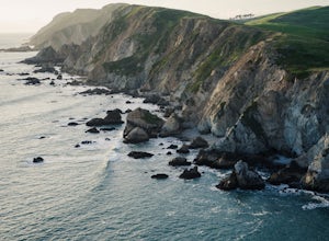
4.51.82 mi / 151 ft gainChimney Rock is a 1.8-mile out-and-back, single-track trail. The trailhead gets crowded (even on weekdays) with amateur and professional photographers, as well as nature lovers clutching field guides. Hikers seeking a quiet nature experience may wish to look elsewhere. The display is impressive, ...Read more -
Inverness, California
Abbotts Lagoon Trail
4.63.43 mi / 102 ft gainIf you like beaches, headlands, scenic landscapes, wildflowers, and tons of wildlife viewing, you should give this hike a try. Although it only takes about an hour to complete the out-and-back, the vibe surrounding this area is just begging you to slow down and enjoy your natural surroundings. T...Read more -
Inverness, California
Marshall Beach Trail
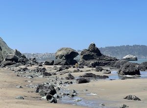
5.02.41 mi / 305 ft gainMarshall Beach Trail is an out-and-back trail that provides a good opportunity to see wildlife located near Inverness, California.Read more -
Saint Helena, California
Lake Hennessey Loop
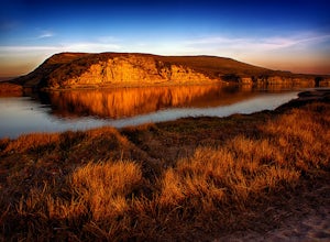
5.06.53 mi / 764 ft gainThe "lollipop" hike starts at the "Ranch House" parking lot off of Chiles Pope Valley Road - alternatively, you can access from Conn Valley Road for a shortened 5.6-mile loop. You turn off Chiles Pope Valley Road onto Moore Creek Trail, drive past a private house (you can see it on the map) and t...Read more -
Sanborn County Park, California
Hike Sanborn County Park via the San Andreas Trail
4.04.2 mi / 1282 ft gainThis is a moderately rated 4.2 mile trail that winds through the redwoods west of Saratoga. It features a dirt trail with tall trees and a creek. The hike is very tranquil and there is lot s of greenery. There are big rocks in the creek that can you can sit on. People often meditate here as i...Read more -
Saratoga, California
Backpack Castle Rock State Park
4.7Castle Rock Trail Camp has a different policy than other backcountry camps in the area (i.e. campsites along Skyline to the Sea). This campground is open all year and is available on a first come, first served basis. If you can, grab a spot a Frog Flat Camp. To get to the camp, park your car at t...Read more -
Los Gatos, California
Hike the Saratoga Gap Trail
4.64.7 miThe Saratoga Gap Trail is relatively lightly trafficked trail that is good year round, although waterfalls peak in late winter and spring. Overall, this 4.7 mile partial loop hike is moderate, with about 1000 feet in elevation change. Trailhead elevation is about 3090 feet. The featured hike desc...Read more -
Santa Rosa, California
Hood Mountain Summit Via Lower and Upper Johnson Ridge Trails
5.95 mi / 2054 ft gainHood Mountain Summit via the Lower Johnson and Upper Johnson Ridge Trails is a 6 mile out-and-back trek located in Santa Rosa, CA. The trailhead starts at the Pythian Road parking lot, accessed from Highway 12. The hike takes 3.5 to 4 hours to complete and is considered strenuous. All trails are...Read more -
Los Gatos, California
Hike Los Gatos Trail to Jones Trail Loop
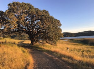
3.8 mi / 511 ft gainThis trail winds its way along the Los Gatos Creek and ends at the Lexington Reservoir before looping back to the start. It is 3.8 miles and makes for a great way to get exercise and relax in nature. You can hear the creek as you hike, and can even go down to it. There is a lot of green foliage t...Read more -
Santa Rosa, California
Taylor Mountain Loop
4.24.89 mi / 1096 ft gainFrom the northern entrance to the park, you can access an 18-hole disc golf course as well as a number of trails. The Eastern Trail takes you up a steep 1,000 feet to the top of Taylor Mountain, where you can see most of Sonoma County laid out before you. Mt. St. Helena is visible in the distance...Read more -
Inverness, California
Watch the Sunset at Point Reyes Lighthouse
3.7From San Francisco, drive north over the Golden Gate Bridge and onto the scenic Route One. Plan to spend a full day on the round trip if you're going for the first time; along the drive, you'll most likely want to stop every ten minutes to check out the charming seaside towns or the stunning coas...Read more -
Santa Rosa, California
Hiking, Swimming, and Fishing in Wine Country
5.0Annadel State Park is located in the historic Valley of the Moon, just 60 miles north of San Francisco, in Sonoma. This popular 5,200 acre park features a wonderful variety of options to explore, boasting views of the Sonoma Valley, rolling meadows of wildflowers, and direct access to 26 acre Lak...Read more -
Pescadero, California
Camp at Butano State Park
Butano State Park definitely flies under the radar. But for those who love quick escapes, small crowds, fun hikes, and beautiful redwoods, it's a favorite. The park features miles of hiking trails, 21 drive-in campsites and 18 walk-in campsites. Restrooms with running water are provided. Drinking...Read more


