Palomar Mountain, California
Looking for the best photography in Palomar Mountain? We've got you covered with the top trails, trips, hiking, backpacking, camping and more around Palomar Mountain. The detailed guides, photos, and reviews are all submitted by the Outbound community.
Top Photography Spots in and near Palomar Mountain
-
Poway, California
Mount Woodson and Potato Chip Rock
4.66.45 mi / 900 ft gainMt. Woodson is located in Poway's most eastern region and is one of San Diego's most popular and most iconic hiking trails. Known for its grand photo opportunistic "Potato Chip Rock", Mt. Woodson is a 7.5mi out-and-back trail with amazing vistas, convenient rest stops and breathtaking views. The...Read more -
Borrego Springs, California
Anza Borrego Metal Sculptures
4.6Here's a map I made that marks where most of the sculptures are (here). First, you enter the park and drive through the little city of Borrego Springs. There will be a roundabout you can't miss, so you know you're on the right path. There is nowhere to park to get to the sculptures specifically,...Read more -
Santa Ysabel, California
Three Sisters Falls
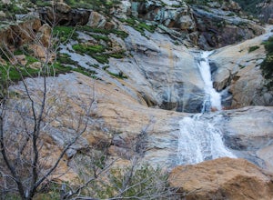
4.93.42 mi / 906 ft gainThree Sisters Falls is by far the best hike, for the most reward, that I've gone on in the close vicinity of San Diego. Only a short hour and a half drive from downtown San Diego, the hike offers all the draws of a National Park: remote wilderness, strenuous hiking, scenic mountain views, and ama...Read more -
Ramona, California
Iron Mountain Peak Trail
4.15.67 mi / 1030 ft gainIron Mountain is the longest wilderness trail in Poway, CA. The parking lot is free and provides bathroom and water fountain amenities. The distance from the parking area to the summit is approximately 3.2 miles. Beginning with a wide smooth trail, slowly transitioning into semi-technical incline...Read more -
Mountain Center, California
Mount San Jacinto via Devil's Slide
4.514.57 mi / 4475 ft gainMt. San Jacinto is the second tallest peak in Southern California at 10,834’. Although this route requires a fair amount of work, the effort is more than rewarded by the expansive views, forest, meadows, and dramatic topography. You will need an Adventure Pass ($5/day) to park at Humber Park, as...Read more -
Mountain Center, California
Tahquitz Peak via Devils Slide Trail
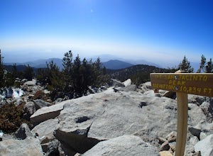
5.08.31 mi / 2238 ft gainTahquitz Peak via Devils Slide Trail is a moderately trafficked 8+ mile out and back trail located near Idyllwild, California. This trail is one of the most popular hikes in the San Jacinto area that features a fire lookout tower at the peak and amazing views of the valley below. At an elevation...Read more -
Poway, California
Catch a Sunset at Twin Peaks Mountain
2 miStart by parking at Silverset Park. You will see the trail head for Twin Peaks just behind the park. Park outside of the park if you think you'll be staying past sunset, as the park gates close at dark! Once you spot the trail head, veer left to the path heading up towards the peaks. You will eve...Read more -
Carlsbad, California
Hike and Fish at Lake Calavera
4.06.24 miLake Calavera Preserve is located in Carlsbad, CA and is home to one of North America's smallest volcanoes. It is the end peak of each trail and is what's known as a "volcanic plug" (cool hardened lava). The northern face of Mount Calavera is that of columnar joints- columns of molded lava. Geolo...Read more -
Riverside County, California
San Jacinto Peak via Marion Mountain Trailhead
11.25 mi / 4505 ft gainSan Jacinto Peak is the second highest peak in Southern California which sits at 10,833'. There are several trails to summit San Jacinto, but Marion Mountain is the shortest but also a tough one. You will start the hike at an elevation of 6300' and continuously climb 4500' in less than 6 miles. ...Read more -
Banning, California
Lake Fulmor Loop Trail
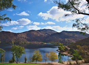
5.00.53 mi / 89 ft gainLake Fulmor is a small lake in the San Jacinto Wilderness near Idyllwild, CA. The trail loops around the lake offering spectacular views and is good for all skill levels. There are picnic tables, grills, and a small dock where you can peer out over the lake or cast a line. To fish in Lake Fulm...Read more -
Palm Springs, California
Palm Canyon Trail
4.51.94 mi / 308 ft gainThe fifteen mile long Palm Canyon, one of the Indian Canyons, is among the most beautiful natural sites in Western North America. Its indigenous flora and fauna, expertly used by the Cahuilla people, and its abundant Washingtonia Filifera (California Fan Palm) stand in breathtaking contrast to th...Read more -
Julian, California
Hike Stonewall Peak
4.73.82 mi / 820 ft gainThis hike is one of the most popular in the Cuyamaca Rancho State Park. When you reach Stonewall Peak's summit, enjoy the view of the surrounding park and nearby Lake Cuyamaca. The hike up the east side is a popular and relatively easy trail. Although you'll be gaining 800 feet, the hike is relat...Read more -
Julian, California
Hike Cuyamaca Peak
4.55.5 mi / 1700 ft gainThis peak is one of the tallest in the county. Reaching the summit of the peak takes you to an elevation of 6500'. Although this peak isn't as challenging as others nearby, it's located in the center of San Diego, which offers up amazing views, which is the main reason to take this hike. The best...Read more -
Palm Springs, California
Seven Falls via Murray Canyon Trail
4.01 mi / 587 ft gainA very scenic 4-mile round trip with a rewarding waterfall after a 2.5-mile hike/stroll. Lucky visitors may catch a glimpse of the Peninsula Big Horn Sheep (an endangered species), mule deer or other wild animals still roaming the high ground above the canyon. Less visited, Murray Canyon has its ...Read more -
Palm Springs, California
Andreas Canyon
5.01.03 mi / 154 ft gainAndreas Canyon in Indian Canyons is located very close to Palm Springs in the Agua Caliente band of Cahuilla Indians Reservation. It is one of the few places with abundant shade and running fresh water in an otherwise dry desert landscape. Enjoy a longer hike to a waterfall (Seven Falls) or stay ...Read more -
San Diego, California
Explore Chambers Hidden Dam and Waterfall
3.20.5 miOnce you get off on Poway road, turn right onto Sabre Springs Parkway. Take your immediate left onto Creekbridge Road and park right there on the hill. Walk straight down towards the black gate and go down the hill. Turn right on the trail and walk down 1/4 mile to the dam, and another 500 yards ...Read more

