Rancho Santa Margarita, California
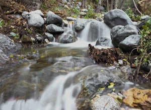
Rancho Santa Margarita, California, offers some of the best trails and outdoor activities. The top pick is the Arroyo Trabuco Trail, a 10-mile round trip hike that features a river and is rated as moderate. This trail is known for its scenic landscapes, including the O'Neill Regional Park, Trabuco Creek, and various rock formations. Another must-visit is the Tijeras Creek Trail, a 4.7-mile loop trail with a river view and a moderate difficulty level. It's perfect for hiking, walking, and bird watching. For those seeking a shorter trail, the Dove Canyon Waterfall Trail is a 2.1-mile out-and-back trail that leads to a beautiful waterfall. Rancho Santa Margarita is also home to the Lago Santa Margarita, a man-made lake that offers fishing and boating. These outdoor adventures make Rancho Santa Margarita a top choice for hikers and
Top Spots in and near Rancho Santa Margarita
-
Rancho Palos Verdes, California
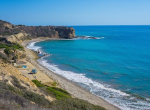
Abalone Cove Shoreline Park
4.3Abalone Cove Shoreline Park is a Palos Verdes gem. This 64-acre reserve is a state ecological preserve. There is something for everyone here, whether you want to relax and lay out or be adventurous and swim across channels to get to sea caves. The large parking area is very easy to find and costs...Read more -
Rancho Palos Verdes, California
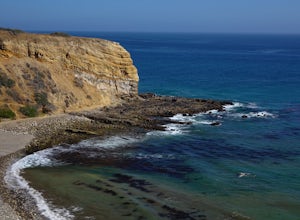
Sacred Cove View Trail
4.52.08 mi / 292 ft gainThis area is spectacular - the views of the cliffs, the channels of water entering the caves, and the marine life (sea lions, whales, dolphins, sea urchin and sea anemone) are huge draws. Bring anyone here that has a sense of adventure and be ready to get wet. Only attempt swimming across the cha...Read more -
Arcadia, California
Hermit Falls Trail
4.82.49 mi / 1014 ft gainNote: Hermit Falls is Temporarily Closed From Roberts Camp, many hikers will head to Sturtevant Falls, which is an amazing 60-foot waterfall. But, if you choose to head in the opposite direction on First Water Trail, you’ll be rewarded with a fresh water swimming hole at this 35-foot tumbling wa...Read more -
Arcadia, California
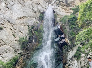
Sturtevant Falls
4.61.61 mi / 423 ft gainThis trail is currently closed. Visit the Forest Service website for updates. As you head down to Roberts Camp, a historic set of historic cabins, you’ll head out on a steep, paved road for approximately 0.6 miles. Once you reach the camp, head over the bridge and keep an eye out for the sign f...Read more -
Arcadia, California
Mt. Wilson Loop from Chantry Flat
5.012.74 mi / 4852 ft gainMt. Wilson is one of the more difficult mountains in the San Gabriel to hike, making this adventure Intermediate. While 5,700 feet doesn't seem that tall, the mountain has a prominence of almost 5,300 feet, meaning that hike is steeper and longer than some of the other popular mountains that star...Read more -
Palomar Mountain, California
Hike Thunder Spring and Chimney Flat Loop
3.04 mi / 900 ft gainPalomar Mountain is the hidden gem of San Diego. Well, not so hidden per se- but most don't know that the little climb up the mountain can transport you from the prevalent brush-filled terrain of SD to a lush, diverse forest.The great thing about Palomar is that every day you visit could be compl...Read more -
Palomar Mountain, California
Hike to French Valley
5.03.8 mi / 450 ft gainWhen it comes to Palomar Mountain State Park, most people stick to Doane Lake and Upper Doane Valley. Yet on the far right of the parking lot at Doane Pond, there is actually a trailhead that will guide you to a completely different section of the park. The Lower Doane Valley trail is, in my opti...Read more -
Crestline, California
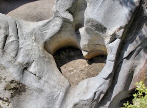
Hike the Heart Rock Trail
4.51.8 miThis short but nice hike near Crestline, CA in the San Bernadino Forest is one for the whole family. Although finding the trailhead/parking lot can be a bit confusing, it is definitely worth it. Driving in from the Inland Empire/LA Area, follow The Rim of the World Trail (SH18) until you see the...Read more -
Escondido, California
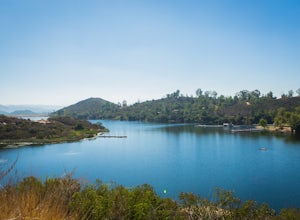
Camp at Dixon Lake
2.1 mi / 295 ft gainDixon Lake is Escondido's best kept secret! A man-made reservoir located right next to Daley Ranch, Dixon Lake offers overnight camping, boat rentals, fishing, and hiking, along with picnic areas, a kids park, and more. The campground is open year-round and is located next to the lake with a lof...Read more -
Avalon, California
Camp at Hermit Gulch on Catalina Island
3.9 mi / 1206 ft gainThe Avalon port in Catalina is most easily accessed through the Catalina Express leaving from Dana Point, Newport Beach or Long Beach. The Hermit Gulch campsite is only a 20 min walk from the boat and is well run with restrooms, showers... etc. They also sell anything you might have forgotten for...Read more -
Rancho Palos Verdes, California
Terranea Beach Sea Cave
4.31.63 mi / 210 ft gainHead to the Pelican Cove parking lot where there’s plenty of free parking right at the trailhead. From the parking lot, take the Terranea Beach Trail and you will see views of the Point Vicente Lighthouse down the coast to your right. Continue on the trail through the luxury Terranea Resort whic...Read more -
Los Angeles, California
Los Angeles Historic Park
5.01.17 mi / 46 ft gainLos Angeles Historic Park is a loop trail that is good for all skill levels located near Dodgertown, California.Read more -
Rancho Palos Verdes, California
Pelican Cove
0.38 mi / 95 ft gainGetting There Coming from San Pedro, make a U-turn at the Hawthorne Boulevard stoplight onto Palos Verdes Drive South. From here, you can access the parking lot for Pelican Cove, where you'll get a 120° view of the ocean. It might be tempting to take in the sunset from the car, but you should def...Read more -
Palomar Mountain, California
Hike to Palomar Observatory from the Palomar Observatory Campground
5.04.4 mi / 718 ft gainSituated in the Palomar Mountains of Cleveland National Forest, Palomar Observatory Campground offers many amenities for enjoyable camping and exploring the area. A portion of the campsites loop has been cleared of trees with level cement pads to allow campers to set up their own telescopes. Dr...Read more -
Escondido, California
Lake Hodges Overlook
4.66.73 mi / 1407 ft gainElfin Forest is one of the most beautiful and unique trails in all of San Diego, CA. The parking is free as well as the overflow parking area. There is an Interpretive Center located in the staging area where you can speak to park rangers, learn about the wildlife and trail locations. The parking...Read more -
Altadena, California
Eaton Canyon to Idlehour Trail Camp
4.510.99 mi / 3291 ft gainIdlehour is nestled deep in the Angeles National Forest, so it feels like you're in the heart of some untapped wilderness instead of six miles away from a bustling metropolis. The trail camp is accessible by foot through a variety of locations, but the most popular route is through Eaton Canyon, ...Read more

