San Clemente, California
Looking for the best hiking in San Clemente? We've got you covered with the top trails, trips, hiking, backpacking, camping and more around San Clemente. The detailed guides, photos, and reviews are all submitted by the Outbound community.
Top Hiking Spots in and near San Clemente
-
Ramona, California
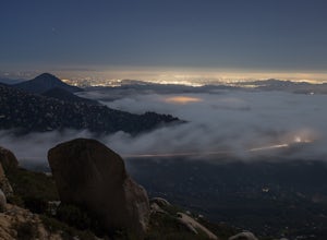
Mount Woodson's East Approach
3.03.96 mi / 1385 ft gainMount Woodson is a well-known hiking trail in San Diego County. It is known for its breathtaking views and the famous potato chip rock. The Trail on the east side of the Mountain is fairly steep but is about half the distance of the trail on the west side of the mountain. To get to the trail on ...Read more -
Redlands, California
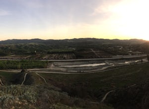
Run the Carriage Trail
3.52.5 mi / 300 ft gainThere is room to park just off San Timoteo Road. On the other side of the trail is more parking off Alessandro. You can park your car on either side and start your run/walk/bike ride. This is a nice little "get away" trail to take a break from suburbia.Read more -
Ramona, California
Iron Mountain Peak Trail
4.15.67 mi / 1030 ft gainIron Mountain is the longest wilderness trail in Poway, CA. The parking lot is free and provides bathroom and water fountain amenities. The distance from the parking area to the summit is approximately 3.2 miles. Beginning with a wide smooth trail, slowly transitioning into semi-technical incline...Read more -
Rancho Palos Verdes, California
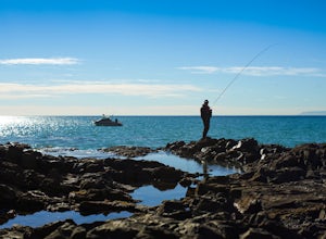
Surf Fishing Off Of Inspiration Point
Tucked away, at the base of Inspiration Point in Palos Verdes is an outcropping of rocks, perfect for surf casting and catching ocean fish, away from the crowds. It's a challenge to get there, but the less travelled spot is used by many professional sportsmen, practicing their skills at fishing f...Read more -
Rancho Palos Verdes, California
Burma Road Trail & Ishibashi Trail Loop
4.35.09 mi / 1148 ft gainGetting There: The easiest way to get to Portuguese Bend Nature Reserve is by following Crenshaw Boulevard up Rancho Palos Verdes to the very end of the street. You can park on either side of the street near Del Cerro Park, which also happens to be a great place for picnics if you want to eat bef...Read more -
Rancho Palos Verdes, California
Sacred Cove View Trail
4.52.08 mi / 292 ft gainThis area is spectacular - the views of the cliffs, the channels of water entering the caves, and the marine life (sea lions, whales, dolphins, sea urchin and sea anemone) are huge draws. Bring anyone here that has a sense of adventure and be ready to get wet. Only attempt swimming across the cha...Read more -
La Verne, California
Marshall Canyon Trail
4.05.99 mi / 722 ft gainFor this adventure you can choose to start in a multiple of places; for the easiest parking use Oak Mesa Park located next to Oak Mesa Elementary School. From the parking lot cross the soccer field towards the bridge on the north east end of the school. Once across the bridge follow Los Robles ea...Read more -
Poway, California
Hike around Goodan Ranch
5.03 miStarting at the Sycamore Canyon Trail head, you will see the sign and gate that leads to Goodan Ranch. Head down the gravel road for 1.1 miles, until you reach a 3-way directional split. Heading straight for another .5 miles will take you directly to the ruins of the old Goodan house. Here you wi...Read more -
Claremont, California
Claremont Wilderness Loop
4.85.03 mi / 1020 ft gainDrive to the top of Mills Ave in Claremont. There is a main parking area to the left and overflow parking a block south on the right. It costs $3 to park for 4hrs. As the name implies, the Wilderness Loop is a loop that connects to other trails in the Claremont Hills Wilderness. You can choose t...Read more

