Somerset, California
Looking for the best hiking in Somerset? We've got you covered with the top trails, trips, hiking, backpacking, camping and more around Somerset. The detailed guides, photos, and reviews are all submitted by the Outbound community.
Top Hiking Spots in and near Somerset
-
Twin Bridges, United States
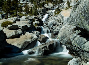
Hike Horsetail Falls
4.22.8 mi / 700 ft gainGreat views are waiting for you at the top of Horsetail Falls. Pyramid Creek flows down the steep, glacier carved granite faces of Desolation Wilderness to create this awesome waterfall that is estimated to be about 800 feet tall. You will follow Pyramid Creek up the granite rocks to the top of t...Read more -
Twin Bridges, California
Hiking to Ralston Peak
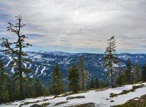
4.07 mi / 2375 ft gainStarting at the lower lot it's less than a mile to access the trail. The hike starts off in shade through a lot of red fir forest and continues at a steady upward route. Approximately 45 mins into the hike you'll come across a sign that says you are entering desolation wilderness. The forest will...Read more -
Twin Bridges, California
Summit Price & Agassiz from Desolation Wilderness
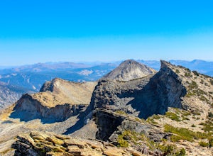
5.0Mount Price (9,975') is the second highest summit in the Desolation Wilderness, standing just eight feet lower than Pyramid Peak to the south. In between these two peaks stands Mount Agassiz (9,967'), whose overhanging summit resembles a granite wave poised to crash down into the Desolation Vall...Read more -
Markleeville, California
Caples Lake to Emigrant Lake
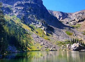
5.08.71 mi / 971 ft gainThis is an awesome out-and-back hike for the weekend warrior. The trail begins at the western-most point of Caples Lake, and takes you to Emigrant Lake. The first 2/3 of the trail is rather flat and appropriate for all skill levels. The last mile up to the lake schleps up the hill, and has some ...Read more -
Auburn, California
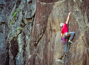
Rock Climb at the Quarry
5.02.6 mi / 800 ft gainMany thanks to the Climbing Resource Advocates for Greater Sacramento (CRAGS) and the Access Fund for their hard work in re-opening this location to make it climbing-legal. Where to Park:Put in "Parking lot for the Quarry Trail, California 193, Auburn, CA 95603"This is the designated parking lot ...Read more -
Auburn, California
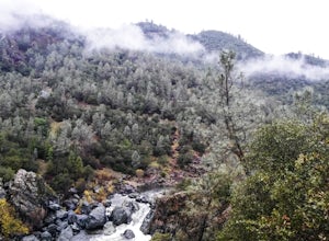
Hike the Quarry Trail in the Auburn SRA
4.011 miParking in the Auburn State Recreation Area parking lot has a cost of $10.00. Free parking is allowed on the right side of the road located on the right after driving over the bridge. From here the Quarry Trail parking lot and Trail head are a short walking distance ahead on the left side of th...Read more -
Auburn, California
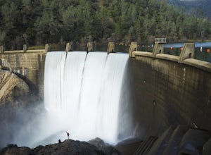
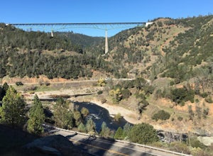
Hike to the North Fork Dam of Lake Clementine
5.04 miLocated only roughly 40 minutes from Sacramento. This trail will allow you to view and walk under the 5th largest bridge in the US as well as enjoy the waterfall spectacle of a top releasing Dam. Once reaching Old Foresthill Road from the town of Auburn, drive over the smaller bridge spanning the...Read more -
Auburn, California
Hike Training Hill
4.54.5 mi / 1126 ft gainTraining Hill is a 4.5 mile loop trail that features beautiful meadows and wildflowers, with limited views to Folsom Lake and the Auburn canyon. The trail to Training Hill branches off from the Calcutta Falls trail right before the first cement bridge over the American River. Training Hill is r...Read more -
Tuolumne County, California
Hike the South Grove Trail in Big Trees SP
3.75 mi / 560 ft gainThe South Grove Trail of Calaveras Big Trees State Park sees far less traffic than the North Grove due to its increased mileage and distance from the park entrance. The trail starts at the South Grove Trail head which is located nine miles east of the entrance on the main park road. The trailhead...Read more -
Alpine County, California
Hike The Sisters in the Mokelumnee Wilderness
8 mi / 2500 ft gainThe Sisters offer a great day hike with fun scrambling and beautiful views of the Northern Sierra, Lake Tahoe, the Mokelumnee Wilderness, and the Carson River Canyon.The trail to The Sisters begins at Woods Lake (38.6855° N, 120.0095° W), at the end of Woods Lake Road off Highway 88, 1.5 miles we...Read more -
Alpine County, California
Hike Round Top Summit and Winnemucca Lake Loop
6.6 mi / 1272 ft gainThis hike begins near the Woods Lake campground. Start off by hiking towards Winnemucca Lake. You will begin your journey going through the forest beside a crystal-clear stream. Soon the trail opens up to become more open, full of all colours of wild flowers. You follow this breathtaking trail up...Read more -
Tahoma, California
Glen Alpine Falls and Grass Lake
4.85.29 mi / 725 ft gainPark your car at the Glen Alpine Trailhead adjacent to Lily Lake and southwest of Fallen Leaf Lake. Head west on Glen Alpine Creek Trail passing Lily Lake on your left. After a little over a mile and a half of trekking through the alpine forest and taking in mountain views, you'll arrive at Alpin...Read more -
Tahoma, California
Susie Lake, Desolation Wilderness
5.07.96 mi / 1496 ft gainStarting at the Glen Alpine trailhead (best access to Susie Lake): To get to the trailhead, head toward Fallen Leaf Lake in South Lake Tahoe. From HWY 89, turn onto Fallen Leaf Rd and drive past the summer homes and marina until you reach a small firehouse on the left side of the road. You'll fol...Read more -
Tahoma, California
Hike to Half Moon Lake in Desolation Wilderness
5.011 mi / 1600 ft gainThis hike starts at the Glen Alpine Trailhead near Fallen Leaf Lake. Because Desolation is a wilderness area, you are required to fill out a day-use permit which can be found at the trailhead. If you are backpacking make sure to obtain an overnight permit either online or at the Taylor Creek Visi...Read more -
South Lake Tahoe, California
Gilmore Lake in Desolation Wilderness
8.66 mi / 1919 ft gainThe easiest way to get to Gilmore Lake is to start at the Glen Alpine trailhead. The trail head is southwest of Fallen Leaf Lake. There is a decently sized parking lot at the trailhead, but parking is also available on the road up. Because desolation is a wilderness area, you must fill out a perm...Read more -
South Lake Tahoe, California
Meiss and Round Lake via Tahoe Rim Trail
10.5 mi / 1257 ft gainMeiss and Round Lake via Tahoe Rim Trail is an out-and-back trail that takes you by a lake located near Kirkwood, California.Read more

