Tahoe City, California
Tahoe City, California has many activities for outdoor adventurers. From scenic trails to must-visit attractions, there's something for everyone. Popular attractions in and near the area include the Emerald Bay State Park, Donner Memorial State Park, and the Tahoe City Golf Course. For those who enjoy hiking, the Tahoe Rim Trail provides stunning views of the lake and surrounding area. The Donner Summit Trail offers a more challenging experience, with its steep inclines and rocky terrain. For a more leisurely experience, kayaking and stand-up paddleboarding are popular activities on the lake. An abundance of wildlife can be spotted in and around the area, including bald eagles, ospreys, and mule deer. Whatever your outdoor interests, Tahoe City has something for you. Explore the best trails and outdoor activities in and near the area for a truly memorable experience.
Top Spots in and near Tahoe City
-
Auburn, California
Hike the Quarry Trail in the Auburn SRA
4.011 miParking in the Auburn State Recreation Area parking lot has a cost of $10.00. Free parking is allowed on the right side of the road located on the right after driving over the bridge. From here the Quarry Trail parking lot and Trail head are a short walking distance ahead on the left side of th...Read more -
Auburn, California
Hike Training Hill
4.54.5 mi / 1126 ft gainTraining Hill is a 4.5 mile loop trail that features beautiful meadows and wildflowers, with limited views to Folsom Lake and the Auburn canyon. The trail to Training Hill branches off from the Calcutta Falls trail right before the first cement bridge over the American River. Training Hill is r...Read more -
Arnold, California
Upper Gardner Meadow via Highland Lakes Trail
3.96 mi / 364 ft gainUpper Gardner Meadow via Highland Lakes Trail is an out-and-back trail where you may see wildflowers located near Markleeville, California.Read more -
Grass Valley, California
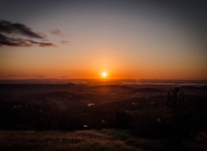
Photograph a Sunset on Wolf Mountain
5.0While all of the hiking trails to the Wolf Mountain summit cross private land, Wolf Mountain Road provides public access to several excellent viewpoints overlooking the Central Valley and the nearby ruins of old radio towers.To get there take McCourtney Road west from CA Highway 49/20 and go 3.2 ...Read more -
Plumas County, California
Hike to Little Jamison Falls
3.02 mi / 500 ft gainTo get to the falls from the town of Graeagle, CA take Graeagle-Johnsville off Highway 89 towards the town of Johnsville. After 4.5 miles take a left on a dirt road to Jamison Mine Day Use Parking. If you go over the bridge and into the town of Johnsville, you have gone too far. Continue down th...Read more

