Tahoma, California
Looking for the best hiking in Tahoma? We've got you covered with the top trails, trips, hiking, backpacking, camping and more around Tahoma. The detailed guides, photos, and reviews are all submitted by the Outbound community.
Top Hiking Spots in and near Tahoma
-
New Washoe City, Nevada
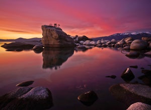
Photograph Bonsai Rock
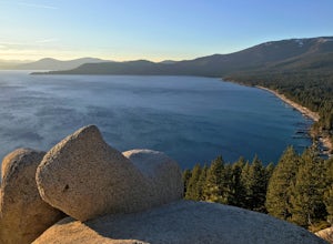
5.0Bonsai Rock is a popular attraction for photographers as it is a unique boulder with tiny trees growing out of it, enclosed next to the shoreline. This makes it a beautiful place to enjoy a scenic sunset, as well as play with some long exposure photography.It's located on the east side of Lake Ta...Read more -
Incline Village, Nevada
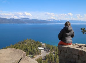
Walk to the Historic Stateline Fire Lookout site
5.01.8 mi / 340 ft gainThe hike up to the Historic Stateline Fire Lookout above Lake Tahoe's Crystal Bay area is somewhat of a misnomer, as the fire lookout no longer exists. Instead, the path, which follows a paved forest road, up to the site where the tower once stood will bring hikers to a panoramic viewpoint that l...Read more -
Incline Village, Nevada
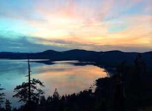
Quick Hike and Photo Op at Stateline
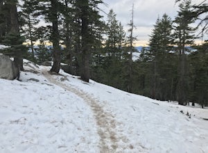
5.02 miThis quick 2-mile RT hike takes you to a lookout point above the Stateline of California and Nevada. The road to the lookout is paved so beginners can make the trek to the top in the summer; winter covers the road with snow, so snowshoes or boots are recommended. The lookout offers spectacular vi...Read more -
Glenbrook, Nevada
Castle Rock via Tahoe Rim Trail
5.01.79 mi / 407 ft gainCastle Rock via Tahoe Rim Trail (The Bench) is an out-and-back trail that takes you through a nice forest located near Zephyr Cove, Nevada.Read more -
Incline Village, Nevada
Bike or Take a Stroll along the Tahoe East Shore Trail
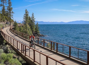
5.02.75 mi / 300 ft gainLake Tahoe's East Shore Trail is a wide paved walking and cycling path running between Incline Village and Sand Harbor State Park. Opened in 2019, the path lies completely separate from the road, sometimes hovering well above it on the mountainside, and other times running parallel to it on a bri...Read more -
Incline Village, Nevada
Monkey Rock
4.72.64 mi / 463 ft gainMonkey Rock is an out-and-back trail that takes you by a lake located near Incline Village-Crystal Bay, Nevada.Read more -
Kyburz, California
Hike to Twin and Island Lakes
5.07 mi / 1600 ft gainThe Twin Lakes trail starts winding through a pine forest, with a couple bridge crossings over crystal clear trout-filled streams. The marsh-like water is very slow moving, and even though it is indeed beautiful, it is also a prime location for pesky mosquitoes in the summertime. Be sure to loa...Read more -
Kyburz, California
Backpack to Smith Lake, Desolation Wilderness
5.05.6 mi / 1750 ft gainTo get to the Twin Lakes Trailhead from the Bay Area/Sacramento, head east on HWY 50 past Kyburz for 4 miles until you see the left-hand turnoff for Wrights Road. If coming westbound on HWY 50, this will be a right-hand turn 5 miles past Strawberry. Follow this paved road for 8 miles (watch for p...Read more -
Kyburz, California
Hike the Grouse, Hemlock, and Smith Lake Trail
5.0Starting from the Wright's Lake parking area, walk past the service gate to find the loop trail. Follow the loop trail to the signed trail for Twin, Grouse, Island, and Hemlock Lakes heading toward the right. You will begin an approximate 150 foot ascend before coming to a saddle. Another 150 foo...Read more -
Echo Lake, California
Hike Flagpole Peak from the bottom of Echo Summit
3.5 mi / 1900 ft gainFor this hike there are two places you can start from. One is at the Echo Lakes parking lot and the other is at the bottom of Echo Summit (where we started at). Parking at the gun tower at the bottom of Echo Summit you'll be looking right at the face of Flagpole. After parking just off the side o...Read more -
Kyburz, California
Backpack Desolation's Primitive Western Edge through Rockbound Pass
4.426.28 mi / 5151 ft gainThis 26 mile loop meanders through some of the most primitive trails in Desolation Wilderness. Starting from Wrights Lake, the route proceeds over Rockbound Pass, loops around several lakes, and returns to Wrights Lake. Not many hikers venture past the steep and rocky Rockbound Pass to enter this...Read more -
Kyburz, California
Gertrude Lake Trail
8.28 mi / 1362 ft gainGertrude Lake Trail is an out-and-back trail that takes you by a lake located near Kyburz, California.Read more -
Kyburz, California
Hike to Bassi Falls
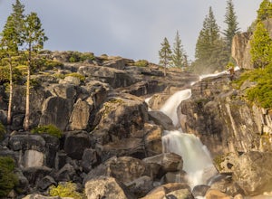
4.61.22 mi / 194 ft gain109' tall Bassi Falls is located in the Crystal Basin area of the El Dorado National Forest. These gorgeous falls at peak Springtime flow crash over enormous boulders and the water sheets over huge, flat slabs of granite. It is located off a rural, pot-holed dirt road (high clearance vehicles re...Read more -
Echo Lake, California
Backpack to the "Waterfall Camp" in Desolation Wilderness
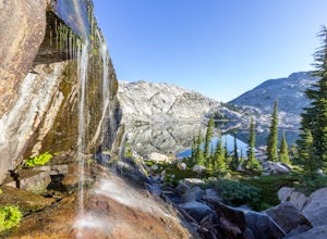
4.710.5 mi / 1522 ft gainAlthough this hike can be done as a day hike, it is an awesome place to camp. There is a lot to explore and you will want to spend as much there time as you can. The easiest way to start this hike is to start at the Echo Lakes. There is ample parking above the marina and you even have the option ...Read more -
Echo Lake, California
Hike to Jabu Lake in Desolation Wilderness
3.7Although this hike can be done as a day hike, there are incredible camping spots near the lake. The easiest way to start this hike is to start at the Echo Lakes. There is ample parking above the marina and you even have the option of taking a water taxi across the echo lakes to cut off around 2.5...Read more -
Echo Lake, California
Ski Ralston Peak
5.0Ralston Peak is a classic south Lake Tahoe backcountry skiing and snowboarding area, and is excellent for hiking in the summer, too. Please note, however, that backcountry skiing and snowboarding is dangerous – make sure you know the conditions and have avalanche equipment.There are two main appr...Read more

