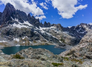
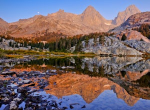
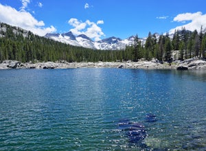
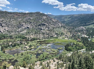
Wawona, California
Looking for the best hiking in Wawona? We've got you covered with the top trails, trips, hiking, backpacking, camping and more around Wawona. The detailed guides, photos, and reviews are all submitted by the Outbound community.
Top Hiking Spots in and near Wawona
-
Madera County, California
Cecile Lake via Agnew Meadows
16.11 mi / 2667 ft gainLocated in the heart of the Ansel Adams Wilderness, Cecile Lake can be reached from a variety of trailheads. I chose to start out in Agnew Meadows. From here, the trail criss-crosses through a serene lowland environment with several crystal clear streams. After passing Olaine Lake, veer left an...Read more -
Madera County, California
Climb Mount Ritter
Mt Ritter is a long climb, but it is worth the effort. Start out by establishing camp at Ediza Lake prior to your ascent. The SE Glacier route (first ascent by John Muir) follows the path of least resistance up the SE side of Mt Ritter.The route first gains a broad bench below Ritter and Banner P...Read more -
Madera County, California
Backpack to Waugh Lake
5.011 mi / 1000 ft gainThere are several trailheads you can start at to get to the lake, but we chose the River Trail in Agnew Meadows because it was the only trailhead that hadn't met the quota yet. You can check on permit's and trailheads here. If the River Trail is booked other great options are Shadow Creek, Fish C...Read more -
Mono County, California
Gem Lake via Rush Creek
5.06.91 mi / 2313 ft gainThis hike starts next to Silver Lake in the June Lake Loop, located just north of Mammoth Lakes, CA off HWY 395. There is a parking lot near the RV park as well as street parking across the road from the trailhead. Once you head out on the hike, you'll start gaining elevation as you hike up tow...Read more -
Lee Vining, California
Hike to Agnew Lake from Silver Lake
4.04.4 mi / 800 ft gainJune Lake never ceases to amaze. In just about any weather, this particular portion of the 395 is something to be experienced in its entirety.If you are dedicating a day or two to explore the June Lake loop, then a trek to Agnew Lake is the perfect hike to throw into the plans. It is not extremel...Read more -
June Lake, California
Hike to Fern Lake
5.03.5 mi / 1500 ft gainLess than 30 minutes north of Mammoth Lakes, the beauty of the region is captured even on the drive to get to the trailhead. No bathrooms at the trailhead, however the town of June Lake is a short bit away. Out of the gate, the trail quickly climbs 850 feet in just less than a mile. The way up, w...Read more -
Tuolumne County, California
Middle Gaylor Lake
1.46 mi / 764 ft gainThe main trail to the Middle Gaylor Lake is about 1.5 miles round-trip, but if you’re looking for more adventure, you can hike a little further to Upper Gaylor Lake (which will add a mile to your trip) or continue on to the Great Sierra Mine (which will add 2 miles to your trip). The Gaylor Lake...Read more -
Twain Harte-Tuolumne City, California
Mount Dana
5.04.89 mi / 3120 ft gainThere's something special about the landscape that Yosemite National Park offers, and the scenery around Mount Dana is no different. The trail begins at the Tioga Gate entrance to Yosemite with the trailhead at the north end of the small parking lot south of the gate. It winds through the ponds,...Read more -
Lee Vining, California
Climb the Third Pillar of Dana
From Highway 120 (Tioga Road) you can park at the lot just above Tioga Lake. Another mile up the road is the Yosemite entrance, so if you hit that, you've gone too far. Follow the trail around the south side of the lake and into Glacier Canyon. After about 2 miles you'll start scrambling on the N...Read more -
Friant, California
Pincushion Peak
2.49 mi / 1043 ft gainHead North on Friant Rd. It will begin to head East, becoming Millerton Rd. Stay on Millerton Rd for 4.2 mi. Turn left onto Sky Harbor Rd (street JUST before Table Mountain Casino). Follow Sky Harbor Rd for 5.8 miles to the end of the road. Parking is available along the road. There are port a po...Read more -
Groveland, California
Drive the Yosemite Valley Loop
4.3Upon entering Yosemite Valley National Park I made it a point to see Half Dome, El Capitan, and Washington Column and several other famous Yosemite formations. What I didn't realize was as soon as I entered The Village was that all could be seen within a 15 minute loop around the valley floor. Th...Read more -
Shaver Lake, California
Balsam Forebay
4.01.05 mi / 62 ft gainAccess to the forebay starts at the trail head from the parking lot 6,700 ft up, also from the parking lot there is access to two different sets of boulder patches separate from the ones encountered along the hike in. Hike Start the 1 mile out and back hike from the parking lot following the t...Read more -
Lakeshore, California
Hike to George Lake
9.2 mi / 1050 ft gainThe hike to George Lake starts out about 4 miles after you turn off 168 onto Kaiser Pass Rd. You'll want to park at the parking lot right before Badger Flat Campground. The parking lot is easy to notice and it is located on the right hand side of the road, two pit toilets and bear lockers are loc...Read more -
Mammoth Lakes, California
Backpack from Mammoth Mountain to Yosemite Valley via the John Muir Trail
5.052 mi / 6300 ft gainCross country hiking can be a daunting idea. There are so many things to plan for, and such a long distance to cover. If you are an experienced backpacker, and you want to get a taste of hiking on the John Muir Trail this hike might interest you. Planning GPS Map (Caltopo): https://caltopo.com...Read more -
Lakeshore, California
Hike to White Bark VIsta
2.3 mi / 462 ft gainA short 1 mile hike in from Kaiser Pass will lead you to the top of a ridge line with incredible views toward the east. There are two pit toilets located at the top of Kaiser Pass. If you have a high clearance, 4x4/AWD vehicle you can probably drive to this location. (I made it up here in a stock...Read more -
Mammoth Lakes, California
Backpack to Garnet Lake
5.014 mi / 2030 ft gainAlthough this trip specifically describes how to get to Garnet Lake, there are several other pristine alpine lakes (Shadow Lake and Thousand Islands Lake) along this looped trail, only a few short miles away from each other, that are just as worthy if you have the time. A minimum of 3 days/2 nigh...Read more

