Whittier, California
The Hellman Park Trail in Whittier, California is a top choice for outdoor adventures. This 4-mile round trip hike offers a moderate challenge with its steady incline and uneven terrain. Along the trail, you'll find scenic vistas of the city and the San Gabriel Mountains. Unique rock formations and native chaparral provide a backdrop for your hike. The trail also features a small stream and a variety of bird species. Near the location, the Whittier Narrows Recreation Area is a must-visit. It offers fishing, biking, and picnic areas along the San Gabriel River. The best Trails and Outdoor Activities are waiting for you in Whittier, California. Get your hiking boots ready and explore these natural attractions.
Top Spots in and near Whittier
-
Redlands, California
Run the Carriage Trail
3.52.5 mi / 300 ft gainThere is room to park just off San Timoteo Road. On the other side of the trail is more parking off Alessandro. You can park your car on either side and start your run/walk/bike ride. This is a nice little "get away" trail to take a break from suburbia.Read more -
Avalon, California
Trans-Catalina Trail
5.037.67 mi / 8189 ft gainThis adventure is a great way to see the entire island of Santa Catalina. Catalina Island is situated less than 30 miles off the coast of Southern California, and can be reached by ferry from Dana Point, San Pedro, or Long Beach. Catalina Express in the company that operates the ferry. This adve...Read more -
Santa Clarita, California
Hike to Saint Francis Dam Disaster National Monument
3.2 mi / 153 ft gainThe Saint Francis Dam Disaster National Monument, established in 2019, memorializes the site where the Saint Francis Dam, built by famed engineer William Mulholland, collapsed in 1929, tragically killing more than 400 people in the middle of the night as a 150+ foot wave of water crashed through ...Read more -
Malibu, California
El Matador Beach
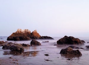
4.6There's something magical about this strip of beach and it never fails to deliver at sunset. Lined with strange and jagged rock formations/caves, there are endless opportunities for finding unique compositions and new perspectives. Although it's become quite the popular spot for photographers and...Read more -
Malibu, California
Ocean Overlook Loop Trail
4.02.7 mi / 397 ft gainOcean Overlook Loop Trail is a loop trail where you may see beautiful wildflowers located near Malibu, California.Read more -
Malibu, California
Reservoir Trail to East Meadow Trail Loop
2.3 mi / 334 ft gainReservoir Trail to East Meadow Trail Loop is a loop trail where you may see wildflowers located near Malibu, CaliforniaRead more -
Canyon Lake, California
Kabian Memorial Park Loop
5.03.48 mi / 335 ft gainKabian Memorial Park Loop is a loop trail that takes you by a lake located near Quail Valley, California.Read more -
Castaic, California
Paddle Castaic Lake State Recreational Area
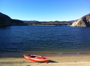
6 miCastaic Lake is a man made reservoir located 41 miles north of downtown Los Angeles, CA in the town of Castaic. Made up of two bodies of water, separated by a 425-foot dam, Upper and Lower Castaic Lakes have a combined 29 miles of shoreline forming the Castaic Lake State Recreational Area. The s...Read more -
San Clemente, California
Beach Day at San Onofre
5.0This spot is no secret but it’s by far one of the best beaches California has to offer and has been regarded since the 1950s as a friendly surfing sanctuary. The beach is divided into three surf spots (named from North to South), known as “The Point,” “Old Man’s,” and “Dogpatch.” To access the be...Read more

