Allenspark, Colorado
Looking for the best backpacking in Allenspark? We've got you covered with the top trails, trips, hiking, backpacking, camping and more around Allenspark. The detailed guides, photos, and reviews are all submitted by the Outbound community.
Top Backpacking Spots in and near Allenspark
-
Parshall, Colorado
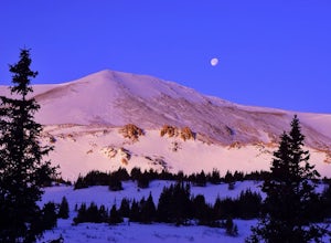
Ski or Snowshoe Jones Pass
4.06 mi / 1600 ft gainIts sister trail, Butler Gulch, is an all-time favorite hike (both summer and winter), and since they share a trailhead, I knew Jones Pass would be special as well.Jones Pass is not the type of trail I normally take, since it is actually a 4x4 road that is used for Jeeping in the summer and snowm...Read more -
Walden, Colorado
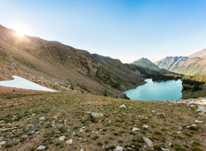
Backpack to Kelly Lake In State Forest SP
13.2 mi / 2624 ft gainRound trip will take you along 13.2 beautiful miles of Northern Colorado backcountry. Starting from the trail head which can be found within the entrance of the park (near the horse ring and car camping), you'll head into some beautiful backcountry. Before you reach the woods, a 4x4 trail will be...Read more -
Dillon, Colorado
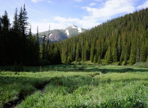
Wildflowers, Lakes, and Peaks, Oh My!
5.0Herman Gulch is one of those special places that makes you fall in love with Colorado all over again. This spectacular wildflower hike that ends at an alpine lake will have your head swiveling from start to finish. Wildflower season is July and August, with peak season being mid-to-late July. Ple...Read more -
Idaho Springs, Colorado
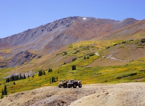
ATV Leavenworth Creek Road (Guanella Pass)
16.6 mi / 3655 ft gainSeptember is famous in Colorado for clear, deep blue skies,sublimely perfect temperatures, and gold-digging – of the leaf variety, thatis. On September 9, wildflower season was recently past and the best of theleaves were yet to come, but it was the perfect, clear and sunny day to checkout the hi...Read more -
Bellvue, Colorado
Climb Greyrock Mountain
5.07.1 mi / 3000 ft gainThe main trail begins at the Cache La Poudre river on the Poudre Canyon Highway about 30 minutes from Fort Collins. After about .75 miles the trail splits. To go left on Greyrock Meadows trail adds 2 miles to your trip and provides excellent views of Greyrock Mountain and Meadows from the south, ...Read more -
Idaho Springs, Colorado
Lower and Upper Chicago Lake
4.59.22 mi / 2270 ft gainFrom the parking lot, stay to the right of Echo Lake and you will run into the Chicago Lakes Trailhead. Follow the switchbacks down and across Chicago Creek. After crossing the creek, follow the sign indicating that the trail follows the dirt road and hang a left; from here, you'll reach the Idah...Read more -
Evergreen, Colorado
Hike the Resthouse/Lincoln Lake Trail
4.5While the Mt. Evans Wilderness never has a shortage of visitors, thanks to its proximity to Denver, it is possible to find a more private hike if you know where to look. Lincoln Lake Trail, accessible from Echo Lake year-round, is not as glamorous as its sister trail, Chicago Lakes, but is a wond...Read more -
Silver Plume, Colorado
Grays and Torreys Peaks
4.37.97 mi / 3458 ft gainAt about an hour's drive from Denver, Grays Peak (14,270 ft./4338m) and its sister mountain, Torreys Peak (14,267 ft./4337m), are two of the most popular 14ers in the state. Because of this, a wealth of information is available on the internet. Rather than go into all the details of the technical...Read more -
Dillon, Colorado
Silver Dollar Lake Trail
5.03.93 mi / 945 ft gainGuanella Pass, which connects the charming and historic town of Georgetown in the north to the blink-and-you’ll-miss-it Grant to the south, is a recreational outdoorsman’s dream. Volumes could be written on what this 22-mile scenic byway has to offer. Silver Dollar Lake Trail is just one tiny po...Read more -
Silverthorne, Colorado
Backpack to Upper Slate Lake
5.028 mi / 1386 ft gainStarting from the Rock Creek Trailhead parking lot, it is an up and down trek to Upper Slate Lake. The trail map states 10 miles each way, but accounting for switchbacks it ends up being closer to 14 long, hard miles.You will be among aspens and pines for the first half as you have a few moderate...Read more -
Silverthorne, Colorado
Lily Pad Lake
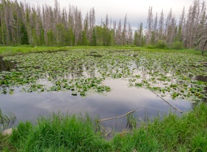
4.73.27 mi / 531 ft gainLily Pad Lake is a well known destination just outside of Silverthorne and in the Eagle's Nest Wilderness. The trail may be heavily trafficked on the weekends, but solitude can still be found in the early mornings or during the weekdays. The trail starts at the Lily Pad Lake Trailhead, just to t...Read more

