Allenspark, Colorado
Top Spots in and near Allenspark
-
Estes Park, Colorado
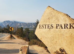
Photograph at The Estes Park Sign
This sign is on the mountainous decline just before you reach town. There's a small parking lot that fills up quick in peak season, but most people only spend a few minutes here on their way in to Estes Park and Rocky Mountain National Park. It is easy enough to have people take your picture, jus...Read more -
Estes Park, Colorado
Climb at Lumpy Ridge
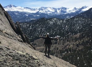
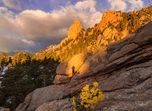
Lumpy Ridge is mostly a traditional climbing area with most climbs being two or more pitches after a mile to 3+ miles of mostly flat walking. From climbers left to right the larger areas consist of Sundance Buttress, The Bookend, The Bookmark, The Book, and Twin Owls. There are smaller formatio...Read more -
Estes Park, Colorado
Lumpy Ridge to Gem Lake
4.33.12 mi / 950 ft gainBegin by parking at the Lumpy Ridge trailhead, which is a couple miles outside of Estes Park on McGregor Avenue. At the trailhead, there are numerous signs indicating hiking trails, climbing routes, and other information about the area. After parking start hiking on the trail to the right of the ...Read more -
Grand Lake, Colorado
Car Camp at Timber Creek Campground
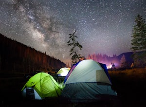
3.0This campground just 10 miles north of Grand Lake is a prime example of the amazing campgrounds you can find in Rocky Mountain National Park. Located along the Colorado River, Timber Creek has 98 campsites that are all first-come-first-serve. If you're on top of it and show up at a decent time, y...Read more -
Grand Lake, Colorado
Photograph Moose in Rocky Mountain National Park
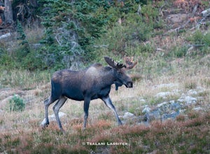
4.3Moose are the largest members of the deer family. They can stand over 6ft tall at their shoulders and weigh over 1500lbs. Males have antlers which can reach 6ft across and weigh up to 40lbs each. Amazingly these impressive creatures are strictly herbivores and will eat several dozen pounds of veg...Read more -
Estes Park, Colorado
Chapin Pass Trail to Mount Chapin
3.95 mi / 1316 ft gainChapin Pass Trail to Mount Chapin is an out-and-back trail where you may see beautiful wildflowers located near Estes Park, Colorado.Read more -
Grand Lake, United States
Hike to Timber Lake
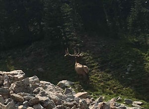
4.59.6 mi / 2050 ft gainI love Timber Lake! I never see that many people on the trail and I can't figure out why. The hike starts at the Timber Lake trailhead and climbs gradually through Pine and Aspen trees on the way up. We saw a few elk on the way up that didn't seem to be bothered by our presence. We also started h...Read more -
Estes Park, Colorado
Mt. Ida via Milner Pass
5.09.28 mi / 2112 ft gainThe hike to Mt. Ida offers some of the most stunning views of Rocky Mountain National Park. How to get there: From the east, take Trail Ridge Road all the way to the west side of the park. You will pass Alpine Visitor Center and the road sharply turns south at Medicine Bow Curve. The trailhead...Read more -
Estes Park, Colorado
Backpack Alpine Terrain to Haynach Lakes
17 miBegin at the Milner Pass Trailhead off of Trail Ridge Road in Rocky Mountain National Park. Commonly used to summit Mount Ida, this trailhead is often popular with summer hikers. The trail climbs steeply through the trees before revealing open slopes of tundra and fantastic panoramic views. Altho...Read more -
Grand Lake, Colorado
Hike the Colorado River Trailhead Loop
5.013.6 mi / 1245 ft gainSince this hike is 13.6 miles (according to my watch the hike was more around 14 miles, but it's in that range), I'm going to break it down into four different parts. To Lulu CityTo Little Yellowstone / Thunder PassThe Grand Ditch Red Mountain Trail The first 0.5 miles and the last 0.5 miles a...Read more -
Estes Park, Colorado
Catch a Sunset Above Milner Pass
This is a great place to be at sunrise or sunset. Bring a camera & tripod and check the weather ahead of time.Take Trail Ridge Road all the way to the top and park at the Alpine Visitor Center. There's a great view from here, but if you're interested in photography I recommend taking the tr...Read more -
Nederland, Colorado
Backpack to Caribou Lake
4.08.2 miThis is one of the most beautiful hikes I have ever done in Colorado. It is a great trip for photographers, fisherman or anyone who enjoys mountain views, forests filled with wildlife and peaceful meadows. Distances: Arapaho Pass: 3.2 miles, Caribou Lake: 4.2 miles, Caribou Pass: 6.4 miles, Meado...Read more -
Nederland, Colorado
Hike the Arapaho Traverse
8.3 mi / 3500 ft gainBegin at the Fourth of July Trailhead. Day parking is free and overnight parking is $5. Fourth of July is a popular trailhead and to ensure parking, you should arrive early in the morning (6am-ish... cause, I mean, you gotta 7 hour day in front of you). Follow the Fourth of July trail from the ...Read more -
Nederland, Colorado
Hike to Diamond Lake in the Indian Peaks Wilderness
5.05.7 mi / 1361 ft gainDiamond Lake is located in the Indian Peaks Wilderness. This is a super popular destination, so make sure you arrive early to get a parking spot (and be sure to follow all parking rules, they do give out tickets at this trailhead and others nearby). The drive to the trailhead is about 4 miles dow...Read more -
Nederland, Colorado
Hike to Arapaho Pass and Lake Dorothy
4.37.5 mi / 2080 ft gainBegin by parking at the 4th of July trailhead. This can be reached by conituing past the Eldora ski area and up a rough but passable (for all vehicles) gravel road to the trailhead. The trail is easy to find, and will continue to rise for the next 1.15 miles.At just over a mile there is a fork fo...Read more -
Nederland, Colorado
Hike South Araphaho Peak
5.08 mi / 2533 ft gainStart your hike at the 4th of July Trailhead, just outside of Eldora, CO. From the trailhead at the north end of the parking lot, steadily climb through the trees until a junction at 1 mile. Take the right fork towards Arapaho pass.You'll start to climb above treeline, with spectacular views of t...Read more

