Larimer County, Colorado
Looking for the best hiking in Larimer County? We've got you covered with the top trails, trips, hiking, backpacking, camping and more around Larimer County. The detailed guides, photos, and reviews are all submitted by the Outbound community.
Top Hiking Spots in and near Larimer County
-
Fort Collins, Colorado
Hike to Horsetooth Falls
4.52.22 mi / 101 ft gainHorsetooth Mountain Park is an outdoor trail haven just minutes from downtown Ft. Collins. The 2711 acre area has 29 miles of trails of varying length and difficulty for all levels of adventurers to explore. Horsetooth Falls is one of the shortest (yet stunning) trails in the area. This hike is i...Read more -
Fort Collins, Colorado
Hike the Coyote Ridge Trail
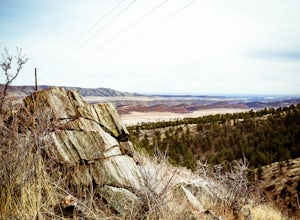
1.03 mi / 550 ft gainThe Coyote Ridge Natural Area is one of several Larimer County "gateway" preserves and Open Lands that lead into the Front Range of the Rocky Mountains, connecting the shrublands of the Great Plains to the Rocky Mountain themselves through a network of trails, parks, and preserves. The Coyote Rid...Read more -
Loveland, Colorado
Climb Green Ridge in the Roosevelt National Forest
9.8 mi / 2400 ft gainGreen Ridge is a fantastic series of summits in the Front Range that make for excellence training hikes, but is often forgotten as it lies outside of the nearby Bobcat Ridge Natural Area and just inside of Roosevelt National Forest. The summit itself at 7,402' is fantastic, featuring a nearly 900...Read more -
Loveland, Colorado
Hike the Valley Loop Trail in the Bobcat Ridge Natural Area
4.4 mi / 500 ft gainThe Valley Loop Trail in the Bobcat Ridge Natural Area begins at the main entrance of the Natural Area, just off W County Road 32 C near Masonville, west of Fort Collins and the Horsetooth Reservoir.To get there take West County Road 38 E west from Fort Collins over and around the Horsetooth Rese...Read more -
Loveland, Colorado
Hike the D.R. Trail in the Bobcat Ridge Natural Area
3.76.2 mi / 1050 ft gainD.R. Trail, named for David Rice Pulliam who donated the land to create the Bobcat Ridge Natural Area, is a 3.1 mile spur off the Valley Loop Trail that climbs roughly 1,000' into Mahoney Park before it intersects with the Powerline and Ginny Trails. To get to the start of the trail, take the Val...Read more -
Loveland, Colorado
Hike the Powerline Trail in the Bobcat Ridge Natural Area
3.8 mi / 1100 ft gainPowerline Trail is a 1.9 mile spur off the Valley Loop Trail in the Bobcat Ridge Natural Area that climbs 1,100 feet from the valley floor to Mahoney Park.To get to the start of the trail, take the Valley Loop Trail .9 miles in the Bobcat Ridge Natural Area from the main entrance of the Natural A...Read more -
Loveland, Colorado
Hike the Devil's Backbone in Colorado
4.32.5 miThe Devils Backbone Open Space offers great hiking in the Front Range foothills. The main feature is the rock formation running along the western boundary of the park, but the open space also supports a large wildlife and plant population. Here, you'll find great opportunities for year-round hiki...Read more -
Livermore, Colorado
Mt. McConnel Summit Trail Loop
4.26 mi / 1453 ft gainThis 4.3-mile round trip hike gains 1300 feet of elevation before reaching the Mt. McConnel summit. The primitive trail is rated as difficult and has an ascent of many switchbacks, leading up to a wild flower-covered summit. The trail winds along the ridge line around 8,000 feet, offering panoram...Read more -
Red Feather Lakes, Colorado
Camp near Lost Lake (in the Red Feather Lakes area)
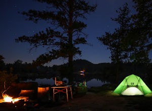
I need to start by saying I stayed here on Memorial Day weekend, a very busy camping weekend in Colorado. Online searches for a suitable campsite were useless, everything was booked. It is hard to drive 2 plus hours to an area and hope you find a place for dispersed camping. Thankfully a friend t...Read more -
Cheyenne, Wyoming
Hidden Falls Loop
5.04.32 mi / 469 ft gainDirections: From Laramie, take I-80 east to exit 323 and continue on HWY 210 east for approximately 15 miles. From there the entrance to Curt Gowdy State Park will be clearly marked on the right side of the road. Then drive south for 1.4 miles until you reach a large parking area on the right sid...Read more -
Cheyenne, Wyoming
Hike to the Chameleon
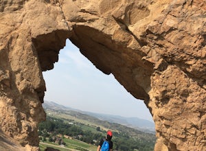
4.5 miCurt Gowdy State Park, one of the few southeast Wyoming hot spots, has a couple of hidden gems. One of the best is the “Chameleon,” ruler of Curt Gowdy State Park. To reach the Chameleon, head out on Crow Creek Trail, then loop back on Mo’ Rocka Trail. The trailhead is near the entrance of Curt G...Read more -
Buford, Wyoming
Turtle Rock Trail
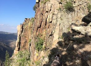
2.77 mi / 292 ft gainStarting at the trailhead near the parking lot, the trail starts off relatively paved and moves close to the base of Turtle Rock, a large outcrop of Sherman Granite that has stood the test of time from the creation of the Rocky Mountains. Following the trail to the left at the loop intersection,...Read more -
Buford, Wyoming
Scramble Twin Mountain
1.7 mi / 500 ft gainThis adventure is located between Laramie and Cheyenne on Happy Jack Road (WY 210). Take Forest Road 707A east for 1.4 miles and th en take a left at the fork (Forest Road 707AG). The trailhead is at the end of the second left turn (only about 200 yards from the fork). The forest roads are not...Read more -
Longmont, Colorado
Hike or Trail Run on Rabbit Mountain, CO
4.03.95 mi / 472 ft gainThis is a great hike/trail run in Boulder County. It is located between Longmont and Lyons and is part of Boulder County Open Space. Rabbit Mountain has over 5 miles of trails and 2,733 acres of beautiful open space. The views are incredible as most of your hike you are looking out at the entire ...Read more -
Estes Park, Colorado
Lumpy Ridge to Gem Lake
4.33.12 mi / 950 ft gainBegin by parking at the Lumpy Ridge trailhead, which is a couple miles outside of Estes Park on McGregor Avenue. At the trailhead, there are numerous signs indicating hiking trails, climbing routes, and other information about the area. After parking start hiking on the trail to the right of the ...Read more -
Bellvue, Colorado
Hike to Comanche Lake in Pingree Park
3.58 mi / 700 ft gainYou start out hiking through the average Colorado forest for the first 4 miles of the 7-8 mile trip at about 6,500 feet. The trail is largely downhill for the first couple miles until it levels out and you are headed North. A little more than halfway, you come to Comanche Reservoir and hike up al...Read more

