Leadville, Colorado
Looking for the best camping in Leadville? We've got you covered with the top trails, trips, hiking, backpacking, camping and more around Leadville. The detailed guides, photos, and reviews are all submitted by the Outbound community.
Top Camping Spots in and near Leadville
-
Idaho Springs, Colorado
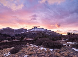
Watch the Sunrise at Guanella Pass
5.01 mi / 100 ft gainFrom Denver, take i70 to Georgetown and simply follow the signs through town to the top. This pass can also be accessed from the south via US Highway 285 at the town of Grant. Guanella Pass is closed in the winter, typically from about the last week in November through the last week of May. Watch...Read more -
Idaho Springs, Colorado
Camp at Guanella Pass
4.5This is a beautiful campground that serves as a great basecamp for many different outdoor activities in the Front Range. Whether you are looking for a casual day fishing or trying to knock one of the nearby 14ers off of your bucket list, this is an excellent place to begin. There are also abandon...Read more -
Snowmass, Colorado
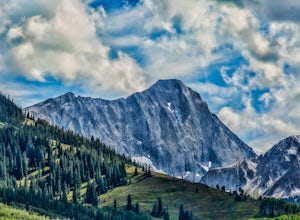
Capitol Lake via Capitol Ditch
5.012.28 mi / 2575 ft gainThe route to Capitol Lake is fairly straightforward, but not without its minor hardships. The route begins at the end of Capitol Creek Road, 9 miles from the small "town" of Snowmass (NOT Snowmass Village - that's the high-class ski resort). The last few miles of this road provide the first min...Read more -
Jefferson, Colorado
Camping at Lost Park Campground
4.5This campground is a great spot to crash at before heading out on a backpacking trip through the Lost Creek Wilderness but serves as an amazing campground itself. The area immediately surrounding the campground is beautiful. There are 12 campsites that can accomodate two vehicles per site and eac...Read more -
Jefferson, Colorado
Backpack Lost Creek
4.05 miI included a trail map of where I camped. There are many sites all throughout this area. From the Lost Park Campground Parking lot follow the Lost Creek for 2.4 miles. At the 1 mile mark was the best place that we found to cross the creek (there are two logs that make a bridge across the creek). ...Read more -
Crested Butte, Colorado
Conundrum Hot Springs via Copper Creek
22.5 mi / 4000 ft gainPlease Note: Conundrum Springs camping requires an overnight permit. You must get a permit in order to camp at the springs. If you're looking for an incredibly challenging hike, Copper Creek to Triangle Pass to Conundrum Springs is the hike for you! When you plug in "Conundrum Springs" into you...Read more -
Crested Butte, Colorado
Hike Rustler's Gulch
5.09 mi / 1748 ft gainFrom Crested Butte, continue 6 miles past the town of Gothic to Rustler's Gulch Road. Turn right on the road, cross the East River to get to a small parking area near the river. If you don't have 4WD, park here and hike another 1/2 mile to the trailhead. It's a pretty steep hike. If you do have 4...Read more -
Parshall, Colorado
Camp at Jones Pass
4.5To locate these campsites all you have to do is type in Jones Pass Road into google maps or your iPhone and it will take you straight there. There are road signs once you get off I-70 that will help you the rest of the way that say Jones Pass. Once you hit the dirt road and pass the Jones Pass Tr...Read more -
Bailey, Colorado
Payne Creek Trail via Brookside McCurdy Trailhead
4.517.98 mi / 3773 ft gainDay 1: Park at the Payne Creek/Brookside Trailhead (8,040 ft.) right outside Bailey. You'll go on the trail for about a mile before the trail parts to Craig Meadows or Craig Park. If you start this in the nighttime, it's best to camp before you part ways on the trail as it's a little more spaciou...Read more -
Carbondale, Colorado
Backpack the Lead King Basin Trail
4.5 mi / 2000 ft gainWe began our hike at the beginning of the afternoon after about two-three hours driving up the 14 mile road. The first mile of the trail was mild, turning into an uphill adventure. Lots of switchbacks, winding paths, and some tree coverage. By mile 2, we were on a steep grade the rest of the way....Read more -
Basalt, Colorado
Camp at Thomas Lake and Summit Mt. Sopris
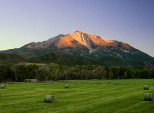
5.013 mi / 4400 ft gainWith the Elk Mountain range behind it, It appears to be standing by itself, and has the resemblance of a grand volcano.From Hwy 133 out of Carbondale, turn down Prince Creek Road and drive 6 miles to the trailhead. The trail is a nice mixture of meadows and woods, with excellent views of the vall...Read more -
Carbondale, Colorado
Camp at Paradise Divide
At a literally breathtaking 11,250 feet, Paradise Divide offers seclusion and scenery that can't be beat. Just fifteen miles outside of the world renowned ski resort Crested Butte, this area boasts wildflowers, wildlife, stunning peaks, and opportunities to watch amazing sunrises and sunsets pain...Read more -
Salida, Colorado
Hike Mount Shavano and Tabeguache Peak
4.09.25 mi / 4600 ft gainStart out on the Shavano and Tabeguache Trailhead off of FR 252 outside of Poncha Springs, at about 9,700 feet, and begin your trek into the forest. In the first half of a mile there are a few trail marker signs that should be read carefully to insure the right path is followed, but these signs ...Read more -
Crested Butte, Colorado
Camp at Oh Be Joyful Campground
5.0Oh Be Joyful Campground sits on the banks of the Slate River and consists of 15 camp sites dispersed over a decent amount of ground, split into two sides of the river. The river, when it's low is more of a stream and is only passable when it's low. It's a small thrill to drive through it to get t...Read more -
Crested Butte, Colorado
Explore the waterfalls of Oh Be Joyful Creek
If you're not already camping there, park at Oh Be Joyful Campground, about 5 miles up County Road 734 from downtown Crested Butte. There's parking on either side of the river crossing, but you're going to have to get your feet wet anyway, so might as well park in the first parking lot and walk a...Read more -
Idaho Springs, Colorado
Lower and Upper Chicago Lake
4.59.22 mi / 2270 ft gainFrom the parking lot, stay to the right of Echo Lake and you will run into the Chicago Lakes Trailhead. Follow the switchbacks down and across Chicago Creek. After crossing the creek, follow the sign indicating that the trail follows the dirt road and hang a left; from here, you'll reach the Idah...Read more

