Lyons, Colorado
Looking for the best photography in Lyons? We've got you covered with the top trails, trips, hiking, backpacking, camping and more around Lyons. The detailed guides, photos, and reviews are all submitted by the Outbound community.
Top Photography Spots in and near Lyons
-
Nederland, Colorado
Hike to Diamond Lake in the Indian Peaks Wilderness
5.05.7 mi / 1361 ft gainDiamond Lake is located in the Indian Peaks Wilderness. This is a super popular destination, so make sure you arrive early to get a parking spot (and be sure to follow all parking rules, they do give out tickets at this trailhead and others nearby). The drive to the trailhead is about 4 miles dow...Read more -
Nederland, Colorado
Hike to Arapaho Pass and Lake Dorothy
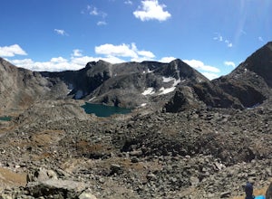
4.37.5 mi / 2080 ft gainBegin by parking at the 4th of July trailhead. This can be reached by conituing past the Eldora ski area and up a rough but passable (for all vehicles) gravel road to the trailhead. The trail is easy to find, and will continue to rise for the next 1.15 miles.At just over a mile there is a fork fo...Read more -
Nederland, Colorado
Hike to the Lost Lakes via the Hessie Trail
4 mi / 1000 ft gainAccessed by Hessie Trailhead, Lost Lake is a relatively moderate 4 mile round-trip hike with about 1,000 feet of elevation. The core of the hike is uphill and on a gravel path, 2/3rds of the hike runs parallel to a rushing waterfall. After parking your car, head towards the Hessie Trailhead. Yo...Read more -
Nederland, Colorado
King Lake via Hessie Trailhead
5.011.32 mi / 2375 ft gainThe normal route from the east side is via the Hessie trailhead outside Nederland Colorado. From the west it is most often accessed via the short trail from Rollins pass, which is open in the summer. As noted above, it is also a lake and area ripe for creating your own adventure. The description ...Read more -
Nederland, Colorado
Snowshoe Lost Lake
5.02.7 mi / 791 ft gainDriving through the towns of Nederlands and Eldora alone is a beautiful experience. Once you come up to Hessie Trailhead, you'll already be in a daze because you'll be staring at Eldora Mountain and will see some ski runs in the distance.Getting to the trailhead early is best. Parking starts alon...Read more -
Nederland, Colorado
Hiking the Indian Peaks Wilderness' Lost Lake
4.34.5 mi / 1000 ft gainLost Lake of the Indian Peaks Wilderness area is a scenic short hike (about 3 hours) with a lot to see. The trailhead is tucked at the end of a road that passes through Eldora, a charming village of cabins and old abandoned buildings. You will pass by the lost "town" of Hessie on foot, which is w...Read more -
Estes Park, Colorado
Photograph the Night Sky Over Trail Ridge Road
4.0The highest continuous paved road in North America, Trail Ridge Road takes you above 12,000 ft to an alpine tundra. Being above treeline means you have unclogged panoramic views of the night sky and any possible meteors. You can start your trip from Grand Lake in the west or Estes Park in the ea...Read more -
Estes Park, Colorado
Watch the Sunset at Forest Canyon Overlook
5.00.2 mi / 32 ft gainTrail Ridge Road is an incredible highway that crosses the mountains between Grand Lake and Estes Park, one of the most famous parts of Rocky Mountain National Park. It features incredible views of the Rockies and the Front Range, as well as the unforgettable experience of being immersed in the t...Read more -
Fort Collins, Colorado
Mountain Bike Reservoir Ridge
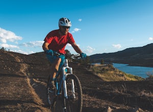
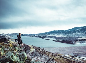
2.3 mi / 216 ft gainSummary One of my favorite post-work rides in Fort Collins, Colorado is a short but challenging loop along Reservoir Ridge. The scenery is incredible and includes water, mountains, a great trail system, and a spattering of intermediate, rocky sections. This is a solid loop to get your heart rate ...Read more -
Golden, Colorado
Hike Racoon Trail to Panorama Point
4.03.3 mi / 750 ft gainSummer is a magical time of year in the Rocky Mountains. One great way to experience this stunning beauty is through hiking Raccoon Trail to Panorama Point at Golden Gate State Park. Raccoon Trail is 3.3 mile moderately difficult hike which can be completed in under an hour, although it will like...Read more -
Golden, Colorado
Hike the Mountain Lion Trail
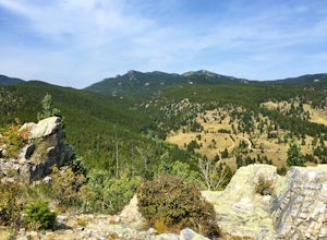
6.7 mi / 1230 ft gainThere are three parking lots with direct access to the Mountain Lion Trail. The main one is off of Crawford Gulch Road, but any of them are good starting points! This loop has pretty similar elevation gain and loss profiles no matter which way you go, so you can go any direction. This adventure ...Read more -
Granby, Colorado
Mirror and Crater Lakes via Cascade Creek Trail
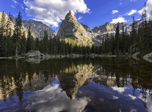
4.614.94 mi / 2421 ft gainStart at the Monarch Lake trailhead (where there is a $5 parking fee unless you have one of the national lands passes) and follow the cascade creek trail around the north side of the lake. After about 1.5 miles the trail splits with the Arapaho pass trail, follow the cascade trail to the left as ...Read more -
Golden, Colorado
Hike to Forgotten Valley
4.33.6 mi / 852 ft gainThere are over 35 miles of hiking trails in the park. The twelve trails in Golden Gate Canyon State Park are named after an animal and marked with the animal’s footprint.For a 2.6 round trip hike, start at the Burro Trailhead in Golden Gate Canyon State Park. You’ll immediately cross over a lit...Read more -
Estes Park, Colorado
Backpack the Gorge Lakes
11.5 mi / 3200 ft gainStart at the Rock Cut Parking Area. Head east on Trail Ridge Road 0.25 miles to a more gradual and bald western slope leading down into Forest Canyon. This bald is located between two creeks which merge before joining the Big Thompson River (a small creek in mid September). Use the creeks to navi...Read more -
Fort Collins, Colorado
Hike the North Loop via Foothills Trail
5.06.5 mi / 700 ft gainDespite its singular name, the Foothills Trail in Fort Collins is an interconnected series of trails that follows the ridges and hogsbacks which comprise the majority of the eastern side of the Horsetooth Reservoir. The trail can be accessed at several points along its length (by trails also call...Read more -
Fort Collins, Colorado
Fat Tire Bike the Foothills Trail
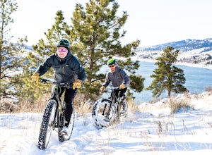
5.08.5 mi / 1000 ft gainThe Reservoir Ridge and Foothills trail system around Horsetooth Reservoir and Fort Collins is excellent for mountain biking, trail running, and hiking. During the winter it is particularly great for fat tire mountain biking, and the Foothills Trail is one of the best. The trail itself is roughly...Read more

