Nederland, Colorado
Just up the canyon from Boulder, this sleepy mountain town serves as a gateway to the Indian Peaks Wilderness, with it's myriad options for backpacking, hiking, climbing, and backcountry skiing. In the winter, Eldora is an awesome ski resort just 10 min outside of town.
Top Spots in and near Nederland
-
Breckenridge, Colorado
Spruce Creek Loop
4.29 mi / 1001 ft gainSpruce Creek Loop is a loop trail that takes you by a lake located near Breckenridge, Colorado.Read more -
Castle Pines, Colorado
Explore Daniel's Park
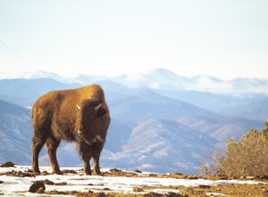
Daniel's Park is a small park in Douglas County that offers unparalleled views of the front range. There is a small walking trail that follows the road if you choose to go on foot, or you can stay in the car and drive the length of Daniel's Park Road. There is a bison herd that calls Daniels Park...Read more -
Bellvue, Colorado
Snowshoe Sawmill Creek Trail
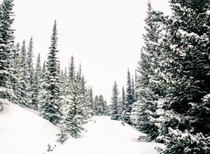
7 mi / 1660 ft gainTo reach the Sawmill Creek Trailhead you have to park at the Blue Lake Trailhead parking lot located across from Long Draw Road (Rd 156) Turn-off. Once you park here you'll see a big sign for the Blue Lake Trail but you'll have to continue following the road up (Southwest) for about 100 yards unt...Read more -
Jefferson, Colorado
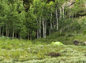
Camping at Lost Park Campground
4.5This campground is a great spot to crash at before heading out on a backpacking trip through the Lost Creek Wilderness but serves as an amazing campground itself. The area immediately surrounding the campground is beautiful. There are 12 campsites that can accomodate two vehicles per site and eac...Read more -
Jefferson, Colorado
Backpack Lost Creek
4.05 miI included a trail map of where I camped. There are many sites all throughout this area. From the Lost Park Campground Parking lot follow the Lost Creek for 2.4 miles. At the 1 mile mark was the best place that we found to cross the creek (there are two logs that make a bridge across the creek). ...Read more -
Frisco, Colorado
Backpack the Colorado Trail: Copper Mountain to Hagerman Pass
39 miThe Colorado Trail (CT) runs for 483 miles from Denver to Durango, crossing through eight mountain ranges and passing through six wilderness areas. There are great resources on completing a thru-hike of the CT; this post is about Segments 8-9 of the CT from Copper Mountain to Tennessee Pass.These...Read more -
Fort Collins, Colorado
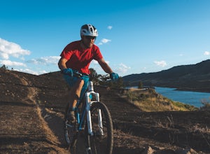
Mountain Bike Reservoir Ridge
2.3 mi / 216 ft gainSummary One of my favorite post-work rides in Fort Collins, Colorado is a short but challenging loop along Reservoir Ridge. The scenery is incredible and includes water, mountains, a great trail system, and a spattering of intermediate, rocky sections. This is a solid loop to get your heart rate ...Read more -
Vail, Colorado
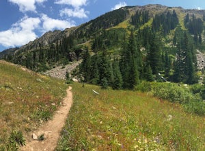
Hike to Booth Falls and Booth Lake, CO
5.010 mi / 3000 ft gainThis day hike begins as a steady climb through aspen trees for the first mile. The trail then flattens out a bit, and you reach Booth Falls at mile two. This is a beautiful 60 ft waterfall that allows for easy rock climbing and hiking through the stream upstream of the falls. This is also a popul...Read more -
Walden, Colorado
Snowshoe or Ski to Lower Montgomery Pass Yurt
5.6 mi / 853 ft gainThe Lower Montgomery Pass Yurt is a part of the Never Summer Nordic yurt system and can be reserved through their website here. In the summer it can be accessed via a 4WD road but in the winter the road closes and you can either ski, snowshoe, or snowmobile the 2.8 miles to the yurt. The trek beg...Read more -
Windsor, Colorado
Windsor Lake Loop Trail
4.02.28 mi / 36 ft gainWindsor Lake Loop Trail is a loop trail that takes you by a lake located near Windsor, Colorado.Read more -
Summit County, Colorado
Hike to Crystal Peak
5.08.6 mi / 2482 ft gainOnce you turn off of Colorado hwy 9 onto dirt, your GPS will lead you to a gravel lot. At the end of that lot there's a pretty steep gravel road that heads NNW (GPS coords: 39°25'43.01"N 106° 4'11.30"W | Map Link if you want to plug that into your GPS for parking). From this lot you'll walk up t...Read more -
Vail, Colorado
Ice Climb Pumphouse Falls in Vail
To get to Pumphouse Falls take Interstate 70 toward East Vail, Colorado, get off at exit 176 S. Frontage Road headed east. At the traffic circle take the third exit and continue on South Frontage Rd. for 2.5 miles, turn right into the small parking lot next to the Nordic ski track. Follow the sig...Read more -
Walden, Colorado
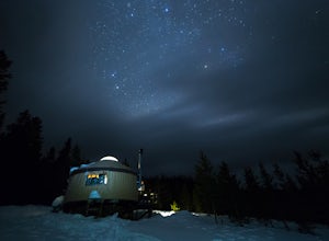
Dancing Moose Yurt [Closed]
NOTE: This property is currently closed as NeverSummer, the yurt operator, is no longer in business. The yurt is located near the small town of Walden, CO (coordinates: 40 33'57.43"N , 105 59'16.93"W) about two hours west of Fort Collins. In the winter, there are many backcountry ski runs, cros...Read more -
Fort Collins, Colorado
Hike the North Loop via Foothills Trail
5.06.5 mi / 700 ft gainDespite its singular name, the Foothills Trail in Fort Collins is an interconnected series of trails that follows the ridges and hogsbacks which comprise the majority of the eastern side of the Horsetooth Reservoir. The trail can be accessed at several points along its length (by trails also call...Read more -
Fort Collins, Colorado
Fat Tire Bike the Foothills Trail
5.08.5 mi / 1000 ft gainThe Reservoir Ridge and Foothills trail system around Horsetooth Reservoir and Fort Collins is excellent for mountain biking, trail running, and hiking. During the winter it is particularly great for fat tire mountain biking, and the Foothills Trail is one of the best. The trail itself is roughly...Read more -
Breckenridge, Colorado
Hike the East Ridge of Pacific Peak
5.08 mi / 3500 ft gainStart from the McCullough gulch trailhead. If possible it would be worth having 2 cars and leaving one at the main McCullough trailhead so you don't have to walk the road on your way down. Bushwack through trees and willows up the ridge directly to the north of the trailhead. You might be lucky a...Read more

![Dancing Moose Yurt [Closed]](https://images.theoutbound.com/uploads/1454553015692/sthmscbw5916pqfr/1b559ecab7d81fde80eacc99e3b36020?w=300&h=220&fit=crop&q=60&s=f88fa81bfb38a785f8adb78434f83f54)
