Telluride, Colorado
Looking for the best hiking in Telluride? We've got you covered with the top trails, trips, hiking, backpacking, camping and more around Telluride. The detailed guides, photos, and reviews are all submitted by the Outbound community.
Top Hiking Spots in and near Telluride
-
Durango, Colorado
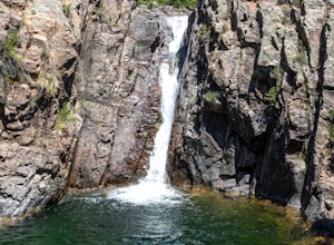
Adrenaline Falls
5.00.43 mi / 279 ft gainAdrenaline Falls is a popular spot for the locals to swim and relax during the warm summer months. The pool at the bottom of the falls is deep and popular for cliff jumping. To get to the waterfall, turn onto the North access to Lime Creek road. A high clearance 4x4 vehicle is recommended to ...Read more -
Durango, Colorado
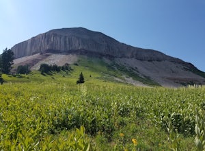
Engineer Mountain via Cold Bank Pass
5.05.85 mi / 2293 ft gainWe were vacationing in the San Juan Mountains for 2 weeks. A local resident suggested the hike as a great place to see wildflowers. The "Engineer Mountain" sounded a bit too technical to be a scenic hike but we decided to hike like a local and this was one of the best hikes we did in 2 weeks. Ac...Read more -
Lake City, Colorado
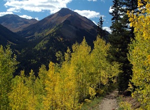
Hike Redcloud and Sunshine Peaks
5.012 mi / 4800 ft gainThe easier drive to the Silver Creek / Grizzly Gulch trailhead is reached by traveling south from Lake City and turning right onto County Road 30. Although parts can be rough and the shelf road around the base of Sunshine Peak may cause a tighter grip on the steering wheel, in dry conditions a hi...Read more -
Lake City, Colorado
Backpack to Wetterhorn Basin
13 mi / 3000 ft gainThis trip is for the lover of solitude and the appreciator of the unscathed backcountry. Wetterhorn Basin is in the heart of the beautiful San Juan Mountain range in Southwestern Colorado.With a 4WD high clearance vehicle start at the West Cimarron Trailhead at 10,750 feet (38.1117N -107.5533W),...Read more -
Durango, Colorado
Columbine Pass via Purgatory Flats
5.034.52 mi / 6932 ft gainThis hike begins at the Purgatory Flats Trailhead across from the Purgatory resort. The register is about a hundred yards from the Trailhead and is located next to a trail map. From here you will begin your descent down into the flats, which is roughly a 600-700 foot descent over the course of ju...Read more -
Durango, Colorado
Summit 3 Peaks in the Chicago Basin
5.0I tell people all the time that if they only do one hike in Colorado, this is it. You get a little taste of everything: Colorado history, wildlife, beautiful campsite views, 14ers, and the largest wilderness in the state.This itinerary assumes you’re hitching a ride on the train from Silverton. ...Read more -
Lake City, Colorado
Uncompahgre Peak (14,309')
5.07.3 mi / 2881 ft gainAt 14,309 feet, the summit of Uncompahgre Peak is the highest point in the entire San Juan range, but getting to it requires only good hiking skills, good physical shape, and a four-wheel-drive, high-clearance vehicle to get to the trailhead. From Lake City, head west along the Alpine Loop about...Read more -
Lake City, Colorado
Explore Nellie Creek Falls
5.00.8 mi / 300 ft gainNellie Creek Falls is a beautiful little falls, up County Road 23. The waterfall is surrounded by a forest of aspens leading up the valley. To get to the falls take the northern route of the Alpine Loop from Lake City towards Engineer Pass. In about 5 miles you come to Nellie Creek Road on the ri...Read more -
Lake City, Colorado
Capture Fall Foliage and Whitmore Falls on Engineer Pass
5.0Just outside of the small community of Lake City, Colorado is Engineer Pass, a dirt road that has amazing views and opportunities to hike, take pictures, and maybe even explore an abandoned mining town. Four wheel drive or all wheel drive is preferable, but the road can definitely be driven by a ...Read more -
Durango, Colorado
Hike Goulding Creek
4.05.9 mi / 2122 ft gainThis trailhead is only about 15 miles from Durango on Highway 550. Look out for Glacier Club/Tamarron on your right, and soon after (about a mile) there is a small dirt turn-off on the opposite side of the highway. There is one other turn off on the west side of the highway in this stretch, but i...Read more -
Hesperus, Colorado
Summit Centennial Peak in the La Plata Mountains via Sharkstooth Trailhead
6 mi / 2162 ft gainFrom the western end of the town of Mancos, follow CR 42 north until it enters the national forest and becomes FR 561. Go right on FR 350 and keep right at any junctions (there are two of them) until you reach the signed Sharkstooth Trailhead about 19 miles from Mancos. Enjoy your drive through ...Read more -
Durango, Colorado
Hike the First Fork/Red Creek Loop
9.8 mi / 2195 ft gainLeaving from Durango, head north on Florida Road/CR 240. From the intersection with County Road 250 (the last stoplight), drive about 8 miles until you reach Colvig Summer Camp. Turn northwest here. The road will soon narrow and turn to dirt - continue straight. 1 mile further, there will be a la...Read more -
Durango, Colorado
Hike the Falls Creek Loop
4.54.1 mi / 393 ft gainThe Falls Creek Loop is a 4.1 mile trail in the San Juan National Forest, just outside of Durango, Colorado. Lots of side trails jut out from the main trail, and it is easy to lose your way. Take the middle trail at the first split, and keep following the main splits. You will find yourself on a ...Read more -
Durango, Colorado
Hike the Colorado Trail to Gudy's Rest
4.08.1 mi / 1400 ft gainThis hike, a local favorite is less than five miles from downtown Durango. The entire hike offers beautiful views especially once your reach the top of Gudy's Rest. The trail starts off with a gradual uphill along Junction Creek. On this section of the trail, you will likely run into locals proba...Read more -
Montrose, Colorado
Hike to Tomichi Point and Gunnison Point Overlooks
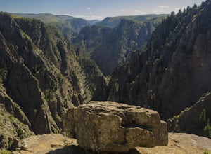
5.02 miTo access the South Rim of the Black Canyon of the Gunnison National Park, take US 50 and CO 347 to the south entrance, 15 miles east of Montrose. There is no bridge between the north and south rims of the canyon - make sure you enter from the Montrose side.After passing through the entrance stat...Read more -
Montrose, Colorado
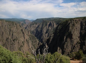
Drive the Scenic loop at Black Canyon of Gunnison National Park
4.5The Black Canyon of Gunnison is know for 2000 foot cliffs and a beautiful raging river below. The south side of the canyon is the most popular and the easiest to get to. The visitor center is also on the south side making it convenient for information and getting souvenirs. The scenic drive also ...Read more

