Beacon Falls, Connecticut
Top Spots in and near Beacon Falls
-
Cold Spring, New York
North of New York City by 90 minutes lies the town of Cold Spring in the Hudson Valley. Cold Spring has a hometown quality with a Main Street, a firehouse, and art galleries of local artists. Despite its proximity to NYC, locals maintain a slower pace and enjoy many outdoor activities.
Just a sho...
Read more
-
Beacon, New York
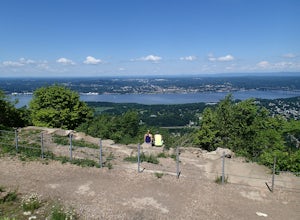
There are some great view points along this route. Start from the Mount Beacon Park trailhead parking area. This leads to the Casino Trail (red markers). The trail climbs steeply to some old ruins of a casino. Most of what remains is only the brick structure housing the mechanics for a trolle...
Read more
-
Shelter Island, New York
Just a short ferry ride from the Hamptons, South Ferry Road is exactly where it sounds; very close to the South Ferry of Shelter Island. The parking lot of Mashomack Preserve is marked by a large sign. When you walk in, you'll see a large nature center. Sign in at a clipboard at the table out fro...
Read more
-
Beacon, New York
Starting in the quaint town of Beacon there are a couple of options for hikes of varying difficulty. From the station the walk is about 1.5 miles to the trail heads, alternatively if you choose to stay the night at Malouf's Mountain Sunset Campground you can arrange for the host to meet you, take...
Read more
-
Beacon, New York
4.8
3.83 mi
/ 1332 ft gain
Mount Beacon is a very popular trail along the Hudson River, and for good reason. It offers a good workout, fantastic views for both sunrise and sunset (and of course the time in between), a recently rebuilt fire tower, and all with incredibly easy access right on the edge of a lively town.
The ...
Read more
-
Cold Spring, New York
This is a difficult loop hike that has several different starting points. I chose to start at the Washburn Trail Head, which is the lowest starting point you can select. Nearly on the Hudson River, the trail ascends immediately along a well maintained road designated by white disc markers. Aft...
Read more
-
Philipstown, New York
The Osborn Loop trail itself is not a loop. It connects to a 2.5 mile section of the Appalachian Trail. Hiking these together creates the loop. Start at the trail head for the Appalachian Trail on South Mountain Pass Road. There is parking for two or three cars. Walk up the road a short dist...
Read more
-
Cold Spring, New York
This loop is a great option to avoid crowds on the west side of the Washburn trail. Start at the same trailhead for the Washburn Trail. The Cornish Trail is on the left and there is an obvious sign at the trail split a few feet from the parking area. The Cornish Trail is an old road from about...
Read more
-
Cold Spring, New York
4.5
3.52 mi
/ 1375 ft gain
Mt. Taurus (or Bull Hill) is a short, family and dog friendly, hike just outside the town of Cold Spring, easily accessible by car or taking the train into town. It snakes along the edge of an old quarry that is just now being retaken by nature and provides lookouts towards the Hudson, other near...
Read more
-
-
Cortlandt, New York
4.5
5.92 mi
/ 1759 ft gain
This approximately 3-hour hike borders the Hudson River, and is one of the best in Westchester County. Start off at the parking area at the Bear Mountain Tollhouse, or at a small parking area farther up Bear Mountain Road, if you want a slightly shorter hike. The trail is fairly steep in places, ...
Read more
-
Rye, New York
4.0
1.55 mi
/ 125 ft gain
Located along the Long Island Sound, this 147-acre conservancy is home to a plethora of different birds, including marsh wrens, seaside sparrows, and American woodcocks. The conservancy has 3 miles of trails, all easy to navigate.
Starting out from the visitor's center, take the trail to the rig...
Read more
-
Cold Spring, New York
4.7
4.33 mi
/ 1562 ft gain
The Breakneck Ridge to Sugar Loaf Loop gives rise to various bypasses that offer hikers moderate to advanced terrain and multiple rock scrambles. The loop entails a total elevation gain of 1,670 feet and a total distance of 5.5 miles.
The start of the trail begins at the (white blazes) at the no...
Read more
-
Cold Spring, New York
5.0
5.91 mi
/ 1526 ft gain
This short but steep loop hike in Hudson Highlands State Park offers multiple panoramic views of the Hudson River along the way. Please note that only experienced hikers should attempt this route – although the hike seems short, the elevation gain and steep rocky scrambles offer serious technical...
Read more
-
Beacon, New York
5.0
2.15 mi
/ 820 ft gain
Trail is currently closed. Get updates at parks.ny.gov.
Sugarloaf Mountain is part of the Hudson Highlands State Park, along with Breakneck Ridge, Bull Hill, and Mt Beacon. Though the views are just as impressive as its sister trails, it is never as crowded and it's one of my favorite spots in ...
Read more
-
Beacon, New York
4.0
8.92 mi
/ 2470 ft gain
This loop hike form the Notch Trail northern trailhead on Route 9D.
There is enough parking at this trailhead for about 5-6 cars. The Notch
Trail is identified with blue trail markers. It is well maintained and
plenty of markers to guide your way. This is important because there
are m...
Read more

