Monroe, Connecticut
Looking for the best hiking in Monroe? We've got you covered with the top trails, trips, hiking, backpacking, camping and more around Monroe. The detailed guides, photos, and reviews are all submitted by the Outbound community.
Top Hiking Spots in and near Monroe
-
Bear Mountain, New York
Hike Bald Mountain, Bear Mountain State Park
4.76.8 mi / 1080 ft gainFrom your starting point at the Bear Mountain Inn, go left along the Cornell Mine Trail. (This part can be a bit confusing, but go past the carousel to a shaded picnic area; that is where the trail starts.) You will go under a bridge and follow the trail until it takes a sharp left and descends t...Read more -
Beacon, New York
Explore Long Dock and Dennings Point Parks
4.0Long Dock and Dennings Point are two of the most popular parks in Beacon, that just so happen to be connected by a train track turned trail. Plenty of parking is available at Long Dock, and its a perfect spot to picnic, launch your kayak into the Hudson, or cast your line hoping to reel in the bi...Read more -
Cornwall, New York
Storm King Mountain Loop
4.52.44 mi / 400 ft gainThis is an easy, yet very rewarding hike with a lot of viewpoints on the way up. Technically you scale up two mountains, Butter Hill and Storm King, but most people just describe it as Storm King Mountain. This is a great hike for families with younger kids, those who don't have much time but wan...Read more -
Cornwall, New York
Hike the North Point Loop
6.5 mi / 1400 ft gainThere is three different trailheads to access the North Point Loop. I chose the trailhead that would give me the longest hike. That would be the Butter Hill parking area on Route 9W north. From the parking lot, start on the connector trail designated with white markers. Follow this for about ...Read more -
Granby, Connecticut
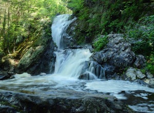
Hiking Enders Falls
4.0Enders State Forest sprawls over approximately 2000 acres, and is found within the towns of Granby and Barkhamsted in Connecticut. Enders has a good sized parking lot directly on Route 219. From the junction of Route 219 and Route 20, visitors will proceed west on Route 219 for 1.2 miles and tu...Read more -
Highland Falls, New York
Popolopen Torne
4.51.18 mi / 531 ft gainPopolopen Torne is a hidden gem in the Hudson Valley, a surprisingly unknown trail with a beautiful payoff and a far deeper meaning. A short hike to the top puts you at the foot of a memorial to those who have served their country, a pile of painted rocks carried up by those who want to pay their...Read more -
Cornwall-on-Hudson, New York
Hike the Stillman - Bluebird Loop
5.4 mi / 1200 ft gainThis loop hike starts at the northern trailhead of the park where the Stillman Trail begins. The parking area has enough space for only 6 or 7 cars. Start off on a wide maintained carriage road. After about a half mile, the Stillman Trail (yellow markers) breaks of to the left. However, stay ...Read more -
Glastonbury, Connecticut
Blackledge Falls
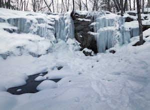
4.01.46 mi / 207 ft gainAlthough the park contains hiking trails, a pond and a streambelt, the primary draw of this parcel of land is the 25 foot waterfall. The falls flow varies depending on the volume of precipitation, from a trickle in the dry months to a three-pronged vertical drop after some consistent snow melt or...Read more -
East Haddam, Connecticut
Explore Chapman Falls in Devil's Hopyard SP
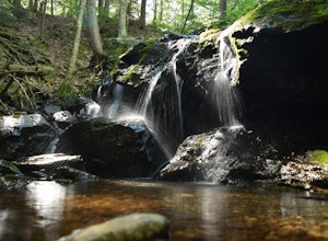
4.0If you map to Chapman Falls in East Haddam, CT, you will be brought to a parking lot opposite from the waterfall in Devil's Hopyard, a beautiful Connecticut state park. Once there, it's only a few minute walk down a very clear trail to the base of the 60 foot falls. There's plenty of room to set ...Read more -
Salisbury, Connecticut
Explore Riga Falls
The best part of the adventure is finding this hidden gem also known as Riga Falls. Riga Falls is actually one of Connecticut's lesser known waterfalls, but arguably the most scenic. A helpful hint is that the waterfall lies beside dirt road, keep your ears open! I've already said too much, happy...Read more -
Norfolk, Connecticut
Hike to Campbell Falls
4.01.4 mi / 187 ft gainCampbell Falls, one of the most beautiful parks in CT. Don't let the size of the park fool you, that's what adds to the beauty. With it's strong pine and fresh flower scented woods you slowly forget that you're even in Connecticut. The trails aren't labeled the greatest but still can be made out....Read more -
Salisbury, Connecticut
Bear Mountain Loop
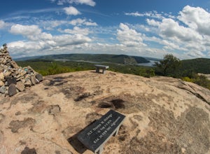
4.56.05 mi / 1516 ft gainAt 2,316 feet, Bear Mountain is the highest peak in Connecticut. The peak is about a half-mile south of the Massachusetts state line on the Appalachian Trail. The views are great. On a clear day you can see some of the peaks in southern New Hampshire. The remnants of a stone tower are on the summ...Read more -
Yonkers, New York
Run the Old Croton Aqueduct Trail
5.026.5 miThis trail traces the route of the Old Croton Aqueduct, which carried water to New York City between 1842 and 1955. Our recommended route starts near the Greystone Station in Yonkers, NY (Metro-North Hudson Line) and ends by the Scarborough Station, but you can easily modify your route – the enti...Read more -
New Windsor, New York
Hike Jessup/West Ridge Loop via the Sweet Clover Trail
10 mi / 1700 ft gainSchunnemunk Mountain State Park is one of my favorite parks. It offers many trails and possibilities for different loops. The attraction of Schunnemunk Mountain is the long double ridges running parallel to each other and amazing views in all directions.This hike starts at the Taylor Road parki...Read more -
Closter, New Jersey
Hike Alpine White Trail (Stateline Lookout)
5.05 mi / -520 ft gainStarting at about 520 feet, the White path takes you along the Stateline Lookout which is a small stone building overlooking the Hudson River. The initial descent is your average hike through the woods and across a couple of wooden bridges until you reach the Giant Steps. The Giant Steps take you...Read more -
Mount Washington, Massachusetts
Mount Frissell and Brace Mountain Loop Trail
5.08 mi / 807 ft gainMount Frissell and Brace Mountain Loop Trail is a loop trail where you may see beautiful wildflowers located near South Egremont, Massachusetts.Read more

