Blairsville, Georgia
Looking for the best hiking in Blairsville? We've got you covered with the top trails, trips, hiking, backpacking, camping and more around Blairsville. The detailed guides, photos, and reviews are all submitted by the Outbound community.
Top Hiking Spots in and near Blairsville
-
Tallulah Falls, Georgia
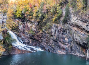
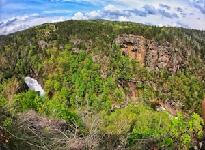
Hike to Hurricane Falls, Tallulah Gorge SP
4.41.85 mi / 564 ft gainThe trail is located in Tallulah Gorge State Park which is about 1 ½ hours northeast of Atlanta, off of Highway 441. There is a $5 per car entry fee into the park and they prefer the use of cash. From there, follow the signs to the Jane Hurt Yarn Interpretive Center, where there is parking and pl...Read more -
Tallulah Falls, Georgia
Camp at Tallulah Gorge State Park
4.7Tallulah Gorge is a must-see feature of Georgia. Campers can lay low and experience the gorge from its floor, engaging in river activities such as kayaking or swimming. Those seeking a thrill can hike the rim trails of the gorge, and even cross an 80' high suspension bridge. (Hikers who may be fe...Read more -
Jasper, Georgia
Mount Oglethorpe
0.69 mi / 49 ft gainMount Oglethorpe, located in Jasper, Georgia, offers a challenging hiking trail that spans approximately 0.69 miles. The trail is marked by a steady incline, making it suitable for intermediate to advanced hikers. The path is well-maintained and clearly marked, ensuring a safe journey for all hik...Read more -
Joyce Kilmer-Slickrock Wilderness, North Carolina
Backpack Slickrock Creek Trail #42
30 mi / 3700 ft gain8:30 a.m. and we’re winding our way down Highway 129 near Robbinsville, NC. The fog is still thick over the Little Tennessee River as we slow down crossing the bridge into Graham County. “I think we missed it,” I say as we continue onward. Within minutes the Tapoco Lodge comes into view. My pre-h...Read more -
Franklin, North Carolina
Wesser Bald Fire Tower
4.72.36 mi / 807 ft gainThe road leading to the trailhead is rough the last mile, but doable in any car. Just make sure to take it easy going up and be careful, especially if there has been any rain or snow. You will have reached the parking area for the hike once you see a large green Appalachian trail sign and a few...Read more -
Clayton, Georgia
Hike to Martin Creek Falls
5.00.6 miThere are two different ways to get to this waterfall.The easiest way is through a trail in the Warwoman Wildlife Management Area. To get to this trail head, drive east on Warwoman Road from Clayton, GA. At approximately 3.5 miles, take a left onto Finney Creek Road (FS 152). You will see a sign ...Read more -
Tellico Plains, Tennessee
Hike to Conasauga Falls
4.51.5 mi / 400 ft gainGetting to the trailhead can be a challenge if there has been any heavy precipitation or icy conditions due to the fact the last two miles are one mile of broken pavement and the last mile a dirt road. You should be fine in good conditions in any car; however, just make sure to take it easy on th...Read more -
Copperhill, Tennessee
Hike the Beech Bottom Trail to Jacks River Falls
5.09 mi / 315 ft gainJacks River Falls is one of Georgia's most impressive waterfalls. Containing several cascades that combine to an 80 foot waterfall, this destination provides spectacular views and refreshing pools to take a dip in. You can approach the falls from either Jacks River Falls trail or the Beech Bott...Read more -
Vonore, Tennessee
Camp at Citico Creek
5.0There are a few options for getting to Citico Creek, you can either go up the windy gravel road from US 411 or get off of the Cherohala Skyway and go down the mountain past the Indian Boundary campground. The Citico Creek campground has about 5 or 6 spots but is rarely full because it is very sec...Read more -
Robbinsville, North Carolina
Hike the Big Fat Gap Trail
12 mi / 3000 ft gainThere are many trailheads leading into the wilderness on either the Tennessee or North Carolina side. My favorite is the Big Fat Gap trail on the North Carolina side at an elevation of 3,060'. To see the best of what this area has to offer take the Hangover Lead South Trail to the 5,180' Hangover...Read more -
Dillard, Georgia
Hike to Rabun Bald
5.03 mi / 4696 ft gainStarting at the trailhead you begin by following the yellow blazes. The trail isn't well marked so keep an eye out for the blazes you see. The trailhead starts at the dead end of Kelsey Mountain Trail. The path immediately starts to incline and doesn't stop. A few minutes in you will come to a fo...Read more -
Reliance, Tennessee
Rainbow Falls, Cherokee National Forest
4.83.37 mi / 531 ft gainStarting at the parking lot, head up the trail (Clemmer #302/Scenic Spur #78) and it should say "1.7 miles to waterfalls". At the top of the hill in approximately 0.1 miles, veer to the right on trail #78. Continue for another 0.6 miles trail - #86 cuts across but continue straight on #78. From t...Read more -
Reliance, Tennessee
Hike the Scenic Spur Trail
5.03.9 mi / 426 ft gainVery little elevation gain leads to an easy hike along a river right outside of the Ocoee river region. First .7 miles is very flat, then leads to some slight elevation gain but nothing too serious. This trail traverses through the lush forest for a short distance when you come across a small cre...Read more -
Long Creek, South Carolina
Hike to the Brasstown Falls
4.50.5 miThese waterfalls are absolutely beautiful during the summer greenery and fall foliage, but open to access year around.Driving Directions: From Westminister, follow US 76 West for 11.8 miles and turn left onto Brasstown Road. Follow this road 4.1 miles to FS 751. (The pavement ends in 2.6 miles.) ...Read more -
Toccoa, Georgia
Explore Toccoa Falls
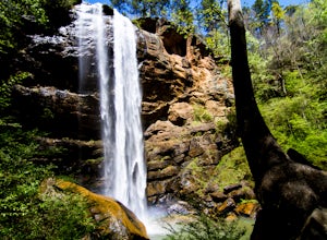
3.60.2 miPark at the welcome center of Toccoa College.The trailhead is behind the welcome center, starting at the gates to the right of the center. The trail takes you along a creek on a gravel trail. After a short distance, you will reach Toccoa Falls, where the water pours off the rocks from over 180 fe...Read more -
Chatsworth, Georgia
Emery Creek Falls
5.05.9 mi / 833 ft gainThe hike to the five waterfalls on the Emery Creek trail is one of the most spectacular hikes in Georgia. This trail is moderate in climb, yet secluded in the Cohutta Wilderness and challenging enough to keep crowds away. Two things to note about this trail: it is wet (there are 20 creek crossing...Read more

