Tallulah Falls, Georgia
Looking for the best hiking in Tallulah Falls? We've got you covered with the top trails, trips, hiking, backpacking, camping and more around Tallulah Falls. The detailed guides, photos, and reviews are all submitted by the Outbound community.
Top Hiking Spots in and near Tallulah Falls
-
Murphy, North Carolina
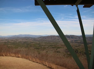
Hike to Panther Top Fire Tower
1.5 mi / 450 ft gainThe Panther Top fire tower is located in the Nantahala National Forest outside of Murphy, NC. To get there you get off of US 74 then turn onto panther top rd and continue till you see the signs for the tower. Once you get there the hike is about .75 there mostly up on the way to the top of the to...Read more -
Balsam Grove, North Carolina
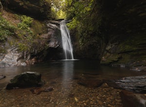
Hike to Courthouse Falls
4.70.07 mi / 40 ft gainFirst off, I want to say although the road is gravel it is accessible for 2WD cars you do not need a 4WD car to access this hike. The trail begins just over the bridge that crosses Panther Branch Creek. Just over the bridge there is a pullout where you can park that should fit at least 3 cars. Th...Read more -
Balsam Grove, North Carolina
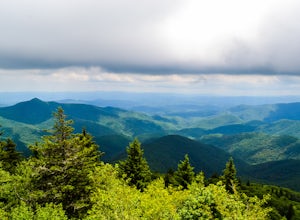
Devil's Courthouse
4.70.85 mi / 246 ft gainThe Devil's Courthouse Overlook and Trail can be one of the best places to see the entire Blue Ridge countryside. Even though it is a short hike, there is a fairly steep incline halfway through, so be prepared to huff and puff a little. It takes anywhere from 15 to 20 minutes depending upon your ...Read more -
Bryson City, North Carolina
Explore Old 288 and the Lands Creek Bridge
2.51 miNC 288 was constructed in the 1920's, but did not last long with the construction of the Fontana Dam as the resulting lake covered the highway. The U.S. government entered an agreement in which they would provide a replacement road, but to this day it has not been completed and is know by locals ...Read more -
Canton, North Carolina
Hike to Bubling Spring Falls
0.1 mi / 50 ft gainThe road to get to this waterfall is right off of NC 215 which comes right off of the Blue Ridge Parkway and is only about 3 miles away from parkway. The parking area is very small and does not offer many parking spots but since it is not that popular of an area parking is usually not a problem. ...Read more -
Sylva, North Carolina
Pinnacle in Pinnacle Park
5.05.98 mi / 2142 ft gainHeading out from the parking area, head north on this challenging hike. For the majority of the hike, you'll have a pretty steady uphill charge. There are some flat parts between climbs, so be sure to catch your breath and get some water in during these times. Once you reach the fork, where you'...Read more -
150 Asbury Drive, South Carolina
Hike the Asbury Trail to Moonshine Falls
5.5 mi / 800 ft gainThe trail to the Matthews Creek cable bridge crossing is easy. The cable crossing is fine - fun for some and a do-able challenge for others. After the creek, to get to Moonshine Falls, turn RIGHT at the post which indicates a trail both left and right. This is the Naturaland Trail in Caesars Hea...Read more -
Morganton, Georgia
Camp at Morganton Point
Morganton Point Campground is one of the most well-maintained campgrounds in North Georgia. There are sites available for both RVs and tents, but the tent section is separate from the RV area so don't worry about any noisy generators! I camped at Site F, a tent-only campsite. This campsite (and ...Read more -
Dawsonville, Georgia
Amicalola Falls
4.30.73 mi / 292 ft gainAdventurers access the falls through the state park entrance. From the parking lot, hikers follow the clearly marked signs to the base of the falls. The incline begins by the pond at the base of the falls. From the pond, follow the incline along the cascading portion of the falls to the stairs. A...Read more -
Dawsonville, Georgia
Hike to Springer Mountain
3.519 mi / 4346 ft gainBegin your journey from Amicalola Falls State Park. Despite the steep climb, you should park at the base of the falls and climb the steps for a great view of one of the grandest falls in the South. (For more on that hike, see: "Climb the Stairs to Amicalola Falls"). From the top of the falls, fol...Read more -
Dawsonville, Georgia
Amicalola Falls Loop via Upper Observation Platform
5.01.93 mi / 666 ft gainTo get there you can use Google Maps or Waze to “Upper Observation Platform” – W Ridge Staircase, Dawsonville, GA 30534. The other option is to start at the visitor center. If you start at the visitor center, it will add about a mile to your hike so parking in the upper parking lot like us will s...Read more

