Ashton, Idaho
Looking for the best hiking in Ashton? We've got you covered with the top trails, trips, hiking, backpacking, camping and more around Ashton. The detailed guides, photos, and reviews are all submitted by the Outbound community.
Top Hiking Spots in and near Ashton
-
Ashton, Idaho
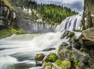
Upper and Lower Mesa Falls Loop
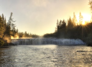
4.82.6 mi / 358 ft gainWhen two waterfalls have their own scenic byway, you know it is worth the additional stop. Lower Mesa Falls and Upper Mesa Falls are spectacular waterfalls along the Henrys Fork River, deep in the Grand Targhee Forest. The winding scenic byway yields some spectacular views of the Grand Targhee Fo...Read more -
Ashton, Idaho
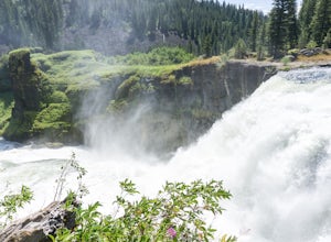
Mesa Nature Trail
5.02.44 mi / 236 ft gainThe Mesa Nature Trail begins on the dirt road to the Upper Mesa Falls overflow parking lot. The first mile of the trail is wide and smooth. Pause a half mile in to admire the Henry's Fork from the top of a lava field. The trail terminates at a flat bluff overlooking the top of Upper Mesa Falls. ...Read more -
Island Park, Idaho
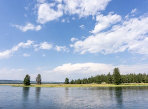
Hike the River Trail and Ranch Loop at Harriman State Park
3 mi / 20 ft gainLocated at 6,100 feet above sea level, Harriman State Park (also called "the Ranch") is renown for it's fly fishing along the Henry's Fork. Whether you bring a fly rod or not, this scenic loop through the park is a delight for hikers of all abilities.Make a stop at park headquarters to pay the en...Read more -
Yellowstone National Park, Wyoming
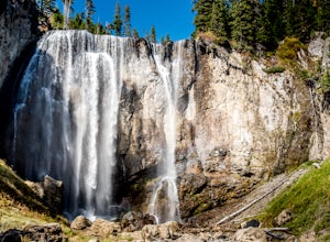
Dunanda Falls via Boundary Creek Trail
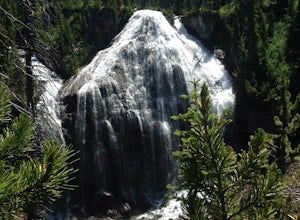
4.516.56 mi / 771 ft gainYou'll start at the Bechler Ranger Station and take the Boundry Creek Trail. Depending on which camp site you reserve your hike will be anywhere from 5-9 miles. We camped at site 9A1 5 miles from the ranger station. Hiking to waterfall is 16+ miles round trip Your feet will get wet on this hike,...Read more -
Tetonia, Idaho
Packsaddle Lake
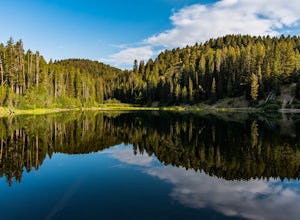
4.80.74 mi / 259 ft gainDirections to the lake:To get here, head North on Highway 20 as if you’re heading to St. Anthony. Then, take exit 339 towards Driggs on ID-33 E. Turn right onto 9th N for .5 miles. Then follow ID-33 E for 24.4 miles until you reach the dirt road Hoopes Rd. Drive. Drive on this road for 5.9 miles ...Read more -
Yellowstone National Park, Wyoming
Photograph Cave Falls
3.5Cave Falls is one of the hidden waterfalls of Yellowstone National Park that really only the natives know about. Although Cave Falls originally derived its name from a cave next to the waterfall, the cave has since collapsed and is no longer accessible. Known for its enormous length of 250 feet, ...Read more -
Island Park, Idaho
Explore Big Springs and Johnny Sack's Cabin
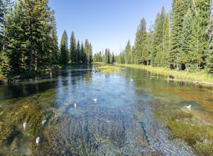
4.51 mi / 20 ft gainBig Springs is the headwaters of the Henry's Fork of the Snake River. Producing 120 million gallons of water per day, the spring forms wide and crystal-clear pools filled with trout (no fishing allowed). A paved trail leads to historic Johnny Sack's cabin, which is open for tours during the summe...Read more -
Alta, Wyoming
Union Falls and Scout Pool
5.015.42 mi / 1755 ft gainOf a summer spent living in Yellowstone, and many overnight trips in the park, the trek to Union Falls and Scout Pool ranked at the top of my list. (Many of my fellow gas station employees agreed!) The hike itself is nothing spectacular, but takes you to two of the most beautiful places in the pa...Read more -
Moose, Wyoming
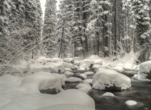
Explore Teton Creek along Sheep Bridge Trail
4.02 mi / 250 ft gainTrailhead: The trail is just outside of Driggs, Idaho in Alta, Wyoming on the way up to Grand Targhee Ski Resort. The hike is fairly easy, so you can enjoy the scenic views of the forest and creek, especially during the winter when the trees have a thick layer of snow on them. You also cross Teto...Read more -
Menan, Idaho
"R" Mountain
3.43.29 mi / 1020 ft gainThe North Menan Butte, or "R" Mountain is a well-known landmark in southeast Idaho for its size and uniqueness. The mountain is known as “R” Mountain by locals because of the large “R” painted on its side for Rexburg, Idaho. "R" Mountain, however, is not actually a mountain but rather an extinct ...Read more -
Island Park, Idaho
Hike Mt. Jefferson and Lake Marie
5.011 mi / 2000 ft gainThis out-and-back hike to the highest point in the Centennial mountains of Idaho and Montana skirts the continental divide and provides stunning views of both states. From U.S. Highway 20, Sawtell Peak Road heads west, winding back and forth up the south side of Sawtell Peak. Because there is a...Read more -
Alta, Wyoming
Summit Table Mountain
4.811 mi / 4000 ft gainTo climb Table Mountain you begin at the Teton Canyon Trailhead near Driggs, Idaho. The trailhead sits at about 6,800 feet elevation and from there you have two options to reach the 11,106 ft. peak -neither of which are technical, and both of which are dog-friendly.The first option, named Huckleb...Read more -
Alta, Wyoming
Hike Darby Canyon to the Wind Cave
4.9The best time to hike Darby Canyon is May through September, since the snow stays late in spring and comes earlier in fall.Hiking up Darby Canyon to the Wind Caves provides spectacular views of the Jedediah Smith Wilderness and is a fun, yet challenging hike. It is a popular day hike, and many fa...Read more -
Moran, Wyoming
Huckleberry Mountain via Sheffield Creek Trail
10.1 mi / 2648 ft gainThis hike has it all and at 10 miles round-trip, is not difficult depending on the conditions. I hiked it the last weekend of October in tennis shoes and shorts (albeit with leggings) and was dressed adequately for about 2/3 of the hike. The last 1.5 miles on the way to the fire tower was through...Read more -
Yellowstone National Park, Wyoming
Upper Geyser Basin Old Faithful Observation Point Loop
4.75.03 miStarting at the Old Faithful Visitor Center, you can follow a flat, meandering path along the Firehole River to view several different geysers and geothermal features. The trail begins on an accessible, paved path but then changes to well-maintained gravel. Depending on the time and energy you h...Read more -
Alta, Wyoming
Leigh Lake
5.02.86 mi / 148 ft gainLeigh Lake is an out-and-back trail that takes you by a lake located near Moose, Wyoming.Read more
Top Activities
Visit Idaho
Idaho is a picturesque state filled with beautiful scenery and warm, wonderful people. It's an ideal destination for family travelers, outdoor enthusiasts, adventure seekers, or those just looking for a relaxing getaway.
Learn More

