Stanton, Kentucky
Looking for the best hiking in Stanton? We've got you covered with the top trails, trips, hiking, backpacking, camping and more around Stanton. The detailed guides, photos, and reviews are all submitted by the Outbound community.
Top Hiking Spots in and near Stanton
-
Stanton, Kentucky
Hike to Courthouse Rock and Double Arch
5.06.1 miStart at the trailhead located just past the Gray's Arch picnic area. Follow Auxier Ridge Trail #204 (white diamonds). You will pass a trail junction at 0.9 miles, but continue on Auxier Ridge. At the following fork in the trail keep right.Along the trail, you will catch views from the ridge of R...Read more -
Stanton, Kentucky
Hike the Auxier Ridge Trail, KY
5.04 mi / 1300 ft gainThis can be done as a quick hike, or as an overnighter so you can catch both sunset and sunrise. Park at the Auxier Ridge Trailhead and take the Auxier Ridge Trail (#204). Do NOT take the branch on the left for the Courthouse Rock Trail (#202), which you will see after about 1 mile. In about 2...Read more -
Slade, Kentucky
Hike the Indian Staircase Loop and Cloudsplitter
5.010 miStarting at the Bison Way Trailhead #210. You'll take this until you come to the intersection of the Sheltowee Trace Trail #100. Go left. You're going to turn right on the unmarked trail just past the sign that says stay on trail. This is quite the incline. Keeping going until you get to the base...Read more -
Slade, Kentucky
Hike to Natural Bridge and Battleship Rock
3.82 mi / 400 ft gainThis popular hike begins near the state park gift shop and has options to continue to other trails at multiple points. The first .75 miles, starting at about 800 feet, is the hike up to the Natural Bridge. This portion of the hike contains basically all of the increase in elevation. As you hike u...Read more -
Stanton, Kentucky
Hike to Gray's Arch
5.03.3 miThe trail approaches the arch through a ravine, passing by cliffs, dense forest, and a stream (Kings Branch) en route.Read more -
Rogers, Kentucky
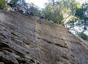
Rock Climb Tectonic Wall in Muir Valley
Directions to Muir Valley (from Miguel's Pizza)Drive south on KY 11 for 6.3 miles. Turn left onto KY 715. Stay on this road for 2.7 miles. Turn right onto road 2016. Stay on this road for 1.4 miles. Keep an eye out for a carpet store on your right. Once you pass the carpet store, the road will st...Read more -
Rogers, Kentucky
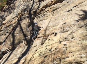
Rock Climb Bruise Brothers in Muir Valley
Directions to Muir Valley (from Miguel's Pizza)Drive south on KY 11 for 6.3 miles. Turn left onto KY 715. Stay on this road for 2.7 miles. Turn right onto road 2016. Stay on this road for 1.4 miles. Keep an eye out for a carpet store on your right. Once you pass the carpet store, the road will st...Read more -
Sky Bridge Loop - Trail #214, Kentucky
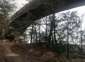
Hike Sky Bridge Loop
0.9 mi / 300 ft gainThe trailhead parking lot is located just off of KY 715. If coming from the North you will cross the Red River at Osborne Bend and continue up the steep hill until the very top. The parking lot access road is in a hairpin curve at the top of the hill. It is marked very well with signs so it is ve...Read more -
Wellington, Kentucky
Rock Climb Foxfire at the Red River Gorge
Directions to Eagle Point Buttress from the Shell gas Station.Head west on KY-15 for 1.6 miles then turn left onto KY 77. Stay on KY-77 for 5.1 miles. While you are on this road you will go through a oneway tunnel so be careful of cars coming out from the other side. Once you cross a bridge over ...Read more -
Beattyville, Kentucky
Climb at the Motherlode in Red River Gorge
1.2 miThese directions are similar to those marked in the Red River Gorge Climbing Guide. Be sure to pick one up at Miguel's Pizza or elsewhere to get a good idea of where all of the crags and climbing routes are. This adventure is to the Volunteer Wall and The Gallery crags. The parking lot is marked...Read more -
Campton, Kentucky
Hike Rock Bridge Loop to Pooch Turtle Falls and Turtle Back Arch
5.05 miExtend your Rock Bridge Loop and explore more areas of the Clifty Wilderness Area of Daniel Boone National Forrest. From Rock Bridge Loop (#207) take Swift Camp Creek Trail (#219). Along the way catch views of Hell's Kitchen over the steep drop-off on the right-hand side of the trail. Half way ...Read more -
Gillmore, Kentucky
Hike the Creation Falls and Rock Bridge Loop
4.81.38 mi / 285 ft gainFrom the Slade, KY exit take KY15 toward Campton to KY715 to Rock Bridge Rd. Park at the Rock Bridge picnic area and take the trailhead closest to the entrance. The trailhead will quickly descend surrounding you with lush vegetation. A rockshelter can be found on the right hand side of the tra...Read more -
Salt Lick, Kentucky
Hike to Tater Knob Fire Tower
1 mi / 200 ft gainStarting at the trailhead hikers will follow a clearly marked trail for 0.5 miles. The trail gains elevation quickly and can be strenuous. The tower is currently closed due to arson damage and is one of the few remaining in the Daniel Boone National Forest. However, the 35 foot steel structure is...Read more -
Salt Lick, Kentucky
Hike Caney Loop Trail at Cave Run Lake
8.8 mi / 1047 ft gainStarting at the Stoney Cove Trailhead, take the trail to the left. This trail was previously marked as trail #1226. However, after the Sheltowee Trace Trail #100 was rerouted, they now run together. Therefore, the trail is very well marked by a white diamond with a turtle, signifying the Sheltowe...Read more -
McKee, Kentucky
Resurgence Cave
4.74 mi / 341 ft gainResurgence Cave in McKee, Kentucky offers a unique hiking trail that is both challenging and rewarding. The trail is of moderate difficulty, requiring sturdy footwear and a good level of fitness. It winds through dense forest, past towering rock formations and along the edge of a clear, fast-flow...Read more -
Berea, Kentucky
Hike the Pinnacles in Berea
4.96.59 mi / 1014 ft gainThis is a trip with multiple sites to visit over the course of a day. Visiting all five would equal around 5 miles, or you can choose to only go to one, as there are some slightly strenuous hills. The most visited is the Main Lookout, and the West Pinnacle offers a little rock climbing. Between ...Read more

