Deerfield, Massachusetts
Top Spots in and near Deerfield
-
285 Salmon Hole Lane, Vermont
Hike Hamilton Falls
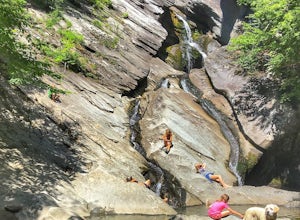
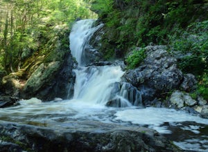
3.56.8 mi / 889 ft gainThe hike to Hamilton Falls is an enjoyable 6.8 miles roundtrip voyage through gorgeous forest scenery alongside a babbling brook. Be sure to visit the upper and lower falls! This trail is kid and dog friendly, so why not bring both?! If you are visiting the falls in the summer, bring a towel and ...Read more -
Great Barrington, Massachusetts
Mt. Wilcox and Beartown Mountain Trail Loop
5.09.29 mi / 981 ft gainMt. Wilcox and Beartown Mountain Trail Loop is a loop trail that takes you by the lake located near Great Barrington, Massachusetts.Read more -
Temple, New Hampshire
Hike the North & South Peaks of Pack Monadnock
5.08.3 mi / 2290 ft gainThis route will take you to both peaks and on most of the trails in this section of the park! Take the Wapack Trail (1.4 miles, rocky, challenging) to the summit of South Pack (2290') and climb the fire tower for some incredible views! On a clear day, you can see the Boston skyline. Then continue...Read more -
Temple, New Hampshire
Hiking Pack Monadnock at Miller State Park
4.02.8 miMiller State Park is the oldest State park in New Hampshire and offers the perfect spring, summer or fall hike. From the parking area, visitors can choose from one of three trails: The Marion Davis Trail (1.4 miles to peak), The Wapack Trail (1.4 miles to peak) or the Auto-road (~ 1.0 miles to pe...Read more -
Great Barrington, Massachusetts
Hike Monument Mountain
4.02 mi / 720 ft gainAt 1642 feet (with a total elevation gain of 720 feet), Squaw Peak is a great spot to see both Mt Greylock along the Vermont border, and the Catskills in New York. There are several trail options here to get to the summit, but no matter which combination you choose, you can keep your trip under ...Read more -
Granby, Connecticut
Hiking Enders Falls
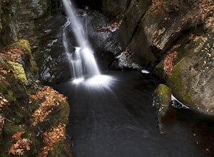
4.0Enders State Forest sprawls over approximately 2000 acres, and is found within the towns of Granby and Barkhamsted in Connecticut. Enders has a good sized parking lot directly on Route 219. From the junction of Route 219 and Route 20, visitors will proceed west on Route 219 for 1.2 miles and tu...Read more -
Shaftsbury, Vermont
Hike Around Lake Shaftsbury
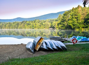
1.3 mi / 42 ft gainLake Shaftsbury State Park is a small park in Southern Vermont between Bennington and Manchester. It is well-loved by locals as swimming spot in the summer, especially for families with kids. Less well known is the nature trail that meanders around the perimeter of the lake. While only a mile in...Read more -
Cropseyville, New York
Hike Dickinson Hill Fire Tower
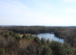
4.53 mi / 200 ft gainOnce you drive onto N. Long Pond Road you will follow it appproximately 1.5 miles to the end. From the parking you can take the short walk back on the road to the start of the trail. The trail is actually a rough Fire Tower Road. You will follow this for about 1.3 miles. Here you will see a se...Read more -
Norfolk, Connecticut
Hike to Campbell Falls
4.01.4 mi / 187 ft gainCampbell Falls, one of the most beautiful parks in CT. Don't let the size of the park fool you, that's what adds to the beauty. With it's strong pine and fresh flower scented woods you slowly forget that you're even in Connecticut. The trails aren't labeled the greatest but still can be made out....Read more -
East Nassau, New York
Kinderhook Creek
5.01.62 mi / 308 ft gainKinderhook Creek is a loop trail that takes you by a river located near Stephentown, New York.Read more -
Clinton, Massachusetts
Watch a Sunset at Wachusett Reservoir
4.5Wachusett Reservoir is located in central Massachusetts, northeast of Worcester. Easy location and parking, you can go anytime of the day and you won't be disappointed. The Reservoir is the second largest body of water in the State of Massachusetts, taking place in 5 cities around the area, West ...Read more -
Glen Road, Vermont
Hike the Lye Brook Falls Trail
4.04.7 mi / 938 ft gainThe Lye Brook Falls Trail is a 4.7 mile hike through scenic trails just outside of Manchester Center, Vermont. The trail is open year-round, but the best time to go is during spring blooms or to see the fall colors. This hike is family friendly and fun for all ages. Dogs are allowed on this trail...Read more -
Simsbury, Connecticut
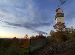
Hike to the Heublein Tower on Talcott Mountain
4.32.54 mi / 404 ft gainThe Heublien Tower Trail, located just inside the Talcott Mountain State Park entrance off of Route 185 in Simsbury CT, is a short 1.25 miles. While the hike isn't long, the first 1/3 of a mile is a steep incline that will get your heart pumping. The trail itself it very well kept, and although ...Read more -
Bolton, Massachusetts
Take a Stroll at Fyfeshire Conservation Area
1.0Fyfeshire is located in Bolton Massachusetts off "Wattaquadock Hill Road", near the "Fotini's Restaurant and Bar". The trailhead begins at a small parking area with a stone gate that says Fyfeshire Conservation area on a wood plank. Once you are in the conservation area you will see an opening in...Read more -
Harvard, Massachusetts
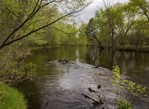
Hike along the Nashua River and the Oxbow National Wildlife Refuge
9.5 mi / 0 ft gainPark in the lot on Tank Road to access the Nashua River Trail. Keep your eyes peeled for turtles, chipmunks, birds, and other wildlife! This trail is open from April to October. The trail can become flooded and muddy after a rain/ snow, so for a shorter alternative to the 9.5 miles, you can take...Read more

