Richmond, Massachusetts
Top Spots in and near Richmond
-
Holyoke, Massachusetts
Whiting Street Reservoir Loop
3.74 mi / 138 ft gainWhiting Street Reservoir Loop is a loop trail that takes you by a lake located near Holyoke, Massachusetts.Read more -
Woodford, Vermont
Woodford State Park Loop
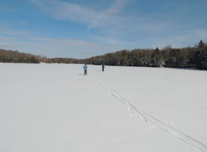
2.41 mi / 203 ft gainA great loop for the summer, Woodford is also amazing when winter winter comes to the State Park. It also comes earlier than just about anywhere else in Southern Vermont. At 2,400 feet above sea level, this is an easy spot to find winter without spending a fortune at the local ski resorts. Woodfo...Read more -
Deerfield, Massachusetts
South Sugarloaf Trail
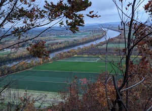
1.48 mi / 404 ft gainSouth Sugarloaf Trail is a loop trail that takes you by a river located near South Deerfield, Massachusetts.Read more -
Elka Park, New York
Hike to Huckleberry Point
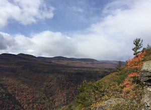
4.54.5 mi / 644 ft gainThis is a 4.5 mile hike that is great for hikers of all skill levels. Because it is short and not overly difficult, beginners will enjoy this hike. There are some steep sections that will get your heart pumping, though, and a stunning payoff is waiting for you at the end.From the trailhead, follo...Read more -
Elka Park, New York
Hike to Plattekill Falls
0.5 mi / 137 ft gainJust outside of Elka Park, New York, Plattekill Falls is accessible from Albany and New York City alike. This is a great hike for families and all skill levels. The falls are spectacular year-round, but the best time to visit is in the spring. From the trailhead, walk left past the red house unt...Read more -
Elka Park, New York
Hike Twin Mountain
6 mi / 1586 ft gainThe DEC Parking lot, is located at the very end of a dead end, along Prediger Rd. Start at the trail head to the right of the trail kiosk and sign in sheet. The trail starts out very easy going as you approach the base of Twin. At mile 0.25, you’ll hit a junction where you’ll turn RIGHT towards T...Read more -
Elka Park, New York
Hike Indian Head Summit via Jimmy Dolan Notch Overlook
4.9 mi / 1512 ft gainThe view from the summit of this hike is incredible. Bring a sack lunch and a camera - you'll want to stay for a while! This trail is open for use year-round and provides great snowshoeing in the winter and fabulous wildflowers in the spring and summer. This is also a great location for birding!Read more -
Elka Park, New York
Backpack the Eastern Half of Devil's Path in the Catskill Mountains
5.014 mi / 3900 ft gainThe Eastern half of Devil's Path has four major summits: Indian Head, Twin, Sugarloaf and Plateau. Each summit is a straight climb up and down, then back up to as much as 3,900 ft. There are some sparse sections of level ground, but most is a steep descent uphill or steep slide downhill. Your ...Read more -
Elka Park, New York
Backpack Devil's Path in the Catskills
24.2 mi / 9000 ft gainDevil's Path is roughly more than 24 miles long, althought it feels like an eternity of milage. Going thru the summits of Indian head, Twin, Sugarloaf, Plateau, Hunter, and Westkill Mountains.Its brutal. Its painful, Its unique. Be prepared for anything and everything. You will encounter wild lif...Read more -
Kent, Connecticut
Explore Kent Falls
5.00.75 mi / 250 ft gainEvery now and then you need a day to rest those sore muscle from all your recent adventures. The only issue is, you don't want to sit around inside, you want to be outside. Insert a trip to Kent Fall State Park. The perfect rest adventure day.Located 1 hour and 45 minutes north of New York City i...Read more -
Windham, New York
Backpack the Catskill's Escarpment Trail
32.4 mi / 8000 ft gainThe Escarpment Trail runs the length of the Catskill Escarpment. The Escarpment rises steeply from the valley below forming the northeast corner of the Catskill Mountains. It offers great views toward the Adirondack Mountains to the north and the great Hudson River to the east. The trail is moder...Read more -
Kent, Connecticut
Hike the Ridge Loop Trail, Macedonia Brook SP
3.0For a quick weekend trip from Newport, RI, Macedonia Brook State Park had a lot to offer for its size. In three or four hours, with lunch, you can hike the 6.4 mile ridge trail and get some fresh air without having to hike on too busy of trails. The elevation gain is only around 700 ft, however, ...Read more -
Elka Park, New York
Camp at Sugarloaf Mountain in the Catskills
4.06 mi / 1500 ft gainBegin by parking at the end of Mink Road in Elka Park (GPS:N42 08.593, W74 09.479). It will be a .7 mile hike to camp. Follow the rocky woods road to the junction where there is a SPRING sign. Continuing straight will take you to the water source. If you do not need water, turn left when you see ...Read more -
Altamont, New York
Hike through the Wolf Creek Falls Preserve
3.03 mi / 200 ft gainOver 3 miles of trails provide access to all parts of the preserve, and end up winding through mixed terrain including a wetland, waterfalls, and old stone walls. The property crosses the Bozenkill Road at two points on either side of private parcels (with beautiful homes), so be vigilant there; ...Read more -
Dover Plains, New York
Hike Dover's Stone Church
4.5Dover Stone Church has been a beautiful and popular destination in the Hudson Valley for some time, and recently the park purchased a new parcel of land and added three trails through the nearby woods. But the gem of the park is, and always will be, the impressive cave with the creek and waterfal...Read more -
Woodstock, New York
Sugarloaf Mountain via Blue Trail
6.54 mi / 2297 ft gainSugarloaf Mountain, is one the 35 highest peaks in New York's Catskills at 3806 ft. There are many ways to approach this peak, and this is an out-and-back hike via Mink Hollow. The parking area is located at the end of Milk Hollow Rd (42.10405386879072, -74.17148500019927). From here, get on the...Read more

