Gardnerville, Nevada
Looking for the best hiking in Gardnerville? We've got you covered with the top trails, trips, hiking, backpacking, camping and more around Gardnerville. The detailed guides, photos, and reviews are all submitted by the Outbound community.
Top Hiking Spots in and near Gardnerville
-
South Lake Tahoe, California
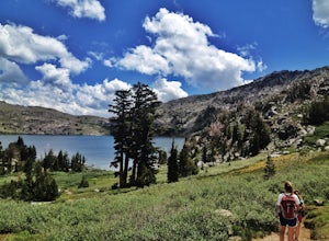
Middle Velma Lake via Eagle Falls Trailhead
4.59.18 mi / 2251 ft gainHiking or backpacking to the Velma Lakes area is a must do if you want to explore and escape the summer crowds of South Tahoe. There are 3 lakes, Upper, Middle, and Lower Velma Lake. The trek out to Middle Velma is 9+ miles roundtrip, but you can add to it depending on how many other lakes you wa...Read more -
South Lake Tahoe, California
Eagle Lake Trail
4.02.35 mi / 571 ft gainThe trailhead starts (and ends) by the beautiful Emerald Bay of Lake Tahoe, and goes west. The trail is well-marked and composed of mostly granite steps. Once you get to the lake, you can swim: it's cold but beautiful. If you keep following the path to the wooded areas (to the left), there are s...Read more -
South Lake Tahoe, California
Eagle Falls Vista Loop
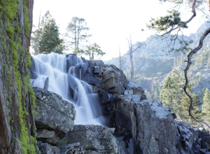
0.56 mi / 138 ft gainEagle falls is a short walk from the main Emerald Bay vista point. The top of the falls are cool to look at themselves, with great views of the lake.Read more -
South Lake Tahoe, California
Rock Climb at Eagle Lake Cliffs
4 miTo Access Eagle Lake Cliffs Crag, head to the West Shore of South Lake Tahoe. You’ll want to park at Emerald Bay Parking Lot and head to the trail register. It’s almost always packed, so come early, or plan to park on the road and walk. Sign yourself and your party number in for the day access pa...Read more -
New Washoe City, Nevada
Deadman's Overlook Trail
4.01.28 mi / 318 ft gainDeadman's Overlook Trail is a loop trail where you may see beautiful wildflowers located near Washoe Valley, Nevada.Read more -
Gardnerville, Nevada
Topaz Lake
Topaz Lake is a family-friendly Lake within a days drive from Reno/ Lake Tahoe area. As you descend Washoe Valley into the Minden area, wonderful open pastures lend itself to gorgeous vistas. The Topaz Lake Recreation Area near Gardnerville on the Nevada side of the lake offers camping and a day...Read more -
Tahoma, California
Backpack to Crag Lake
4.011.1 mi / 1220 ft gainDay 1:This trip is a great early season trip while you are waiting for the snow to melt in the high country or it could be a good first backpacking trip because of its proximity to the trailhead and the fact that it's a relatively easy hike. Also, you get to camp by a beautiful lake with a drama...Read more -
South Lake Tahoe, California
Meiss and Round Lake via Tahoe Rim Trail
10.5 mi / 1257 ft gainMeiss and Round Lake via Tahoe Rim Trail is an out-and-back trail that takes you by a lake located near Kirkwood, California.Read more -
Alpine County, California
Hike to Round Top Peak
5.09 mi / 1821 ft gainThis hike begins at Carson Pass which is accessible from Highway 88. The trail leaves from the parking lot (parking requires a fee of $5) and is easy to follow. After about a mile, you'll pass Frog Lake on the left, which is a nice place to stop for a quick snack.Continue along the trail and stay...Read more -
Twin Bridges, California
Hiking to Ralston Peak
4.07 mi / 2375 ft gainStarting at the lower lot it's less than a mile to access the trail. The hike starts off in shade through a lot of red fir forest and continues at a steady upward route. Approximately 45 mins into the hike you'll come across a sign that says you are entering desolation wilderness. The forest will...Read more -
Twin Bridges, United States
Hike Horsetail Falls
4.22.8 mi / 700 ft gainGreat views are waiting for you at the top of Horsetail Falls. Pyramid Creek flows down the steep, glacier carved granite faces of Desolation Wilderness to create this awesome waterfall that is estimated to be about 800 feet tall. You will follow Pyramid Creek up the granite rocks to the top of t...Read more -
Twin Bridges, California
Ropi Lake via Pyramid Creek
4.74.87 mi / 1581 ft gainThe trailhead to begin this hike is located at: 38.8117 N, 120.1237 W. From Hwy 50 just south of Lake Tahoe, take Hwy 50 southwest for almost 11 miles, where you'll turn into the parking lot after crossing Pyramid Creek. There is a $5 day-use fee to park in the trailhead parking lot. The hike i...Read more -
Alpine County, California
Hike Round Top Summit and Winnemucca Lake Loop
6.6 mi / 1272 ft gainThis hike begins near the Woods Lake campground. Start off by hiking towards Winnemucca Lake. You will begin your journey going through the forest beside a crystal-clear stream. Soon the trail opens up to become more open, full of all colours of wild flowers. You follow this breathtaking trail up...Read more -
Incline Village, Nevada
Monkey Rock
4.72.64 mi / 463 ft gainMonkey Rock is an out-and-back trail that takes you by a lake located near Incline Village-Crystal Bay, Nevada.Read more -
Incline Village, Nevada
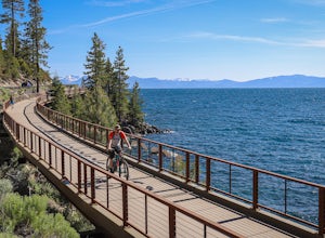
Bike or Take a Stroll along the Tahoe East Shore Trail
5.02.75 mi / 300 ft gainLake Tahoe's East Shore Trail is a wide paved walking and cycling path running between Incline Village and Sand Harbor State Park. Opened in 2019, the path lies completely separate from the road, sometimes hovering well above it on the mountainside, and other times running parallel to it on a bri...Read more -
Alpine County, California
Hike The Sisters in the Mokelumnee Wilderness
8 mi / 2500 ft gainThe Sisters offer a great day hike with fun scrambling and beautiful views of the Northern Sierra, Lake Tahoe, the Mokelumnee Wilderness, and the Carson River Canyon.The trail to The Sisters begins at Woods Lake (38.6855° N, 120.0095° W), at the end of Woods Lake Road off Highway 88, 1.5 miles we...Read more

