Walpack Township, New Jersey
Looking for the best photography in Walpack Township? We've got you covered with the top trails, trips, hiking, backpacking, camping and more around Walpack Township. The detailed guides, photos, and reviews are all submitted by the Outbound community.
Top Photography Spots in and near Walpack Township
-
Paterson, New Jersey
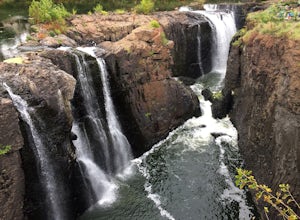
Explore the Great Falls of the Passaic River
3.2Getting to the Great Falls of the Passaic River is a relatively straight shot. It is located off exit 57B on Route 80 which is also accessible from highway 287. Parking is located on McBride Avenue across the street from the park's welcome center.Typically during autumn park rangers offer 45 to 1...Read more -
Cedar Grove, New Jersey
Hike at Mills Reservation
4.72 mi / 200 ft gainMills Reservation is over 150 acres of wooded area located off of Normal Ave. near the Cedar Grove reservoir. Parking space is limited due to the small size but there is another hidden lot towards the back if you make a right out of the parking lot and then the first right turn onto Highland Ave....Read more -
Monroe, New York
Hike the Jessup/Highlands/Long Path Trails
7.8 mi / 500 ft gainThis trails starts at a small park in Woodbury called Gonzaga Park. Closed from mid-November to April, you are still able to park just outside the gate if that is the time of year you are hiking. Three different trail names share this path. The Jessup trail starts/end at Gonzaga Park and trave...Read more -
Penn Forest Township, Pennsylvania
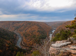
Tank Hollow Vista
4.03.33 mi / 272 ft gainThis is a simple, short hike to a fantastic vista looking out over the Lehigh River Gorge. The trailhead for the hike to Tank Hollow Vista is along Behrens Road just outside of Jim Thorpe, PA. Most of the hike is on state game lands. If the gate is open from the first lot, you can shorten this h...Read more -
Lake Harmony, Pennsylvania
Shades of Death Trail
4.51.89 mi / 223 ft gainThe trailhead and parking are available by the park office or along PA 534 by the nature center and amphitheater. This trail is beautiful and seemed to change around every bend. Sand Spring Run flows alongside the entire trail. Rock formations and rhododendron mix with remains of a logging mill a...Read more -
White Haven, Pennsylvania
Kayak the Francis E. Walter Dam
5.0The Francis E. Walter Dam, located in White Haven, Pennsylvania, is truly an amazing location. Constructed in 1961, Francis E. Walter Dam, has prevented nearly $180 million in flood damages to the Lehigh River Valley. The reservoir was designated for recreation use by Congress in 1988. While kaya...Read more -
Walnutport, Pennsylvania
Lehigh Gap via Appalachian Trail
4.52.15 mi / 817 ft gainLehigh Gap was formed by the Lehigh River carving a large hole in the foothills of the Appalachian Mountains. One side is owned and operated by the Lehigh Gap Nature Center and has some great hikes, but this side is government-owned. Parking for this portion of the Appalachian Travel is up a litt...Read more -
Jim Thorpe, Pennsylvania
Bike the Lehigh Gorge Trail: Lock #2
4 miIt was a rainy day, which brings along mud (but I think mountain biking is better in the rain and mud anyways).Enter the trail by going through the county parking lot and to the left end under the bridge. The trail starts along the tracks and you can admire the restored old rail cars. Cross ove...Read more -
New Windsor, New York
Hike Jessup/West Ridge Loop via the Sweet Clover Trail
10 mi / 1700 ft gainSchunnemunk Mountain State Park is one of my favorite parks. It offers many trails and possibilities for different loops. The attraction of Schunnemunk Mountain is the long double ridges running parallel to each other and amazing views in all directions.This hike starts at the Taylor Road parki...Read more -
Frenchtown, New Jersey
Hike to the Devil's Tea Table
3.00.5 mi / 20 ft gainApart from the rock, there's more trail to follow for a stunning overview and a great spot to hang out and relax. The view is a must-see, it is so much better in person. The hike is not challenging at all, it is basically a straight trail. Climbing some medium sized rocks might be required, but i...Read more -
Stockton, New Jersey
Hike to the Hidden Lockatong Waterfall
3.72 miIf you're on Kingwood Stockton Road, there will be a dirt road with a Lockatong Nature Preserve sign before it (going north on Kingwood Stockton Road, the sign will be on your left. If you're driving south, the sign will be on your right). Just drive all the way until the end of the dirt road and...Read more -
Jim Thorpe, Pennsylvania
Bike the Switchback Trail around Mauch Chunk Lake Park
5.011 miThe trail entrance can be found by going up Broadway and taking Hill Road to the right at the Opera House. At the top of Hill Road will be the entrance to the trail; there is a nice little wooden sign so you don't miss it. This trail can be hiked or biked; we chose to do some mountain biking.Th...Read more -
Tinicum Township, Pennsylvania
Hike the High Rocks State Park Loop
4.61.5 miHigh Rocks State Park, a section of Ralph Stover State Park, offers visitors some of the best views in Eastern Pennsylvania. Across from the parking lot on Tory Road, you will find the main trailhead. This will lead you to several different trail options, all varying in length, and all bringing y...Read more -
Highland Falls, New York
Popolopen Torne
4.51.18 mi / 531 ft gainPopolopen Torne is a hidden gem in the Hudson Valley, a surprisingly unknown trail with a beautiful payoff and a far deeper meaning. A short hike to the top puts you at the foot of a memorial to those who have served their country, a pile of painted rocks carried up by those who want to pay their...Read more -
Hopewell, New Jersey
Hike through the Sourland Mountain Preserve
5.02.91 miThe Sourland Mountain Preserve stretches from Hunterdon County all the way into Somerset County. The trails referenced here are on the southwest side of the preserve in Hunterdon County. They are accessible from an on site parking lot at 233 Rileyville Road in Ringoes NJ.There are several trails ...Read more -
Stockton, New Jersey
Explore Kugler Woods Waterfall
4.00.5 miDrive 5.2 miles north on Route 29 from the center of Stockton, NJ and you will come across a very small parking lot on the left side of the road. If you park your car there, walk back south on Route 29 about 50 feet, and cross over to the woods-side of the road. There you will find the trailhea...Read more

