Sunland Park, New Mexico
Looking for the best hiking in Sunland Park? We've got you covered with the top trails, trips, hiking, backpacking, camping and more around Sunland Park. The detailed guides, photos, and reviews are all submitted by the Outbound community.
Top Hiking Spots in and near Sunland Park
-
Las Cruces, New Mexico
Organ Peak Trail
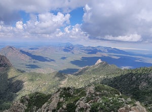
5.09.92 mi / 3458 ft gainOrgan Peak Trail is an out-and-back trail where you may see beautiful wildflowers located near Las Cruces, New Mexico. This is one of the longer and more challenging hikes in the Organ Mountains. An early start is recommended to keep heat down during the warmer months as well trekking poles and p...Read more -
Las Cruces, New Mexico
Organ Needle from Baylor Canyon Road
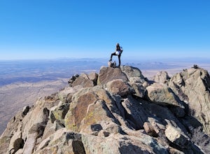
5.07.67 mi / 3658 ft gainOrgan Needle from Baylor Canyon Road is an out-and-back trail that provides a good opportunity for scenic views located near Las Cruces, New Mexico. Keep in mind on the trail, there isn't much in terms of shade or coverage, so please pack accordingly and with sufficient water for the trail. There...Read more -
15595 Baylor Peak Road, New Mexico
Hike the Rabbit Ear Plateau.
5.06 mi / 3000 ft gainPark at the small parking area of Baylor Peak rd. Start climbig up the mountain on a old jeep road. The trail becomes steeper the further up you go. Very good views of the Organ Mountains and the Mesilla Valley. Lots of wildflowers along the way in the summer and also cacti in bloom. Did not make...Read more -
Aguirre Springs Road, New Mexico
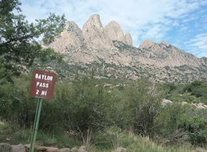
Hike the Baylor Pass Trail
5.06.9 mi / 1568 ft gainModerate hike in the Organ Mountains Desert Peak National Monument in New Mexico. Very good views of the Organ Mountains , the Tularosa Basin and wildflowers in the summer and fall. Excellent place to see the Organ Mountains evening primroseRead more -
Las Cruces, New Mexico
Pine Tree Trail Loop
4.54.29 mi / 1276 ft gainPark in the Parking area at the end of Aguirre Springs Loop. The trailhead is across the road. The trail will take you in a loop. Enjoy the diversity of plant life and the varied landscape. There are numerous interesting geological and ecological features in these foothills.Read more -
Las Cruces, New Mexico
Baylor Peak via Baylor Canyon Pass
8.36 mi / 2772 ft gainBaylor Peak via Baylor Canyon Pass is an out-and-back trail where you may see beautiful wildflowers located near Las Cruces, New Mexico.Read more -
Las Cruces, New Mexico
Hike the Baylor Pass West Trail
6.3 mi / 1548 ft gainStart your hike from the parking lot of Baylor Pass Road. The trail starts to climb gently first and then gradually the climb gets steeper, but nothing too difficult. There is nice desert vegetation along the trail and very good views of the Organ Mountains and valley below.Read more -
2572-2598 Desert Wind Way, New Mexico
Explore the Dona Ana Mountains
5.02 mi / 1000 ft gainThe Dona Ana Mountains offer a variety of outdoor fun. Hiking, rock climbing, wildflowers and petroglyphs. There are several different ranges to explore with arches, steep cliffs and also easy trails. The elevation gain changes depending which trails you decide to take. You can also access the...Read more -
Doña Ana County, New Mexico
Explore Providence Cone
4.02 miWe drove through the desert on a winding dirt road. Once at the cone we started our climb to the top. The ascent is not too difficult and once on top we had very good views of the surrounding landscape. Lots of interesting rock formations and also plants. There are several interesting petroglyp...Read more -
Las Cruces, New Mexico
Hike the Leasburg Slot Canyon
2.4 mi / 675 ft gainLeasburg Slot Canyon is a 2.4 mile trail that offers a unique experience that is close to Interstate 25. The directions will take you to the banks of the Rio Grande where you can park anywhere along the dirt road that is convenient. This hike should only be attempted in the late fall or winter be...Read more

