Albany, New York
Top Spots in and near Albany
-
Elka Park, New York
Layman's Monument and Kaaterskill Falls
3.05 mi / 892 ft gainLayman's Monument and Kaaterskill Falls is an out-and-back trail that takes you to one of New York's tallest waterfalls at 231 feet and to the historical monument for Frank D. Layman, who passed away in 1990 while fighting a forest fire. This trail is located near Haines Falls, New York.Read more -
Haines Falls, New York
Kaaterskill Falls
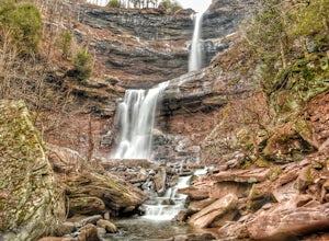
4.52.57 mi / 719 ft gainAlthough this is a super short hike, it is definitely a tough one! The quick, steep climb is totally worth it once you reach the 260 foot cascade and pool at the end. Hike along the trail, hugging Spruce Creek all the way to the falls. If you hike in the spring, the creek and the falls will be ra...Read more -
Adams, Massachusetts
Explore Bellevue Falls
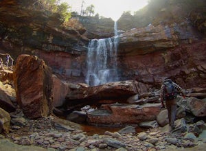
5.0When you reach the falls, you can cliff jump into a large swimming hole at the base. The best time to visit the falls is from April to November. Please note that dogs are not permitted here. Parking is at a cemetery, and the gates are open from 8am to 9pm. Use common sense before cliff jumping - ...Read more -
Haines Falls, New York
Fawns Leap
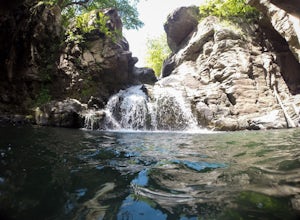
2.3Please be respectful if visiting this local swimming hole. Pack out what you pack in, carry out others' trash, and familiarize yourself with Leave No Trace principles. Hidden in the Catskill Mountains is one of the coolest cliff jumping locations I have ever been to. The first time I went was a...Read more -
Gloversville, New York
Drive the Adirondack Trail Scenic Byway
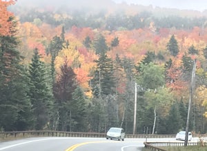
3.0This scenic byway starts in Fonda, NY and travels along Route 30 to Malone, NY. The area described and pictured here is a 65 mile stretch from Mayfield to Indian Lake. Starting in Mayfield you will head north driving past the Great Sacandaga Lake. Continuing through the town of Hope you will dr...Read more -
Stockbridge, Massachusetts
Laura's Tower and Ice Glen
5.02.4 mi / 676 ft gainYou will park at the end of Park Street in Stockbridge, Massachusetts. From the parking are you will cross a beautiful bridge over the Housatonic River. The trail crosses railroad tracks and immediately begins to climb into the woods. You will reach a split in the trail, a left will take you...Read more -
Great Barrington, Massachusetts
Hike Monument Mountain
4.02 mi / 720 ft gainAt 1642 feet (with a total elevation gain of 720 feet), Squaw Peak is a great spot to see both Mt Greylock along the Vermont border, and the Catskills in New York. There are several trail options here to get to the summit, but no matter which combination you choose, you can keep your trip under ...Read more -
Elka Park, New York
Hike to Huckleberry Point
4.54.5 mi / 644 ft gainThis is a 4.5 mile hike that is great for hikers of all skill levels. Because it is short and not overly difficult, beginners will enjoy this hike. There are some steep sections that will get your heart pumping, though, and a stunning payoff is waiting for you at the end.From the trailhead, follo...Read more -
Elka Park, New York
Hike to Plattekill Falls
0.5 mi / 137 ft gainJust outside of Elka Park, New York, Plattekill Falls is accessible from Albany and New York City alike. This is a great hike for families and all skill levels. The falls are spectacular year-round, but the best time to visit is in the spring. From the trailhead, walk left past the red house unt...Read more -
Elka Park, New York
Hike Twin Mountain
6 mi / 1586 ft gainThe DEC Parking lot, is located at the very end of a dead end, along Prediger Rd. Start at the trail head to the right of the trail kiosk and sign in sheet. The trail starts out very easy going as you approach the base of Twin. At mile 0.25, you’ll hit a junction where you’ll turn RIGHT towards T...Read more -
Elka Park, New York
Hike Indian Head Summit via Jimmy Dolan Notch Overlook
4.9 mi / 1512 ft gainThe view from the summit of this hike is incredible. Bring a sack lunch and a camera - you'll want to stay for a while! This trail is open for use year-round and provides great snowshoeing in the winter and fabulous wildflowers in the spring and summer. This is also a great location for birding!Read more -
Elka Park, New York
Backpack the Eastern Half of Devil's Path in the Catskill Mountains
5.014 mi / 3900 ft gainThe Eastern half of Devil's Path has four major summits: Indian Head, Twin, Sugarloaf and Plateau. Each summit is a straight climb up and down, then back up to as much as 3,900 ft. There are some sparse sections of level ground, but most is a steep descent uphill or steep slide downhill. Your ...Read more -
Elka Park, New York
Backpack Devil's Path in the Catskills
24.2 mi / 9000 ft gainDevil's Path is roughly more than 24 miles long, althought it feels like an eternity of milage. Going thru the summits of Indian head, Twin, Sugarloaf, Plateau, Hunter, and Westkill Mountains.Its brutal. Its painful, Its unique. Be prepared for anything and everything. You will encounter wild lif...Read more -
Elka Park, New York
Camp at Sugarloaf Mountain in the Catskills
4.06 mi / 1500 ft gainBegin by parking at the end of Mink Road in Elka Park (GPS:N42 08.593, W74 09.479). It will be a .7 mile hike to camp. Follow the rocky woods road to the junction where there is a SPRING sign. Continuing straight will take you to the water source. If you do not need water, turn left when you see ...Read more -
Shaftsbury, Vermont
Hike Around Lake Shaftsbury
1.3 mi / 42 ft gainLake Shaftsbury State Park is a small park in Southern Vermont between Bennington and Manchester. It is well-loved by locals as swimming spot in the summer, especially for families with kids. Less well known is the nature trail that meanders around the perimeter of the lake. While only a mile in...Read more -
Savoy, Massachusetts
Tannery Falls Loop
0.54 mi / 135 ft gainThe hike to Tannery Falls may be a little confusing, I'll clear it up for you before you even go there! To get to The falls you will travel down a dirt road that isn't very well maintained during the winter. As you keep driving down the dirt road you will notice a pond , which means you are almos...Read more

