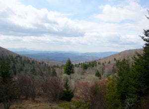
Elk Park, North Carolina
Looking for the best photography in Elk Park? We've got you covered with the top trails, trips, hiking, backpacking, camping and more around Elk Park. The detailed guides, photos, and reviews are all submitted by the Outbound community.
Top Photography Spots in and near Elk Park
-
Shady Valley, Tennessee
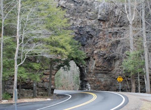
Explore Backbone Rock and Falls
4.7First, from the parking lot, there is a trail which climbs up to walk on top of the rock. The top of the rock is narrow, but has hand rails to hold on to. Once finished walking on top of the rock, cross the road (be extremely careful) and walk away from the tunnel. Here is a good angle to take a...Read more -
Johnson City, Tennessee
Gray Quarry
5.0Gray Quarry is a perfect destination for scuba diving in TN! The quarry is about 70 feet deep with ~3 acres of clear water. They have sunk a plane, bus, truck, firetruck, boat, seedoos, and more to the bottom. There is also a large variety of aquatic animals in the quarry. This is an awesome, loc...Read more -
Marion, North Carolina
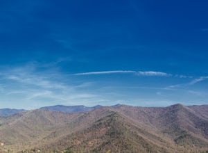
Drive the Scenic Lake Tahoma
This scenic drive is along NC 80 between a small town called Pleasant Gardens and Micaville. It can also be taken in the opposite direction depending on where you are driving from, but the main attraction is Lake Tahoma. Lake Tahoma is a private lake in the Western North Carolina Mountains, but ...Read more -
Old Fort, North Carolina
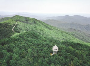
Green Knob Lookout Tower
4.80.76 mi / 292 ft gainGreen Knob Lookout Tower is an abandoned fire tower near Mt. Mitchell and located directly off the Blue Ridge Parkway. The tower boasts a full 360-degree, unobstructed view of Mt. Mitchell, Craggy Mountains, Table Rock, Grandfather Mountain, and the Parkway. Unlike most fire towers, this tower is...Read more -
Colonial Heights, Tennessee
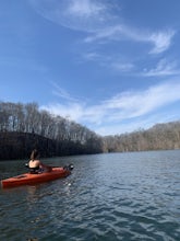
Kayak Patrick Henry Reservoir
5.0Patrick Henry Reservoir in Warriors Path State Park is a great location for kayaking, canoeing and stand up paddling. The reservoir is not always very clean, but it can still be very beautiful when you're on the water. In the Summer and Fall, the trees are beautiful to view. There is also a small...Read more -
Barnardsville, North Carolina
Douglas Falls
5.01.11 mi / 125 ft gainThe trail begins at the back of the parking area and is marked by a trail sign. Once on the trail, it is a straight shot to the waterfall with no turnoffs. Overall the trail is very easy and is a slight descent all the way down. Around .3 miles into the trail you enter a forest of now-dead hemloc...Read more -
Montreat, North Carolina
Hike Lookout Mountain, Montreat
5.01.1 mi / 623 ft gainNestled in the Blue Ridge Mountains is Montreat, North Carolina. Just down the road from Asheville, it neighbors Black Mountain and doesn't disappoint for views. Montreat itself houses a plethora of hiking trails, but the cream of the crop HAS to be Lookout Mountain. After a weekend of checking o...Read more -
Old Fort, North Carolina
Catawba Falls
4.82.19 mi / 394 ft gainPlease note, Catawba Falls is temporarily closed. You can learn more about updates at www.fs.usda.gov. This quick and relatively easy hike is located close to Asheville, NC. If you're looking to have the trail to yourself, it can be a little tough. It's best to get there as early as possible or ...Read more -
Greeneville, Tennessee
Hike to Margarette Falls
5.02.7 mi / 715 ft gainTo reach the trail head, take exit number 39 to Erwin/Jonesborough and turn onto State Route 81/107 west and stay on this for 6.5 miles. Then you will turn left to stay on Route 107 and continue on for 16 more miles. Then you will take a left on Route 351 and drive 4.5 miles. Then you will take a...Read more -
Mouth of Wilson, Virginia
Twin Pinnacles Loop
5.01.35 mi / 157 ft gainPark at the Visitor Center; don't stress when you get to the parking lot and can't see it, it's up the hill. From the parking lot hike across the road and find the staircase. Follow this up to the Visitor Center. If you're standing in front of the Visitor Center, the trailhead will be to the left...Read more -
Mouth of Wilson, Virginia
Twin Pinnacles via Big Pinnacles Trail
5.02 mi / 525 ft gainTo reach the Big Pinnacle Trail Head, park at the Massie Gap Day Parking area, and then follow the road west (away from Massie Gap) until you reach the trail head located on the left side of the road. Follow the Big Pinnacles Trail for 0.4 miles until it intersects with the Twin Pinnacles Trail....Read more -
Mouth of Wilson, Virginia
Wilburn Ridge and Massie Gap Loop
5.02.32 mi / 318 ft gainTo reach the trail head, park in the Massie Gap Parking Lot. This is the parking lot for most of the trails in the park, so it can fill up very quickly, but you are able to park along the side of the road. Massie Gap as two parking areas: one intended for overnight hikers and one for day hikers...Read more -
Mouth of Wilson, Virginia
Rhododendron Trail to Rock Croppings
5.01.77 mi / 289 ft gainIn order to go when the Rhododendron are blooming you'll need to aim for the first three weeks of June. Starting from the Massies Gap parking area in the Grayson Highlands State Park, follow the trail through the field and towards the base of a large hill. You will see a fence that runs along t...Read more -
Mouth of Wilson, Virginia
Photograph Wild Horses at Grayson Highlands State Park
4.61.8 mi / 306 ft gainThe wild horses gather on top of the bald at the end of Horse Trail North located in Grayson Highlands State Park. Because they are wild, it is important to remember not to touch or feed the horses. The horses are accustomed to hikers and will allow you in their near proximity, but bring a zoom l...Read more -
Mouth of Wilson, Virginia
Mount Rogers Loop
5.015.6 mi / 1079 ft gainFor an awesome 2-3 day trip, start hiking at the Massie Gap trailhead, which can be reached from Grayson Highlands State Park. Take the Rhododendron Trail up the ridge to connect with the AT, keeping an eye out for wild ponies in the Massie Gap area as they like to hang out here. Some of these po...Read more -
Mouth of Wilson, Virginia
Backpack the Grayson Highlands
4.89.1 mi / 1549 ft gainSpanning roughly 4500 acres, located in a portion of Jefferson National Forest, looming under the highest peak in Virginia lies the Grayson Highlands. A part of Virginia’s State Parks system and a United States National Landmark, located in Mouth of Wilson, Virginia, the Highlands are home to wil...Read more

