Linville, North Carolina
Looking for the best hiking in Linville? We've got you covered with the top trails, trips, hiking, backpacking, camping and more around Linville. The detailed guides, photos, and reviews are all submitted by the Outbound community.
Top Hiking Spots in and near Linville
-
Connelly Springs, North Carolina
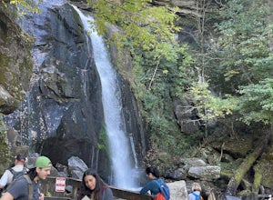
High Shoals Waterfall and H.Q. Loop Trail
4.83 mi / 1043 ft gainHigh Shoals Waterfall and H.Q. Loop Trail is a loop trail that takes you by a waterfall located near Connelly Springs, North Carolina.Read more -
Hickory, North Carolina
Geitner Rotary Park Loop
5.02.65 mi / 354 ft gainGeitner Rotary Park Loop is a loop trail that takes you by a lake located near Hickory, North Carolina.Read more -
Connelly Springs, North Carolina
Chestnut Knob via River Trail
4.05.9 mi / 1115 ft gainThe journey begins at the Cicero Branch Parking Area along South Mountain Road, following Jacob Fork River Trail. The trail runs along the Fork before ascending Chestnut Knob. After completing the trail, you will find yourself on the highest peak of the South Mountain chain, where there are breat...Read more -
Barnardsville, North Carolina
Douglas Falls
5.01.11 mi / 125 ft gainThe trail begins at the back of the parking area and is marked by a trail sign. Once on the trail, it is a straight shot to the waterfall with no turnoffs. Overall the trail is very easy and is a slight descent all the way down. Around .3 miles into the trail you enter a forest of now-dead hemloc...Read more -
Old Fort, North Carolina
Catawba Falls
4.82.19 mi / 394 ft gainPlease note, Catawba Falls is temporarily closed. You can learn more about updates at www.fs.usda.gov. This quick and relatively easy hike is located close to Asheville, NC. If you're looking to have the trail to yourself, it can be a little tough. It's best to get there as early as possible or ...Read more -
Montreat, North Carolina
Hike Lookout Mountain, Montreat
5.01.1 mi / 623 ft gainNestled in the Blue Ridge Mountains is Montreat, North Carolina. Just down the road from Asheville, it neighbors Black Mountain and doesn't disappoint for views. Montreat itself houses a plethora of hiking trails, but the cream of the crop HAS to be Lookout Mountain. After a weekend of checking o...Read more -
Black Mountain, North Carolina
Craggy Pinnacle Trail
4.81.03 mi / 285 ft gainI usually spend the day visiting restaurants and breweries around Asheville. Before it gets late, so you can enjoy the views, head to the Blue Ridge Parkway located right outside the city. After about 30 minutes on the parkway, you will park at the Craggy Pinnacle parking lot Milepost 364.1. Fro...Read more -
Bristol, Tennessee
Lake Ridge Trail and Lakeside Trail
5.04.56 mi / 669 ft gainLake Ridge Trail and Lakeside Trail is a loop trail that takes you through a nice forest located near Bristol, Tennessee.Read more -
Bristol, Tennessee
Lake Ridge Trail to Cross Ridge Trail Loop
5.04.68 mi / 1368 ft gainLake Ridge Trail to Cross Ridge Trail Loop is a loop trail that takes you through a nice forest located near Bristol, Tennessee.Read more -
Bristol, Tennessee
Powerline Trail and Lakeside Trail Loop
4.03.77 mi / 797 ft gainPowerline Trail and Lakeside Trail Loop is a loop trail that takes you through a nice forest located near Bristol, Tennessee.Read more -
Hiddenite, United States
Hike The Hollow Rock Trail at Rocky Face Mountain
4.02.4 mi / 514 ft gainFrom the parking lot, head northwest to find the trailhead for Buzzard Roost Loop. Follow that and stay left to meet up with the Hollow Rock Trail. This is a moderate hike with great views of the park. Perfect for a quick escape with the family. For a quick and tasty bite after your hike, hit up ...Read more -
Troutdale, Virginia
Hike the Appalachian Trail from Elk Garden to Buzzard Rock
5.06.6 mi / 1000 ft gainStarting at the Elk Garden Parking Area hike the Appalachian Trail south (do not cross the road, follow the trail from the parking area). Hike along the trail following the white blazes and at 2.4 miles you'll reach a campsite on your left. This is a great place to camp overnight if you decide to...Read more -
Mouth of Wilson, Virginia
Twin Pinnacles Loop
5.01.35 mi / 157 ft gainPark at the Visitor Center; don't stress when you get to the parking lot and can't see it, it's up the hill. From the parking lot hike across the road and find the staircase. Follow this up to the Visitor Center. If you're standing in front of the Visitor Center, the trailhead will be to the left...Read more -
Mouth of Wilson, Virginia
Twin Pinnacles via Big Pinnacles Trail
5.02 mi / 525 ft gainTo reach the Big Pinnacle Trail Head, park at the Massie Gap Day Parking area, and then follow the road west (away from Massie Gap) until you reach the trail head located on the left side of the road. Follow the Big Pinnacles Trail for 0.4 miles until it intersects with the Twin Pinnacles Trail....Read more -
Mouth of Wilson, Virginia
Wilburn Ridge and Massie Gap Loop
5.02.32 mi / 318 ft gainTo reach the trail head, park in the Massie Gap Parking Lot. This is the parking lot for most of the trails in the park, so it can fill up very quickly, but you are able to park along the side of the road. Massie Gap as two parking areas: one intended for overnight hikers and one for day hikers...Read more -
Mouth of Wilson, Virginia
Rhododendron Trail to Rock Croppings
5.01.77 mi / 289 ft gainIn order to go when the Rhododendron are blooming you'll need to aim for the first three weeks of June. Starting from the Massies Gap parking area in the Grayson Highlands State Park, follow the trail through the field and towards the base of a large hill. You will see a fence that runs along t...Read more

